Download
1 / 17
170 likes | 465 Vues
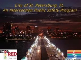
City of Sugar Land Intersection Safety Study. City of Sugar Land Intersection Safety Study. H-GAC/City Partnership Engineering, PW & SLPD participation 12 intersections throughout the City Data covering 2002 to 2005 Consultant: RS&H: Dena Jackson, P.E. Completed: May 2006.

E N D
City of Sugar LandIntersection Safety Study • H-GAC/City Partnership • Engineering, PW & SLPD participation • 12 intersections throughout the City • Data covering 2002 to 2005 • Consultant: RS&H: Dena Jackson, P.E. • Completed: May 2006
Sugar Land Background • Population 1991: 25,000 +/- 2007: < 80,000 • Traffic Signals Operated by City 1995: 0 2007: 72
City Council Goals • Mobility for People - SLPD policies to facilitate traffic movement - Traffic Control Center (remote operations/observations) • Safest City in Area - H-GAC statistics (crashes/100m VMT: 1999 – 2001) Texas 149 H-GAC 8 Co. Area 204 Sugar Land 192 - Access Management Practices - LOS requirements
Methodology of Study • Data Collection • Existing Condition Analysis • Crash Data Analysis • Identify Safety Improvement Countermeasures • Benefit/Cost Analysis • Public Outreach
How do you measure? • Distractions: Phones, TM, radios, etc. • Frustration level • School zone factor • Dynamics of growth: Population, employment, new roads, etc.
Intersections Studied • Williams Trace at Lexington • Williams Trace at S. Parkway • Sweetwater at Town Center S. • Sweetwater at Lexington • Sweetwater at Greystone • Dulles Ave. at Broodmoor Drive
Intersections Studied (cont’d) • Dulles Ave. at Avenue E • Dulles Ave. at Lexington Blvd. • Eldridge Road at Florence • Eldridge Road at West Airport • S.H. 6 at Town Center Blvd. N. • S.H. 6 at Lexington Blvd.
Why these Corridors?Corridor Crash Risk(per 100m VMT) • Williams Trace Blvd. 284 • Sweetwater Blvd. 444 • Dulles Avenue 426 • Eldridge Road 341 • S.H. 6 910 Source: SLPD collision reports, June 2002 – June 2005
Primary Observations • 4 years, 12 intersections, 278 accidents • 40 - 78% of accidents/intersection involved rear end collisions • 35% of crashes involved student drivers • 15 accidents involving commercial vehicle • 1 pedestrian fatality: outside of a x-walk • 1 bicyclist involved: failed to yield ROW
General Recommendations • Increase Enforcement • Implement New Signal Timing Plans • Median modifications • Add Capacity (thru & turn lanes) • Address congestion along S.H. 6 Congestion~ FRUSTRATION~ Accidents
Opening of U.S. 59 Expansion (S.H. 6 to U.S. 90A) Number of accidents reduced at studied intersections along perpendicular corridors: Street20032005% reduced Dulles Ave. 21 6 71.4 Williams Trace 11 5 54.5 S.H. 6 32 24 25.0
S.H. 6 Corridor • Turn lane additions • Closure of channelized median • Between Lexington and Town Center North • 23 accidents in 12 months • Allows for ext. of LTL’s at signalized intersections • Need to address SH 6 congestion
Implementation of Recommendations • Turn Lanes completed & planned • Continued enforcement • Signal timing customized to day of the week, time of day, conditions, season, etc. with real time changes • Enforcement
What’s Next? • Continue to observe and be responsive • RLC’s at 4 intersections in December • Incident Management - More traffic cameras planned - Congestion Index for arterials • Way finding signage for CBD • Intra-City Transit Study planned • SH 6 Access Management Study • Bypass for S.H. 6: University Blvd.