Download
1 / 2
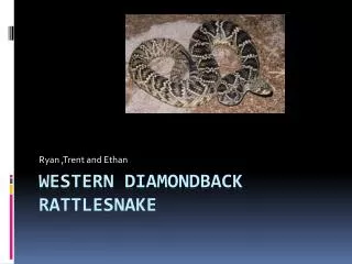
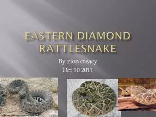
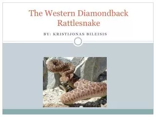
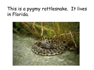
20 likes | 365 Vues
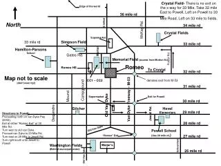
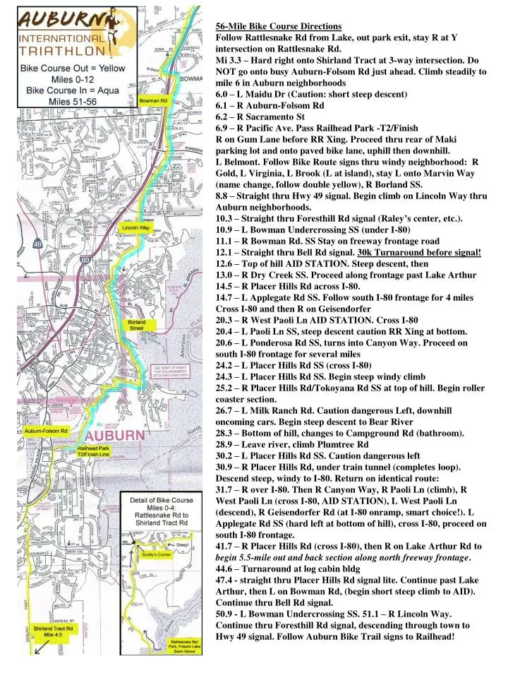
56-Mile Bike Course Directions Follow Rattlesnake Rd from Lake, out park exit, stay R at Y intersection on Rattlesnake Rd. Mi 3.3 – Hard right onto Shirland Tract at 3-way intersection. Do NOT go onto busy Auburn-Folsom Rd just ahead. Climb steadily to mile 6 in Auburn neighborhoods

E N D
56-Mile Bike Course Directions Follow Rattlesnake Rd from Lake, out park exit, stay R at Y intersection on Rattlesnake Rd. Mi 3.3 – Hard right onto Shirland Tract at 3-way intersection. Do NOT go onto busy Auburn-Folsom Rd just ahead. Climb steadily to mile 6 in Auburn neighborhoods 6.0 – L Maidu Dr (Caution: short steep descent) 6.1 – R Auburn-Folsom Rd 6.2 – R Sacramento St 6.9 – R Pacific Ave. Pass Railhead Park -T2/Finish R on Gum Lane before RR Xing. Proceed thru rear of Maki parking lot and onto paved bike lane, uphill then downhill. L Belmont. Follow Bike Route signs thru windy neighborhood: R Gold, L Virginia, L Brook (L at island), stay L onto Marvin Way (name change, follow double yellow), R Borland SS. 8.8 – Straight thru Hwy 49 signal. Begin climb on Lincoln Way thru Auburn neighborhoods. 10.3 – Straight thru Foresthill Rd signal (Raley’s center, etc.). 10.9 – L Bowman Undercrossing SS (under I-80) 11.1 – R Bowman Rd. SS Stay on freeway frontage road 12.1 – Straight thru Bell Rd signal. 30k Turnaround before signal! 12.6 – Top of hill AID STATION. Steep descent, then 13.0 – R Dry Creek SS. Proceed along frontage past Lake Arthur 14.5 – R Placer Hills Rd across I-80. 14.7 – L Applegate Rd SS. Follow south I-80 frontage for 4 miles Cross I-80 and then R on Geisendorfer 20.3 – R West Paoli Ln AID STATION. Cross I-80 20.4 – L Paoli Ln SS, steep descent caution RR Xing at bottom. 20.6 – L Ponderosa Rd SS, turns into Canyon Way. Proceed on south I-80 frontage for several miles 24.2 – L Placer Hills Rd SS (cross I-80) 24.3 – L Placer Hills Rd SS. Begin steep windy climb 25.2 – R Placer Hills Rd/Tokoyana Rd SS at top of hill. Begin roller coaster section. 26.7 – L Milk Ranch Rd. Caution dangerous Left, downhill oncoming cars. Begin steep descent to Bear River 28.3 – Bottom of hill, changes to Campground Rd (bathroom). 28.9 – Leave river, climb Plumtree Rd 30.2 – L Placer Hills Rd SS. Caution dangerous left 30.9 – R Placer Hills Rd, under train tunnel (completes loop). Descend steep, windy to I-80. Return on identical route: 31.7 – R over I-80. Then R Canyon Way, R Paoli Ln (climb), R West Paoli Ln (cross I-80, AID STATION), L West Paoli Ln (descend), R Geisendorfer Rd (at I-80 onramp, smart choice!). L Applegate Rd SS (hard left at bottom of hill), cross I-80, proceed on south I-80 frontage. 41.7 – R Placer Hills Rd (cross I-80), then R on Lake Arthur Rd to begin 5.5-mile out and back section along north freeway frontage. 44.6 – Turnaround at log cabin bldg 47.4 - straight thru Placer Hills Rd signal lite. Continue past Lake Arthur, then L on Bowman Rd, (begin short steep climb to AID). Continue thru Bell Rd signal. 50.9 - L Bowman Undercrossing SS. 51.1 – R Lincoln Way. Continue thru Foresthill Rd signal, descending through town to Hwy 49 signal. Follow Auburn Bike Trail signs to Railhead!