Download
1 / 29
370 likes | 1.43k Vues
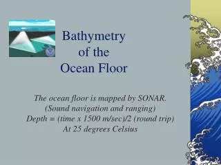
Continental Margins & Ocean Basins. Bathymetry: The Study of Ocean Floor Contours. Early bathymetric studies were often performed using a weighted line to measure the depth of the ocean floor. Advances in Bathymetry Echo sounding Multibeam Systems Satellite Altimetry.

E N D
Bathymetry:The Study of Ocean Floor Contours Early bathymetric studies were often performed using a weighted line to measure the depth of the ocean floor. Advances in Bathymetry Echo sounding Multibeam Systems Satellite Altimetry
Continental Margins & Ocean Basins Continental Margins & Ocean Basins What are the two classifications of ocean floor? Continental Margins – the submerged outer edge of a continent Ocean Basin – the deep seafloor beyond the continental margin
Continental Margins Passive margins Active margins
passive margin active margin
Continental Margins shallow, submerged edge of the continent. abrupt transition from continental shelf to the continental slope. transition between the continental shelf & the deep-ocean floor. accumulated sediment found at the base of the continental slope.
Continental Shelves Are Seaward Extensions of the Continents • The features of a passive continental margin: • Vertical exaggeration 50:1 • (b) No vertical exaggeration • margin.
Continental Shelves Are Seaward Extensions of the Continents
Submarine Canyons Form at the Junction between Continental Shelf & Continental Slope turbidity currents
How do canyons form? river erosion during previous glaciation periods turbidity currents: rapid movement of a mass of sediment down a slope ~ avalanche often caused by earthquakes
Topology of Deep-Ocean Basins Differs from That of the Continental Margin An oceanic ridge is a mountainous chain of young, basaltic rock at an active spreading center of an ocean.
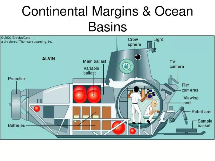
Hydrothermal Vents hydrothermal vents: spring of hot, mineral- and gas-rich seawater near seafloor spreading centers - 1977, Robert Ballard & J. Grassle in Alvin, at 3000 m near the Galápagos Islands
Deep-Ocean Basins Hydrothermal vents are sites where superheated water containing dissolved minerals & gases escapes through fissures, or vents.
Volcanic Seamounts & Guyots Project Above the Seabed Seamounts are volcanic projections from the ocean floor that do not rise above sea level. Flat-topped seamounts eroded by wave action are called guyots. Abyssal hills are flat areas of sediment-covered ocean floor found between the continental margins & oceanic ridges. Abyssal hills are small, extinct volcanoes or rock intrusions near the oceanic ridges.
Deep-Ocean Basins Trenches are depressions in the ocean floor caused by the subduction of a converging ocean plate.
Deep-Ocean Basins Island Arcs, chains of volcanic islands & seamounts, are usually found parallel to the edges of ocean trenches. (left) As two oceanic plates converge, an island arc is formed by volcanic activity. © 2002 Brooks/Cole, a division of Thomson Learning, Inc.
The Abyss abyssal plains: flat, featureless expanses of seafloor covered w/ sediment between continental margins & oceanic ridges 3700-5500 m why so flat?