Download
1 / 48
500 likes | 544 Vues
Research proposal submitted to the faculty of the Graduate School of the University of Maryland, Baltimore County in partial fulfillment of the requirements for<br>admission to candidacy for the degree of Doctor of Philosophy

E N D
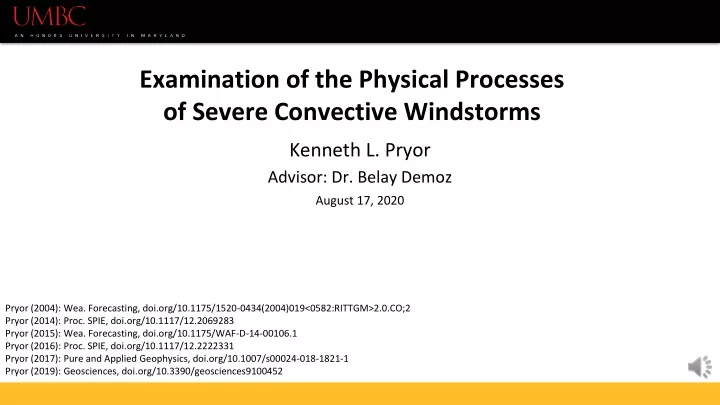
Examination of the Physical Processesof Severe Convective Windstorms Kenneth L. Pryor Advisor: Dr. Belay Demoz August 17, 2020 Pryor (2004): Wea. Forecasting, doi.org/10.1175/1520-0434(2004)019<0582:RITTGM>2.0.CO;2 Pryor (2014): Proc. SPIE, doi.org/10.1117/12.2069283 Pryor (2015): Wea. Forecasting, doi.org/10.1175/WAF-D-14-00106.1 Pryor (2016): Proc. SPIE, doi.org/10.1117/12.2222331 Pryor (2017): Pure and Applied Geophysics, doi.org/10.1007/s00024-018-1821-1 Pryor (2019): Geosciences, doi.org/10.3390/geosciences9100452
Outlineee • Motivation • Background: theory and observations • Research objectives • Timeline
Motivation Severe Convective Windstorm Prediction Convective Windstorms Theory, observations, impacts • Severe mesoscale convective systems (MCS), especially severe convective windstorms, cause major disruptions to society. • Between 1987 – 2002, MCS loss in the USA: • More than $3 billion in the United States, • average loss per event of $96 million. In addition, • 153 deaths and 2605 injuries (1986-2003) compared to 71 deaths for F0/F1 tornadoes (Ashley 2003) • Forecasting severe storms is a key issue: Need to conduct more research in • convective windstorm forecasting, short-term forecasting and nowcasting of convective system genesis, and satellite data exploitation and analysis of convective windstorm evolution. This research effort will add to the understanding of the science of operational forecasting of severe windstorms through examples of employing new satellite and ground-based microwave and vertical wind profile data.
Proposal Outline and Objectives Severe Convective Storms Theory, observations, impacts 2012 Derecho Thermodynamic environment, parameter and pattern evaluation Post-TC Sandy Evaluate models, theoretical and forecasting, parameters/patterns Localized MCS Thermodynamic environment, parameter and pattern evaluation Improved understanding of convective wind formation, evolution, and impacts.
Severe Convective Storms Deep moist convection (DMC): Presence of large CAPE, strong instability Most intense convection is associated with organized DMC. Linear convective systems Mesoscale convective systems Supercell storms Development of a rear-inflow jet is an internal process that can enhance storm outflow and sustain convection development. (Weisman 1992) Upwind (rearward) and downwind (forward) surface outflow interactions can enhance rear inflow and low-level updraft intensity, respectively. Theory Convective Windstorms Theory, observations, impacts Downdraft initiation: a departure from hydrostatic equilibrium: a = F/m = (-1/ρ)(dp/dz) + g(Tve – Tvp)/Tve a = F/m = (-1/ρ)(dp/dz) + g(ρo – ρf)/ρo The resultant force of the downward falling airmass is downward (negative buoyancy). ? (–) (–) (–) (–) ? ? Courtesy of Rob Seigel and Susan C. van den Heever, Global Precipitation Measurement (GPM, available online at https://gpm.nasa.gov/GPM)
Theory Convective Windstorms Theory, observations, impacts Severe Convective Storm Definition: Radar Observation Operational: Classified as “severe” when it contains: hail one inch in diameter or greater, winds gusting in excess of 50 knots (57.5 mph), or a tornado. 3 important conditions for severe thunderstorm development: Moisture of sufficient depth (to mid-troposphere) sufficiently large temperature lapse rate (large CAPE). Sufficient lifting of a moist parcel. Downdraft severity is governed by phase change and “loading” of ice-phase precipitation: induced buoyancy forces that result in a surface pressure perturbation, subsequent outflow, and the outward “bowing” of a linear multicell storm. DAL Outflow boundary Johns and Doswell (1992), Wakimoto (2001)
Theory: Summary of the Convective Wind Process Convective Windstorms Theory, observations, impacts Scales of motion for the different processes ⇒
Theory: Multi scale organization Convective Windstorms Theory, observations, impacts Fujita and Wakimoto (1981)
Theory: Summary of the Convective Wind Process Convective Windstorms Theory, observations, impacts
Theory: Summary of the Convective Wind Process Convective Windstorms Theory, observations, impacts
Theory: Summary of the Convective Wind Process Convective Windstorms Theory, observations, impacts
Theory – Rear Inflow Jet and buoyancy Convective Windstorms Theory, observations, impacts Operationally, I intend to investigate the combined physical factors of buoyancy (thermodynamic) and vertical wind shear (dynamic) in mature convective storms by employing data from wind profilers, Doppler radar, and satellite-based thermodynamic and cloud observations across many scales of convection. Weisman (1992)
Summary of Research Questions Convective Windstorms Theory, observations, impacts • Rear-inflow jet: a) What are the dynamic and thermodynamic forcing factors for the development of a rear-inflow jet b) How does the rear-inflow jet further enhance downdraftintensity and convective windstorm longevity? 2) Rear-flow and convection interaction: a) How does thunderstorm outflow interact with the rear-inflow jet b) How does the rear-inflow jet enhance cold pool strength? 3) How does thunderstorm outflow enhance updraft intensity and downwind propagation of the MCS? This research is focused into the application of conceptual models to the prediction of severe convective windstorms operationally. I use three case studies to seek to answer these research questions across scales from the local to meso-synoptic range. ? ? ?
Data: Theory to Operations Convective Windstorms Theory, observations, impacts • Available data to processes and display: • Vertical variations in moisture using satellite profile data to infer atmospheric instability (e.g. NUCAPS, ATOVS, IASI) • Vertical wind profiles to infer low-level downdraft characteristics(BL wind profilers, NEXRAD VAD) • Cloud top temperature measured by satellite-based passive microwave (MW) sensors to infer convective storm intensity and precipitation phase (MHS, SSMIS) • Systematically consider other variations to the convective environment, such as deeper shear profiles and multidirectional shear profiles, as well as variations to the vertical profile of moisture. • Observational studies indicate that moderate to strong environmental wind shear is associated with development and maintenance of severe convective windstorm activity (Johns and Doswell 1992). • a thorough investigation of the nature of hodographs(vertical wind profile) is needed and could lead to improved forecasting techniques.
Severe Convective Storms Theory, observations, impacts Case Study Selection: Multi-scale Convection 2012 Derecho Thermodynamic environment, parameter and pattern evaluation Post-TC Sandy Evaluate models, theoretical and forecasting, parameters/patterns Localized MCS Thermodynamic environment, parameter and pattern evaluation Improved understanding of convective wind formation, evolution, and impacts. Scale of Organization
Localized MCS: Event Summary Localized MCS A cluster of thunderstorms developed over western Texas (April 27, 2020) then merged to form an intense squall line that tracked rapidly southeastward toward the Gulf Coastal Plain. As the storm passed over Del Rio, a severe downburst was generated that resulted in a wind gust of 67 knots, recorded at Del Rio International Airport at 0135 UTC April 28. Data available and preliminary work: During the afternoon of April 27, a NOAA-20 NOAA Unique Combined Atmospheric Processing System (NUCAPS); nearly six hours prior to a severe windstorm event. Next Generation Radar (NEXRAD) reflectivity imagery, satellite-based microwave sensor data and derived imagery effectively captured signatures indicative of a large storm ice precipitation content and lateral entrainment of sub-saturated air that fostered the generation of intense downdrafts. GOES-16 ABI Split Window IR imagery displayed general convective organization and intensity over a regional scale. Tornado-like damage to the Whispering Palms Inn. Courtesy of the Del Rio News-Herald
The Del Rio, Texas Severe Windstorm of 27 April 2020 Localized MCS A case study of this event was published in the 1 May 2020 NOAA STAR JPSS (JSTAR) Weekly Report and presented to the NUCAPS team on 6 May 2020. F-17 Orbit Pass 27 April 2020 DMSP F-17 overpass was optimal for retrieving cloud microphysical properties prior to downburst occurrence in the Del Rio area.
Thermodynamic analysis: NUCAPS Localized MCS EL Dewpoint LFC LR700-950 = 7.1 C/km LR700-950 = 7.1 C/km Temperature
Localized MCS TB = Tu+ τ∙[ε∙Ts+ (1-ε)∙Td] Ferraro et al. (1998) • The 91 GHz channel is an atmospheric window in the microwave spectrum. • Scattering by ice-phase precipitation particles, especially graupel, hail, and snow above the freezing level, causes 91 GHz brightness temperatures (TB) to be low- known as a “TB depression”(Ferraro et al. (2015), Laviola et al. (2020)). • Thus, convective rain bands tend to have very low TB, often lower than 200 K. • TBnear the storm centroid was remarkably low (~120 K) and corresponded to a maximum in graupel water path (GWP) values (> 10 mm), indicating the presence of a dense core of graupel/hail. Ice precip core Dry-air notches
Localized MCS • Differential brightness temperature difference (BTDR) between the horizontal and vertical polarization channels: • BTDR = 100*(log10(TB91H/TB91V)) • ZDR = 10*(log10(ZH/ZV)) • Small positive values of SSMIS-derived BTDR correspond to large graupel water path values (> 10 mm), and thus, to a mixture of rain, hail, and graupel. • Although Split Window IR imagery displayed general convective organization and intensity over a regional scale, GOES-16 was not able to resolve storm scale structure favorable for downbursts: i.e. ice precipitation cores, dry-air notches Ice precip core
Localized MCS Transition from a linear, multicell storm to a bow echo After downburst occurrence at Del Rio
New Science Value Added Localized MCS Exploitation of microwave window channel TB data to infer storm-structural characteristics: F-17 SSMIS 91 GHz window imagery, with overlying graupel water path measurements: indicate a concentrated area of remarkably cold cloud tops (TB < 120K) at the storm centroid presence of a large ice phase precipitation content Inward-directed V-shaped TB gradients on the downwind (eastern) flank of the storm: suggests the occurrence of wake entrainment of sub-saturated air subsequent downdraft acceleration by the process detailed in Knupp (1989). Absence of an apparent rear-inflow jet was likely a factor in the episodic and short-lived occurrence of downburst winds at Del Rio. Results to be published in a future Bulletin of the American Meteorological Society (BAMS) article titled “Utility of Satellite Retrievals of Atmospheric Profiles in Detecting and Monitoring Severe Weather Events at NOAA”. Expected publication date: Winter 2021
Severe Convective Storms Theory, observations, impacts 2012 Derecho Thermodynamic environment, parameter and pattern evaluation Post-TC Sandy Evaluate models, theoretical and forecasting, parameters/patterns Localized MCS Thermodynamic environment, parameter and pattern evaluation Improved understanding of convective wind formation, evolution, and impacts. Scale of Organization
Derecho Criteria and Definition June 2012 Derecho “ 1) There must be a concentrated area of reports consisting of convectively induced wind damage and/ or convective gusts > 25.7 m s−1 (50 kt). This area must have a major axis of at least 400 km (250 mi).” “2) The reports within this area must also exhibit a nonrandom pattern of occurrence; that is, the reports must show a pattern of chronological progression, whether as a singular swath (progressive) or a series of swaths (serial).” “3-4) Within the area there must be at least three reports, separated by 64 km (40 mi) or more, of either F1 or greater damage (Fujita 1971) and/or “significant” convective gusts of 33.4 m s−1 (65 kt) or greater. No more than three hours can elapse between wind damage events (gusts).” Johns and Hirt (1987), Corfidi et al. (2016)
The June 2012 Derecho June 2012 Derecho Classic progressive derecho Affected millions of people, 22 deaths Broke many records for highest winds Left five million without power Traveled 700 miles in 12 hours Courtesy of Corfidi et al. (2018): available online https://www.spc.noaa.gov/misc/AbtDerechos/derechofacts.htm
The June 2012 Derecho NOAA-19 Orbit Passes 29 June 2012
Derecho Forecasting June 2012 Derecho • Pattern recognition • Parameter evaluation • Two components: • Genesis/ development • Derecho movement • Static stability-wind shear analysis • Thermodynamic profile analysis CI Johns (1993) Coniglio et al. 2004
Derecho Forecast Evaluation MCD #1314 2351 UTC 29 June: “...EXPECT STORMS TO CONTINUE TO ROLL BEYOND THE E SLOPES OF THE APPALACHIANS AND ACROSS MUCH OF VA OVER THE NEXT SEVERAL HOURS. ALONG WITH LIKELIHOOD FOR HAIL...DAMAGING WINDS WILL CONTINUE TO ACCOMPANY THIS MCS FOR AT LEAST THE NEXT COUPLE OF HOURS”. NWS/Storm Prediction Center (SPC) adequately indicated the likelihood of scattered severe winds over the Washington, DC – Baltimore, MD corridor as the derecho tracked east of the Appalachian Mountains during the late evening: However, the density and magnitude of severe wind events, and associated impacts, over the Washington, DC metropolitan area, including the adjacent MD and VA suburbs, was not anticipated by neither SPC nor NWSO Baltimore-Washington. New Science Value Added: The application of afternoon NUCAPS sounding profiles and derived parameters will provide more insight to the evolution of the convective lower troposphere. MW window channel data will more effectively interrogate evolving DCSs and reveal greater detail of storm structure, especially pertaining to convective wind generation. Correlate MW signatures and severe convective wind occurrence.
Thermodynamic Evaluation June 2012 Derecho Wet Microburst/Type B Inverted-V/Type A 12 km N of IAD MWPI: 3.2 WGP: 42 kt MWPI: 6.2 WGP: 55 kt Mid-tropospheric unsaturated layer LR670-950 = 7.6 C/km LR670-970 = 7 C/km
Metop-A MHS BT June 2012 Derecho a) b) Warm advection wing Dry-air notch RIJ Type 2 derecho echo pattern with a warm advection wing (Przybylinski 1995) that extended downwind (eastward) from the northern end of the bulging line echo. Microbursts occurred in Frederick County, MD, within the “warm advection wing” (Smith 1990) of the derecho.
Summary: Derecho case June 2012 Derecho Typical warm-season progressive derecho: associated with a major heat wave and an elevated mixed layer (EML)(Banacos and Ekster 2010, Corfidi et al. 2014). Metop-A MHS, with overlying Sterling, VA (LWX) NEXRAD reflectivity: Presence of the warm advection wing. A dry air notch, displayed as an inward (eastward) pointing TB gradient: Presence of a rear-inflow jet Sustained the MCS and the generation of downburst clusters in the DC-Baltimore corridor. Seminar/conference presentations featuring results of this study: Pryor, K. L., 2013: A Downburst Study of the 29-30 June 2012 North American Derecho, STAR Seminar, 30 April 2013. Pryor, K. L., 2014: Toward the Long-range Prediction of Severe Convective Windstorms, 2014 NOAA Satellite Science Week Meeting, 12 March 2014.
Severe Convective Storms Theory, observations, impacts 2012 Derecho Thermodynamic environment, parameter and pattern evaluation Post-TC Sandy Evaluate models, theoretical and forecasting, parameters/patterns Localized MCS Thermodynamic environment, parameter and pattern evaluation Improved understanding of convective wind formation, evolution, and impacts.
Post-TC Sandy Landfall Post-TC Sandy • “For the ensembles initialized at 0000 UTC 25 October…the NCEP ensemble only has five members that count as hits, and has most of the members indicating a landfall too far north. These are examples of inconsistencies in consecutive forecasts, which are undesirable and troublesome for forecasters.” • The ECMWF model more effectively predicted the general landfall location and central pressure of TC Sandy at the time of landfall. • Exploit geostationary and polar satellite data to infer: • The evolution of a stratospheric intrusion prior to landfall of post-TC Sandy • convective storm development in the left-front quadrant after landfall. Magnussen et al. (2014)
Theta vs Theta-e Cross Section Comparison Post-TC Sandy Stratospheric Intrusion Latitudinal (zonal) cross section at 39° N
Post-TC Sandy DMSP F-16 SSMIS and Metop-A IASI microwave (MW) sounding profiles display significant mid-tropospheric drying near the TC center at the time of landfall (left) and farther inland within the left-front quadrant (right).
Post-TC Sandy Evolution of Stratospheric Intrusion: SSMIS MW Imagery A convective rainband developed in the potential vorticity (PV) gradient region south of the eye of Post-TC Sandy, with a prominent dry-air intrusion apparent in F-17 SSMIS 92 GHz brightness temperature (TB) imagery.
Post-TC Sandy Evolution of Stratospheric Intrusion: MHS MW Imagery The convective rainband continued to propagate inland, with prominent dry-air intrusions still apparent in Metop-A MHS 89 GHz TB imagery.
New Science Value Added Post-TC Sandy • Exploitation of microwave window • channel TB data to infer storm • structural characteristics: • MHS/SSMIS 89-91 GHz window imagery: • indicate cold convective • cloud tops and rainband intensity • presence of a large ice phase • precipitation content and convective wind potential • Vertical sounding profiles to infer moisture stratification: • Presence of stratospheric intrusion • Boundary Layer Wind profiles to infer • vertical wind shear: • Infer mid-tropospheric dry-air intrusions • Downward horizontal momentum transport
Research Objectives TC Modeling Evaluate TC-convective windstorm modeling 1) • Develop conceptual model of convective windstorms. • Develop conceptual models of land-falling TCs and extratropical transition. • Develop methodology to analyze and display satellite and ground-based microwave observations (MW): • Validate convective windstorm and TC conceptual models. • Formulate algorithms to infer storm structure and ice-phase precipitation content. • Derive a relationship between MW signatures and severe convective wind occurrence. 2) • Conclusions on theoretical and forecasting model strengths and weaknesses. • Improved understanding of convective wind formation, evolution, and impacts. 3)
Severe Convective Storms Theory, observations, impacts 2012 Derecho Thermodynamic environment, parameter and pattern evaluation Post-TC Sandy Evaluate models, theoretical and forecasting, parameters/patterns Localized MCS Thermodynamic environment, parameter and pattern evaluation Improved understanding of convective wind formation, evolution, and impacts.
Future Publications Expected Published Papers: “Utility of Satellite Retrievals of Atmospheric Profiles in Detecting and Monitoring Severe Weather Events at NOAA”, Kalluri et al., Bulletin of the American Meteorological Society (BAMS), submit Fall 2020. Polar Satellite Microwave Observations of Severe Convective Storms: A Study of Post-Tropical Cyclone Sandy as a Mesoscale Convective System, submit December, 2020. Polar Satellite Microwave Observations of Severe Convective Storms: A Study of the June 2012 North American Derecho, submit June, 2021.
Post-TC Sandy Governing process of storm intensification prior to landfall Warm Core Seclusion: Galarneau et al. (2013) Role of elevated convection in the left front quadrant of the cyclone in the generation of heavy precipitation and damaging winds. Intense convective rainband developed in the PV gradient and upper level divergence region south of the eye of Hurricane Sandy.
ET Model: Cylindrical to Conic Structure Post-TC Sandy 2100 UTC 29 October 0000 UTC 29 October Cold front WCS
Post-TC Sandy Evolution of Stratospheric Intrusion: WV Imagery
Post-TC Sandy Evolution of Stratospheric Intrusion: WV-IR Imagery