Download
1 / 3
80 likes | 553 Vues
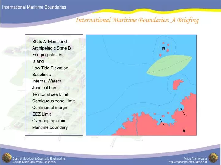
State A Main land. Archipelagic State B. B. Fringing islands. Island. Low Tide Elevation. Baselines . Internal Waters. Juridical bay. Territorial sea Limit. Contiguous zone Limit. Continental margin. EEZ Limit. Overlapping claim. Maritime boundary . A.

E N D
State A Main land Archipelagic State B B Fringing islands Island Low Tide Elevation Baselines Internal Waters Juridical bay Territorial sea Limit Contiguous zone Limit Continental margin EEZ Limit Overlapping claim Maritime boundary A International Maritime Boundaries: A Briefing
Basepoints Distance from basepoints G F A B Envelop of arc C E Maritime zone limit D Irrelevant basepoint International Maritime Boundaries: A Briefing Ocean Land
Robust equidistance line between State A and State B International Maritime Boundaries: A Briefing Equidistance line construction State A State B