Download
1 / 15
150 likes | 430 Vues
How Would You Describe Your Current Geospatial Archive? ... through Internet Archive. Findings from Survey of Archiving Practice in NC Local Agencies

E N D
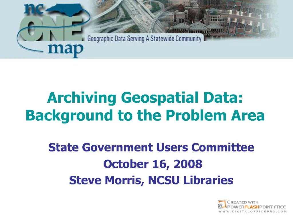
Slide 1:Archiving Geospatial Data: Background to the Problem Area State Government Users Committee
October 16, 2008
Steve Morris, NCSU Libraries
Slide 2:How Would You Describe Your Current Geospatial Archive?
Slide 3:Digital Preservation Points of Failure Data is not saved, or �
can�t be found, or �
media is obsolete, or �
media is corrupt, or �
format is obsolete, or �
file is corrupt, or �
meaning is lost
Slide 4:Problem: Temporal Data Unavailability Industry focus on �latest and greatest� data
�Kill and fill� as a common approach to data management (past versions of vector data lost)
Not just data loss, also: Loss of memory about data
Of superceded county orthophoto flights in NC:
Only 22% recorded in the state�s GIS inventory
Only 30% available on county map servers
Slide 5:Findings from Survey of Archiving Practice in NC Local Agencies
Slide 6:Value in Older Data: Cultural Heritage
Slide 7:Value in Older Data: Solving Business Problems
Slide 8:Different Ways to Approach Preservation Technical solutions: How do we preserve acquired content over the long term?
Cultural/Organizational solutions: How do we make the data more preservable�and more prone to be preserved�from point of production?
Slide 9:Spatial Data Infrastructure:Where Does Archiving Fit? Metadata standards and outreach
metadata quality, best practices
Inventories
Reduce �contact fatigue�, shareable info store
Content exchange networks
Leverage more compelling business reasons to put data in motion
Automate process, add technical & administrative metadata
Framework data communities
Snapshot frequency, schemas, format strategies
Slide 10:Technical Challenges with Geospatial Data Complex vector formats: multi-file, multi-format
No non-commercial, well-supported format
Shift to web services-based access
Data ephemeral, how to record decisions?
Often: Inadequate or nonexistent metadata
Impedes discovery and use
Increasing use of spatial databases for data management
The whole is greater than the sum of the parts but the whole is very hard to preserve
Content packaging
No geospatial industry standard
Slide 11:Preservation Approaches: Original Data vs. �Desiccated� Data State governments have limited resources to make changes to infrastructure to ensure permanent public access to digital information
States typically have few format standards, increasingly decentralized publishing practices among agencies, and lack a single point of controlState governments have limited resources to make changes to infrastructure to ensure permanent public access to digital information
States typically have few format standards, increasingly decentralized publishing practices among agencies, and lack a single point of control
Slide 12:Changes in the Domain: New Location-based Content State governments have limited resources to make changes to infrastructure to ensure permanent public access to digital information
States typically have few format standards, increasingly decentralized publishing practices among agencies, and lack a single point of controlState governments have limited resources to make changes to infrastructure to ensure permanent public access to digital information
States typically have few format standards, increasingly decentralized publishing practices among agencies, and lack a single point of control
Slide 13:Changes in the Domain: Geospatial PDF State governments have limited resources to make changes to infrastructure to ensure permanent public access to digital information
States typically have few format standards, increasingly decentralized publishing practices among agencies, and lack a single point of controlState governments have limited resources to make changes to infrastructure to ensure permanent public access to digital information
States typically have few format standards, increasingly decentralized publishing practices among agencies, and lack a single point of control
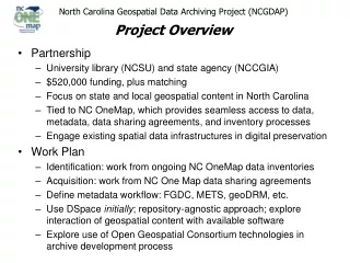
Slide 14:North Carolina Data Archiving Initiatives NC Geospatial Data Archiving Project (NCGDAP)
Part of Library of Congress� National Digital Infrastructure and Preservation Program (NDIIPP)
NCSU Libraries, CGIA: 2004 - 2009
GICC Archival and Long-Term Access Committee
Charged Feb. 2008; report to GICC Nov. 2008
Geospatial Multistate Archival and Preservation Partnership (GeoMAPP)
Part of NDIIPP Multistate initiative
NC (lead: CGIA and State Archives), KY, and UT
Nov. 2007 - Dec. 2009
Slide 15:Thank You!
Steve Morris
Head, Digital Library Initiatives
NCSU Libraries
Steven_Morris@ncsu.edu
(919) 515-1361
http://www.lib.ncsu.edu/ncgdap/