Download
1 / 35
370 likes | 964 Vues
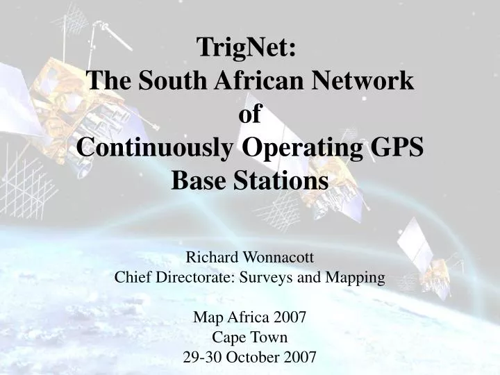
TrigNet: The South African Network of Continuously Operating GPS Base Stations. Richard Wonnacott Chief Directorate: Surveys and Mapping Map Africa 2007 Cape Town 29-30 October 2007. Overview. General Considerations TrigNet Architecture Post Processing and Real Time Services

E N D
TrigNet: The South African Network of Continuously Operating GPS Base Stations Richard Wonnacott Chief Directorate: Surveys and Mapping Map Africa 2007 Cape Town 29-30 October 2007
Overview • General Considerations • TrigNet Architecture • Post Processing and Real Time Services • Methods of Delivery • Co-ordinate System • Current Status • Non-positioning Applications • Future • Conclusion
Chief Directorate: Surveys & Mapping mandated to “establish and maintain a national control survey network” • Up until a few years ago we had a passive network of ~29000 trig beacons • GNSS has been around for some time • CDSM recognized change in philosophy and technology and has installed a network of active GNSS base stations Introduction
General Considerations • System must be receiver independent - RINEX, RTCM • System must be reliable through integrity monitoring and redundancy • Post processing data must be as fresh as possible • Cost of services must not be excessive to user • System must be expandable and flexible • System must meet the accuracy demands placed on it • All stations must be equipped with same basic equipment such as receivers and antennas
Basic Design • Use SWEPOS concept • One control station at Mowbray • Redundancy built into network • Initially only post-processing service available • Have 45 stations installed and in process of expanding • Stations between 40 km and 300 km apart
Reference Station Layout (1999-2006) SIGNAL SPLITTER GPS 2 GPS 1 ACCESS SERVER 2 ACCESS SERVER 1 HUB PC 2 PC 1 ROUTER
Reference Station Layout (2006-20??) SIGNAL SPLITTER GPS 2 GPS 1 HUB ROUTER
Communications Frame Relay Cloud Diginet / VPN Signal splitter GPS 2 GPS 1 OR Hub Network Control Centre ISDN Dial up ISDN Router ROUTER HUB Remote station ISDN Dialup ISDN
Post Processing Services • Data available in Receiver Independent Exchange format (RINEX) • Hourly data from 29 continuous feed stations available approximately 30 minutes after each hour of observation. • 24 hour data from continuous feed and daily download stations available on following day • Data is available via internet (ftp) , e-mail, CD etc. • Achievable accuracy could be 0,05 m or better depending on users receiver and antenna type, location, processing software, etc
Real Time Service • Data available in Radio Technical Commission: Maritime format (RTCM) • DGPS • pseudo range corrections provided in RTCM V 2.3 • sub metre accuracy possible from single base station • RMS 35 cm Hor and 1 m Vert irrespective of distance • used for navigation and GIS applications • RTK • carrier phase corrections provided in RTCM V 3.0 or V2.3 • sub 10cm accuracy possible from single base station • RMS 8 cm Hor at ~100 km • used for precise navigation and by surveyors and • engineers
Methods of Delivery • NTRIP (Network Transport of RTCM by Internet Protocol) • Users download RTCM (RTK and DGPS) corrections • from an Internet site in real time. • Corrections received are based either on one station or on a • network solution. • Field connection to internet can be via any technology eg GSM, • GPRS, Satphone etc • GSM & GPRS have disadvantages of coverage. • Low cost GPRS costs ~R2/Mb. NTRIP uses ~400 Kb/hour • Could be used for in-shore hydrographic work or navigation • Being used extensively in Europe and California
Delivery of Services Telecom Sat OMNISTAR Real Time Users • NTRIP Web Server • DGPS • RTK GSM / GPRS RINEX Web Server GSM / GPRS Land Line etc Active GPS Base station Network Control Centre Post Processing Users Base Station / User Seperation : Post processing – Possible to get <5cm @ 500km or greater DGPS – 35cm irrespective of distance RTK – 8cm @ ~100 km Base Station Centre- > user separation can be up to 400 km for DGPSand 50km for RTK
Networked Real Time Solution 1 • Networked solution • User connects to control centre via internet using Network Transport of • RTCM via Internet Protocol (NTRIP) • User’s receiver sends provisional position to control centre • A virtual reference station is computed close to user’s provisional • position based on data from at least 4 actual reference stations • RTCM corrections then sent to user relative to the virtual station • Are able to provide either • DGPS for the whole country or; • RTK solution in 2 clusters - Gauteng - Western Cape - KZN planned for March 2008
Remote Station Remote Station Remote Station Remote Station Network Control Centre Networked Real Time Solution 2
Remote Station WWW NTRIP Remote Station Provisional position Provisional position Remote Station Remote Station Network Control Centre Networked Real Time Solution 3
Remote Station WWW NTRIP Remote Station Position of virtual reference station & RTCM corrections Position of virtual reference station & RTCM corrections Remote Station Remote Station Network Control Centre Networked Real Time Solution 4 Virtual reference station New reference station when user 10 km from initial station
Hartebesthoek 94 • Based on ITRF91 at epoch 1994.0 (International Terestrial Reference Frame) • WGS84 (reference system for GPS) very close to ITRFxx within few tens of • centimetres of centre of Earth • ITRF 2005 • This is latest realisation of ITRF. WGS84 is even closer to ITRF2005 • ITRF 2005 and TrigNet • Have changed all TrigNet co-ordinates to ITRF2005 • Consistency within TrigNet is better using ITRF2005 co-ordinates • for TrigNet. • Users will have to transform from GPS/TrigNet based co-odrinates to • official Hart94 co-ordinates. • Hartebeesthoek 94 remains the official co-ordinate reference frame Co-ordinate System 1
Northings Eastings Height Sample of TrigNet co-ordinates before and after introduction of new ITRF 2005 co-ordinates. Port Elizabeth Langebaan Co-ordinate System 2
May 2006 Thohoyandau Post process and Real time data Ellisras Pietersburg Post processing data only Phalaborwa BOTSWANA MOZAMBIQUE Steelpoort Int GNSS Service (IGS) Stations Nylstroom Nelspruit Groblersdal Proposed Post processing and Real time data Mafikeng Pretoria Krugers Middelburg NAMIBIA Hartebeesthoek Benoni SWAZI Kuruman LAND Vereeniging Ermelo Upington Ulundi Bethlehem Bloemfontein Ladysmith Kimberley Pietermaritzburg Springbok LESOTHO Durban Prieska DeAar AliwalNorth Beaufort West Umtata Calvinia Queenstown Graaff-Reinet Sutherland Langebaanweg Grahamstown EastLondon CapeTown George PortElizabeth 200KM Hermanus
Thohoyandau Post process and Real time data Ellisras Pietersburg Post processing data only Phalaborwa BOTSWANA MOZAMBIQUE Steelpoort Int GNSS Service (IGS) Stations Nylstroom Nelspruit Groblersdal Proposed Post processing and Real time data Mafikeng Pretoria Krugers Middelburg NAMIBIA Hartebeesthoek Benoni SWAZI Kuruman LAND Vereeniging Ermelo Upington Ulundi Bethlehem Bloemfontein Ladysmith Kimberley Springbok Pietermaritzburg LESOTHO Durban Prieska DeAar AliwalNorth Beaufort West Umtata Calvinia Queenstown Graaff-Reinet Sutherland Langebaanweg Grahamstown EastLondon CapeTown George PortElizabeth 200KM Hermanus September 2007 Kroonstad Malmesbury Stellenbosch
Applications of TrigNet data • Post processing applications • Surveying and GIS • Atmosperic science • Monitoring of atmospheric water vapour for climate monitoring • Monitoring of ionosphere for communication and positioining • Geophysics • Long term monitoring of station positions – plate techtonics • Real time applications • Surveying and GIS • Navigation • Weather forecasting & ionosphere mapping • Timing
Non-Navigation Applications 1 Plate motions C.J.H. Hartnady, E. Calais & R. Wonnacott (2007): “ITRF2000 velocity field from the South African TrigNet GPS array and the African GNSS network: Implications for Nubia-(Rovuma-Lwandle-)Somalia plate motions” East African Rift Conference, Kampala
Non-Navigation Applications 2 • Climate & Weather • Estimation of precipitable water vapour from network of GNSS stations in South Africa
Month Month Dec Dec Nov Nov Oct Oct Sep Sep Aug Aug Jul Jul Jun Jun May May Apr Apr Mar Mar Feb Feb Jan Jan 0 2 4 6 8 10 12 14 16 18 20 22 24 0 2 4 6 8 10 12 14 16 18 20 22 24 Hour of day [UT] Hour of day [UT] Non-Navigation Applications 3 • Space weather • Ionospheric mapping of variation of annual TEC over South Africa from network of GNSS base stations 2004 2002 Thanks to B Opperman of Hermanus Magnetic Observatory for plots
Future • Establish VRS cluster in KZN – Drbn, Pmbg+ 3 others by March 2008 • Converting to VPN as means of remote and control station communication • by March 2008 • Are in the process of purchasing 12 GPS/GLONASS receivers for • installation in WC & Gauteng by March 2008 • Operationalize ionospheric mapping in co-operation with HMO by end 2007 • Implications on single frequency positioning • Will have to consider a rebuild in about 2010 to cater for GPS • modernization plus GLONASS and Galileo • Increase co-operation with SAWS for weather forecasting and climate • monitoring applications
Conclusion • The passive network of Trigonometrical beacons has served • South Africa well for nearly 100 years. • There is a confidence that TrigNet will serve the country just • as well. • The services available from TrigNet are easily available. • NTRIP is “state of the art” in real time service provisison. • The applications of TrigNet are not confined to positioning. • A rebuild is planned to accommodate GPS modernization, • GLONASS and Galileo.
Thank You Website for further information and data www.trignet.co.za
South African ActiveGPS Base Station Network • Chief Directorate: Surveys & Mapping (CDSM) mandated in terms of Land Survey Act (8 of 1997) to “establish and maintain a national control survey network” • Up until a few years ago we had a passive network of ~29000 trig beacons
South African ActiveGPS Base Station Network • GPS has been around for some time • CDSM recognized change in philosophy and technology and has installed a network of active GPS base stations • Consultancy was provided by National Land • Survey of Sweden – strong SWEPOS influence
Hartebesthoek 94 • Based on ITRF91 at epoch 1994.0 (International Terestrial Reference Frame) • WGS84 (reference system for GPS) very close to ITRFxx within few tens of • centimetres of centre of Earth • ITRF 2005 • This is latest realisation of ITRF. WGS84 is even closer to ITRF2005 • Testing ITRF 2005 against Hart94 • Differences between ITRF 2005 and Hart94 co-ordinates of TrigNet stations: • dy = -0.139 m std dev = 0.074 m • dx = -0.358 m std dev = 0.059 m Lo Co-ordinates • dh = 0.105 m std dev = 0.167 m • Consistency within TrigNet will be better using ITRF2005 co-ordinates • for TrigNet. • Users will have to transform from GPS/TrigNet based co-odrinates to • official Hart94 co-ordinates. Co-ordinate System
Northings Eastings Height Sample of TrigNet co-ordinates before and after introduction of new ITRF 2005 co-ordinates. Port Elizabeth Langebaan Co-ordinate System
Co-ordinate System • Hartebeesthoek 94 will remain the • official co-ordinate system
Thohoyandau Post process and Real time data Ellisras Pietersburg Post processing data only Phalaborwa BOTSWANA MOZAMBIQUE Steelpoort Int GNSS Service (IGS) Stations Nylstroom Nelspruit Groblersdal Proposed Post processing and Real time data Mafikeng Pretoria Krugers Middelburg NAMIBIA Hartebeesthoek Benoni SWAZI Kuruman LAND Vereeniging Ermelo Upington Ulundi Bethlehem Bloemfontein Ladysmith Kimberley Pietermaritzburg Springbok LESOTHO Durban Prieska DeAar AliwalNorth Beaufort West Umtata Calvinia Queenstown Graaff-Reinet Sutherland Langebaanweg Grahamstown EastLondon CapeTown George PortElizabeth 200KM Hermanus April 2007 Kroonstad Malmesbury Stellenbosch