Download
1 / 47
480 likes | 786 Vues
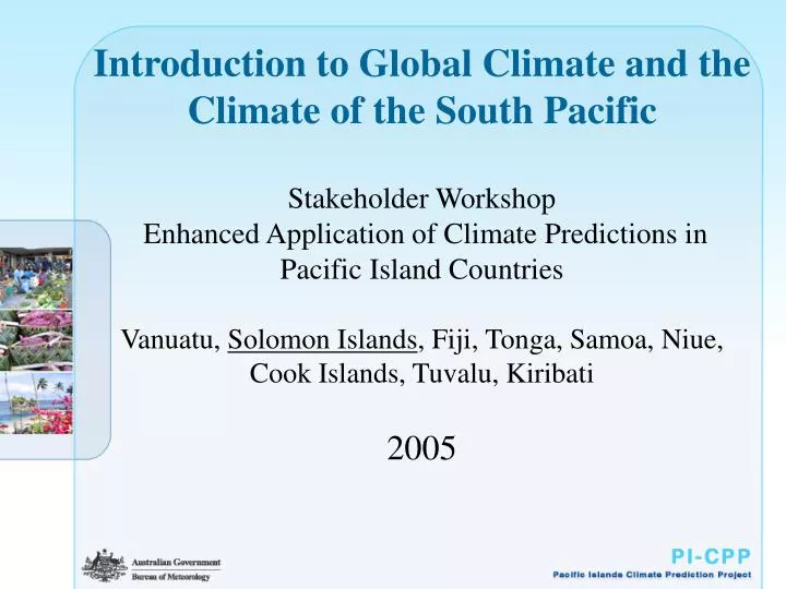
Introduction to Global Climate and the Climate of the South Pacific Stakeholder Workshop Enhanced Application of Climate Predictions in Pacific Island Countries Vanuatu, Solomon Islands , Fiji, Tonga, Samoa, Niue, Cook Islands, Tuvalu, Kiribati 2005. Overview.

E N D
Introduction to Global Climate and the Climate of the South PacificStakeholder Workshop Enhanced Application of Climate Predictions in Pacific Island Countries Vanuatu, Solomon Islands, Fiji, Tonga, Samoa, Niue, Cook Islands, Tuvalu, Kiribati2005
Overview • Introduction to Global and Pacific weather and climate • Intertropical Convergence Zone, South Pacific Convergence Zone • Climate variability in the South Pacific • Climate change in the South Pacific
The Driver for Weather and Climate is Heating from the Sun Heat lost to space • Highly simplified (assumes earth is not rotating) • Result: Low pressure at the equator High pressure at poles All weather and climate is driven by this energy imbalance – this is essentially a global “sea breeze effect” Heat from sun
Focus on the tropical belt The Global Circulation – The Effect of the Earth’s Rotation • Rising motion triggering rain and cloud in the tropics (same as in the no-rotation case) • Sinking motion in the subtropics – deserts. • Mid latitude cyclones around 60º. Heating from sun
West Pacific is usually warmer than the east The warmest waters tend to follow the sun – so does the rain Climate of the Tropics and South Pacific Tropical weather is driven by where cloud and rainfall is favored. Generally, this is where the land or ocean is warmest => rainfall patterns are driven by changes in ocean temperatures. January ocean temperatures July ocean temperatures
Climate of the South Pacific Intertropical Convergence Zone Dry east Pacific South Pacific Convergence Zone
The Inter Tropical Convergence Zone (also called the Equatorial trough) • A zone of high rainfall and much cloudiness • A zone of convergence of the trade winds • Moves north and south with the seasons • Can have ragged edges or “spurs”
The Climate of Suva – Fiji More rainfall in summer when the ITCZ is closest.
The South Pacific Convergence Zone (SPCZ) • The largest and most persistent “spur” of the ITCZ; a belt of high rainfall and cloudiness • Stretches from the Solomon Islands to Fiji, Samoa and Tonga • Associated with a sea surface temperature maxima • Is present year round but most active in the Southern Hemisphere summer
ITCZ tends to move N to S SPCZ tends to move SW to NE Focus of tropical convection can shift from west to east Climate Variability in the South Pacific
Climate Variability Short and Long Term • Climate variability affecting the South Pacific • Seasonal variations (ITCZ and SPCZ) • Interannual variations (El Niño/La Niña) • Long-term Climate Change • Climate change and Climate Variability are not the same.
The El Niño – Southern Oscillation (ENSO) We are interested in El Niño because it is the dominant driver of natural climate variability. El Niño refers to a broad scale warming of water in the central and eastern tropical Pacific Ocean (remember rain tends to occur over the warmest waters). They tend to occur every 3 to 7 years – e.g., 1994, 1997, 2002. La Niña is the reverse of El Niño.
“Typical” SST pattern during an El Niño Increasing sea surface temperatures (SSTs) across the central and eastern Pacific
The Impact of El Nino and La Nina The changes in ocean temperatures associated with El Niño and La Niña, cause large changes in rainfall. Also, El Niño and La Niña can be predicted, and so their impacts can also be predicted.
Periods of rapid change lower predictability The typical cycle of El Nino Period of slow change higher predictability
Paths of Tropical Cyclones El Niño years La Niña years Slide 21.10 Queensland Centre for Climate Applications Source: Peter Hastings, University of Queensland
1997 an El Nino - 2000 a La Nina (mm/day) Central Pacific: 350mm in 2000 versus 1000mm in 1997 Severe western Pacific drought in 1997
Tracking El Niño • Indicators for an El Niño include: • The Walker Circulation and trade winds weaken. • The warm pool region moves east towards the central Pacific - ocean temperatures become warmer than average in the central and eastern Pacific. • The SOI remains negative for several consecutive months. • Cloud and rainfall increase over the central and east Pacific. Decreases in the west - over Australia, Indonesia, Solomon Islands etc. • La Niña is largely the opposite.
Global Climate Change • Global observations show that the climate is changing: Temperatures are generally warming. Rainfall patterns have changed. Some places are wetter, some drier. Climate extremes have change. More hot days and hot nights. These changes are very likely to continue. • The major cause for many of these changes are human influences.
Local Climate Change • South Pacific Sea Level Monitoring Project: • Aim is to "Provide an accurate long term record of sea levels in the South Pacific” • Initiated in 1991 • 14 countries involved
South Pacific Convergence Zone Has shifted northeast in recent decades.
Climate Change in Your Country? • Are there signs of change in your country? Possible signs include: Hotter days and nights Different rainfall patterns Different timing of crops/flowers Coral Bleaching Erosion of beaches and atolls Different fish being caught
Future Climate – Local Changes • Climate Change Projections from a single model: • Short lead: 2025-2034 minus model 1961-1990
Further Information • Your local Meteorological Service • The internet http://www.bom.gov.au/climate/pi-cpp/ http://www.wmo.ch http://iri.columbia.edu/climate/forecast http://www.ipcc.ch
Tracking La Niña • Indicators for a La Niña include: • The Walker Circulation and trade winds strengthen. • The warm pool moves west towards Indonesia - ocean temperatures become cooler than average in the central and eastern Pacific. • The SOI remains positive for several consecutive months. • Cloud and rainfall decrease over the central and east Pacific. Increase in the west - over Australia, Indonesia, Solomon Islands etc.
Model Forecasts of El Niño/La Niña El Niño La Niña
Climate Processes Global climate is highly complex.
Local Climate Change Day Time Temperatures From: Griffiths et al (submitted to International Journal of Climatology). Night Time Temperatures
NOAA Image Thermocline: Layer of water between the warmer surface zone and the colder deep zone. In the thermocline, temperature decreases rapidly with depth.
Climate of Kampala, Uganda, Africa ITCZ crosses twice – hence two rainfall peaks
The Madden Julian Oscillation? A progression of large regions of both enhanced and suppressed rainfall that moves from west to east mainly over the Tropical Indian and Pacific Oceans. It is the dominant influence on weather variations in the tropics.
The MJO Gives rise to rainy spells – an active monsoon Can trigger cyclone development Can influence the development of El Niño