Download
1 / 14
140 likes | 713 Vues
LiDAR Potential in Kansas: A Land Planning and Emergency Management and Response Perspective. Research Sponsors: NSF EPSCoR K-State Targeted Excellence Presented by: Eric A. Bernard, RLA, ASLA David Nathaniel Kersey, MLA Candidate. LiDAR: Acquisition Project 2006. 15 Partners

E N D
LiDAR Potential in Kansas: A Land Planning and Emergency Management and Response Perspective Research Sponsors: NSF EPSCoR K-State Targeted Excellence Presented by: Eric A. Bernard, RLA, ASLA David Nathaniel Kersey, MLA Candidate
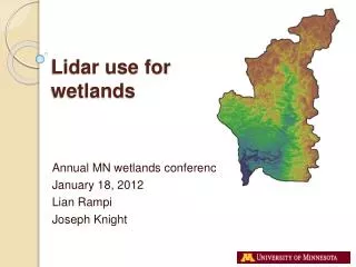
LiDAR: Acquisition Project 2006 • 15 Partners • Led by USGS Ingrid Landgraf • K-State • Wildcat Creek Watershed • Konza Prairie
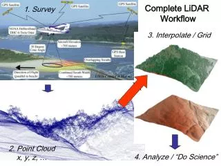
LiDAR: Raw Data • Raw Data: LiDAR LAS Points All Returns 3D Points +/- 1,000,000 per km2 • Capital Building Topeka, KS
LiDAR: Landscape Models • Konza Prairie LTER Site • LiDAR Raw Data Processed with LiDAR Explorer 2.0 ArcScene 9.2 TIN LAS All Returns Illustrating Bare Earth, Vegetation and Structures
LiDAR: Landscape Models • Konza Prairie LTER Site • LiDAR Raw Data Processed with LiDAR Explorer 2.0 NOTE: Lagoons, Utility Poles ArcScene 9.2 TIN LAS All Returns Illustrating Bare Earth, Vegetation and Structures
LiDAR: Structures/Vegetation • LiDAR Raw Data Processed with LiDAR Explorer 2.0 • K-State Campus NOTE: Filter Algorithms for Extracting different Landscape Features ArcScene 9.2 TIN LAS All Returns Illustrating Bare Earth, Vegetation and Structures
LiDAR: Structures • Roof TIN Surfaces ArcScene 9.2 TIN LiDAR Explorer 2.0 Filter for Buildings on LAS data using Building Polygon Boundary for Selection of Points and TIN Boundary
LiDAR: Floodplain Models • 3D River-Stream Channel and Floodplain
LiDAR: Floodplain Models • 3D River-Stream Channel and Floodplain
LiDAR: Flood Prediction Models • 3D River-Stream Channel and Floodplain
LiDAR: Flood Prediction Models Channel Profiles Kansas River Manhattan, KS NED 30m NED 10 m LiDAR • 3D River-Stream Channel and Floodplain
LiDAR: Input to Map2Map Map2Map Flood Inundation Model Inputs: LiDAR data Nexrad Doppler Rainfall Stream Gauge data Hydro Data Model
LiDAR: Aerosol Models • Aerosol Plume Power Plant Lawrence, KS • LiDAR LAS Data Processed with LiDAR Explorer 2.0 NOTE: Filter Algorithms for Extracting different Features ArcScene 9.2 TIN LAS All Returns Illustrating Bare Earth, Vegetation and Structures
Contact: Eric A. Bernard, RLA, ASLA Associate Professor Department of Landscape Architecture Regional and Community Planning Kansas State University 785-532-3944 785-532-6722 fax ebernard@ksu.edu www.growe.ksu.edu www.gis.ksu.edu/ogallala www.k-state.edu/ecoforecasting/