Download
1 / 19
240 likes | 660 Vues
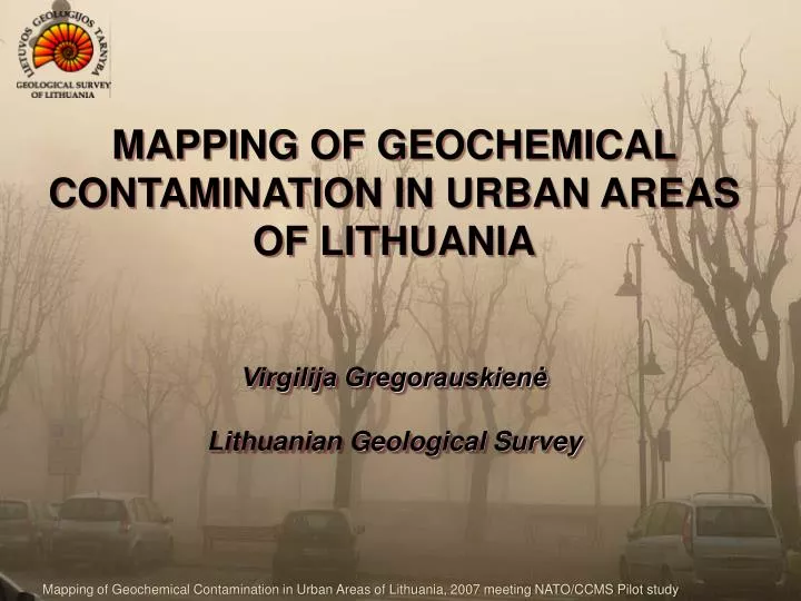
MAPPING OF GEOCHEMICAL C ONTAMINATION IN URBAN AREAS OF LITHUANIA Virgilija Gregorauskienė Lithuanian Geological Survey. M apping of Geochemical Contamination in Urban Areas of Lithuania, 2007 meeting NATO/CCMS Pilot study. OBJECTIVES.

E N D
MAPPING OF GEOCHEMICAL CONTAMINATION IN URBAN AREAS OF LITHUANIAVirgilija GregorauskienėLithuanian Geological Survey Mapping of Geochemical Contamination in Urban Areas of Lithuania, 2007 meeting NATO/CCMS Pilot study
OBJECTIVES • Revelation of spatial geochemical properties of urban soil with regard to distribution of hazardous substances • Sanitary assessment of topsoilcontamination level • Detection of: • contamination sources • its geochemical matrix; • its impact areas • pathways of contamination spread • impact of soil contamination on ground water quality Mapping of Geochemical Contamination in Urban Areas of Lithuania, 2007 meeting NATO/CCMS Pilot study
SAMPLING DESIGN • Spatial topsoil samplinggrid varies: • from 100 m to 500 m, in residentialareas with regard to suspected contamination • from 20 m to 100 m in industrial areas with attempt to collectstatistically significant sample population • Sampling pattern depends on soil sealing pattern, but always is seeking the regular one Mapping of Geochemical Contamination in Urban Areas of Lithuania, 2007 meeting NATO/CCMS Pilot study
SAMPLING DESIGN (2) • Observable suspected hotspots must be sampled • Samples of: • industrialdust from the factory vents and filters (to detect the individual “fingerprints”), • stream & dug well sediments, • vadose zone and • snow (to estimate pathway and area of contamination) are in use if necessary • Follows the standard: ISO 10381-5: 2005 Soil quality – sampling – Guidance on the procedure for the investigation of urban and industrial sites with regard to soil contamination Mapping of Geochemical Contamination in Urban Areas of Lithuania, 2007 meeting NATO/CCMS Pilot study
ANALYTICAL PROCEDURES • Formal procedures: • Total contents of macro- and trace elements ( Al, Ca, Fe, Mg, Ag, B, Ba, Be, Bi, Cd, Ce, Co, Cr, Cu, Ga, Ge, Hf, La, Li, Mn, Mo, Nb, Ni, P, Pb, Sb, Sc, Sn, Sr, Ti, V, W, Y, Yb, Zn, Zr) • LOI, pH • Extra procedures, subject to suspected type of contamination: • Hg, As, other extractable forms (aqua regia, bioavailable) of toxic heavy metals • aromatic hydrocarbons, PAH, oil products • PCB, EOX, pesticides • ions of sulphate, nitrate, fluoride and potassium chloride Mapping of Geochemical Contamination in Urban Areas of Lithuania, 2007 meeting NATO/CCMS Pilot study
ASSESSMENT OF SOILCONTAMINATION LEVEL(according HN 60:2004) • According to criteria: • maximum permissible concentrations (also, reference values related to the background values for sand & sandy loam soil as well as for loam & clay) • risk index K0, calculated by formula • K0=C/MPL, where • C – content of particular element in soil sample (mg/kg) • MPC – maximum permissible concentration of the same element (mg/kg) • index of total contamination Zs, calculated by formula • Zs=ΣKki–(n–1), where • Kki=Ci/Cb, • Ci – measured content of i element-pollutant in soil sample (mg/kg), • Cb – background value of i element-pollutant (mg/kg), • n – number of elements-pollutants, Mapping of Geochemical Contamination in Urban Areas of Lithuania, 2007 meeting NATO/CCMS Pilot study
LINKS between SOILCONTAMINATION and HUMAN HEALTH (HN 60:2004) In residential areas: Mapping of Geochemical Contamination in Urban Areas of Lithuania, 2007 meeting NATO/CCMS Pilot study
LINK between SOILCONTAMINATION and HUMAN HEALTH(2) Methodology developed in 1980-90 in IMGRE, Moskow, Russia by Revich and Saet (Recomendations concerning eco-geochemical assessment of environment in industrial urban areas, 1982: • Methodology certified in 1990-96 in Vilnius, Lithuania during monitoring of environmental pathology: (R. Ptašekas, I. Zurlytė, M. Meilūnas, S. Dapkūnas, D. Stoškuvienė, G. Jonauskas, M. Ramanauskaitė, J. Ptašekas, R. Sabaliauskas, N. Šliachtič. Environmental Pathology of city inhabitants in Lithuania (Aplinkos veikiamų Lietuvos miestų gyventojų patologija) //Ekologija 2004, Nr.3, p. 6 – 16.): • sick’ rate of children neurotoxicosis and alopecia are • related to anomalies of heavy metals in urban topsoil • pregnancy intoxications, premature child birth, • childrenneurotoxicosis, alopecia and tumours are reputed • as eco-genic diseases Mapping of Geochemical Contamination in Urban Areas of Lithuania, 2007 meeting NATO/CCMS Pilot study
ACTIONS inSITES with CONTAMINATED TOPSOIL In residential, recreational and agricultural areas: Mapping of Geochemical Contamination in Urban Areas of Lithuania, 2007 meeting NATO/CCMS Pilot study
GEOCHEMICALY MAPPED URBAN AREAS • Vilnius • Šiauliai • Panevėžys • Alytus • Klaipėda • Mažeikiai • Biržai • Pasvalys • Rokiškis • Radviliškis • Kėdainiai • Kupiškis • Jonava • Joniškis • Trakai • Šilutė Mapping of Geochemical Contamination in Urban Areas of Lithuania, 2007 meeting NATO/CCMS Pilot study
Geochemical soil mapping in Vilniussince 1985: • elaboration and monitoring of geochemical data in whole town • detailed geochemical mapping in industrial Naujamiestis and Žirmūnai districts • assessment of soil contamination level in Šnipiškės district due to the shift of district’ function from industrial-residential to public-administrative • assessment of topsoil sanitary state according the Zs index in residential districts: Old town, Žvėrynas and Antakalnis Mapping of Geochemical Contamination in Urban Areas of Lithuania, 2007 meeting NATO/CCMS Pilot study
Geochemical mapping of Šiauliai town in 1989–1992: • topsoil, lake and stream sediments • main elements-pollutants – Zn, Pb, Cr (leather&footwear), Cu, Ni, Sn, Mo, Ag • anomalies of heavy metals in topsoil reflects historical industrial contamination and allow to identify impact zones of these enterprises • secondary pathways of contamination were found (usage in gardens of contaminated peat from foot-slope of municipal landfill) Mapping of Geochemical Contamination in Urban Areas of Lithuania, 2007 meeting NATO/CCMS Pilot study
Geochemical mapping of Alytus town in 1996–1997: • topsoil & snow • anomalies of heavy metals in topsoil reflects distribution of factories and uncontrolled sanitary landfills • topsoil contamination was observed also in the modern residential suburbs, where sludge from Dalidė lake (former sewage reservoir) was used for soil recultivation • main elements-pollutants – Pb, Ag, Zn, Cu, Sn Mapping of Geochemical Contamination in Urban Areas of Lithuania, 2007 meeting NATO/CCMS Pilot study
Suminio geocheminio rodiklio Zd reikšmės Values of total geochemical index Zs 64-128 32-64 16-32 8-16 4-8 2-4 <2 Zd reikšmės/Values of Zs 2 4 8 16 32 64 128 • Geochemical mapping of Kėdainiaitown in 1989–1992 and revision-monitoring in 1997: • main elements-pollutants – Sr, La, P – waste & emissions of phosphorous fertilizers industry • municipal elements-pollutants - Cu, Zn, Pb, Ag, Sn – typical in urban areas • impact area to soil from JSC “Lifosa” was detected Mapping of Geochemical Contamination in Urban Areas of Lithuania, 2007 meeting NATO/CCMS Pilot study
Geochemical mapping of Mažeikiai town in 1999–2000: • contamination of topsoil (92% of samples) is at the permissible level according the total index of contamination Zs, main element-contaminant – Zn • anomalies of heavy metals were found in the old town, along railway Mapping of Geochemical Contamination in Urban Areas of Lithuania, 2007 meeting NATO/CCMS Pilot study
Assessment of topsoil contamination in towns Panevėžys, Pasvalys, Biržai, Rokiškis, Kupiškis is presented in Geochemical Atlas of Panevėžys County, 2004; • the worst contaminated is Panevėžys town – administrative and industrial seat of County – content of some element in 60% of samples was higher than MPC • dangerous and extremely dangerous contamination was found in industrial areas and close to them; old towns and areas along railways were contaminated at medium dangerous level • main contaminants – Zn, Pb, Cu, Ni, Sn, Ag, V Mapping of Geochemical Contamination in Urban Areas of Lithuania, 2007 meeting NATO/CCMS Pilot study
Assessment of topsoil contamination level at every urban area is carried out in comparable way, i.e. using element contents versusbackground values Background values of elements in soil of various texture (sand, loamy sand, loam, clay, peat), different genesis (glacial, glaciofluvial, glaciolacustrine) and of different administrative districts are published in Geochemical Atlas of Lithuania, 1999 Mapping of Geochemical Contamination in Urban Areas of Lithuania, 2007 meeting NATO/CCMS Pilot study
CONCLUDING REMARKS • Geochemical data of urban soil in Lithuania is circumstantial enough: • geochemically mapped are the main urban areas: • with highest population density, • with the most hazardous pollution sources – enterprises (former and present), • with socially important sites (change of site function, e.g. from industrial or military to residential), • national geochemical data is comparable to the international data due to: • participation in the laboratory intercalibration projects, • participation in the international geochemical projects (BSS, Geochemical Atlas of Europe, NEG) • most of geochemical data is well organized and is kept in DB “Rock Chemistry” of LGT • LGT administers DB of “Pollution Sources”, too • National legislation concerning assessment of soil contamination is developed: • hygiene standards with obligatory limit values of toxic substances (heavy metals, pesticides, hydrocarbons, PAH and PCB) are prepared, • standards valid in topsoil of residential, recreational and agricultural areas • non-valid in industrial areas and subsoil • required actions in contaminated areas at different level often are missed Mapping of Geochemical Contamination in Urban Areas of Lithuania, 2007 meeting NATO/CCMS Pilot study