Download
1 / 40
400 likes | 856 Vues
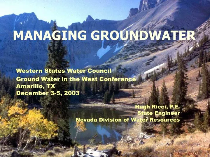
MANAGING GROUNDWATER. Western States Water Council Ground Water in the West Conference Amarillo, TX December 3-5, 2003 Hugh Ricci, P.E. State Engineer Nevada Division of Water Resources. STAFFING. ~80 people in 3 offices – main office in Carson City ~60 engineers/technicians

E N D
MANAGING GROUNDWATER Western States Water Council Ground Water in the West ConferenceAmarillo, TXDecember 3-5, 2003 Hugh Ricci, P.E. State Engineer Nevada Division of Water Resources
STAFFING • ~80 people in 3 offices – main office in Carson City • ~60 engineers/technicians • ~20 clerical/support staff • Seasonal help for water distribution • Hearing Section Chief is an attorney • 2 Deputy Attorneys General
BEAN COUNTING • Receive ~100 applications per month • ~80% of the applications are changes of existing rights • Application No. 70000 was submitted in May 2003 • An additional ~9400 vested and reserved claims
WATER LAW IN NEVADA Prior Appropriation Doctrine • First in time, first in right, • Beneficial use is the limit of the water right, • Use it or lose it vs. Riparian Doctrine
S.E. CRITERIA FOR APPROVING AN APPLICATION • 4 criteria • Water available from proposed source • Does not conflict with existing rights • Cannot prove detrimental to the public interest • Protectible interest in domestic wells - 2001
OTHER IMPORTANT CONCEPTS • Supplemental Rights – two or more rights used together for an intended use. • Comingled Rights – where more than one source, e.g. s.w. and g.w. or g.w. and effluent, are used together simultaneously for an intended use • Preferred Uses – Manner of uses designated as such by the State Engineer, e.g. Municipal, Commercial etc.
DOMESTIC WATER WELLS • A water right application and permit are not required in order to drill a domestic well • Domestic purposes as defined under our statutes extends to culinary and household purposes, in a single family dwelling, the watering of a family garden, lawn and the watering of domestic animals • The maximum daily draught is limited to 1,800 gallons per day (2.02 acre-feet per year)
232 Individual Groundwater Basins of which 119 are Designated or Partially Designated
Perennial Yield • Can be defined as the maximum amount of ground water than can be salvaged each year over the long term without depleting the ground water reservoir
Perennial Yield • Beginning in the early 1950’s, Water Resources and the USGS entered into a series of cooperative agreements whereby the USGS studied every basin and produced a reconnaissance report that estimated the perennial yield of that basin.
Perennial Yield • Original analysis based on the Maxey-Eakin Method using precipitation-elevation data. • New method of analysis is called the ‘PRISM’ Method of determining precipitation. Greater perennial yields have been our experience with this method (2 to 3 times greater).
GROUNDWATER * 1.7 Million Acre – Feet 232 Groundwater Basins EFFLUENT GEOTHERMAL * Perennial Yield of Valley-Fill Reservoirs
How Did the Basins get Overdrafted? • Some were already over appropriated prior to the USGS data available (keep in mind that P.Y’s are as low as 200 acre-feet). • New data changed PY’s • Popular thinking that not all rights would be put to their maximum beneficial use. • In the case of Las Vegas Valley, purposely allowed to overdraft (revocable) with the hope that infrastructure would eventually be in-place to deliver Colorado River water and the over pumping would be curtailed.
How Did the Basins get Overdrafted? • On paper, some basins are ‘over appropriated’ but that may be due to the issuance of supplemental groundwater to existing surface water sources. Only over drafting in drought years. • Additional allocation of the source may be allowed based on the estimated recharge to the basin from irrigation (~30%)
Carson Valley • PY is 45,000 AFA • GW permits total 100,000 AFA • 60,000 AF supplemental to SW (Carson River) • Actual pumpage in drought years is ~29,000 AF and ~20,000 in wet years.
Las Vegas Valley * PY of Las Vegas ValleyDOES NOTinclude secondary recharge from the 300,000 AF of Colorado River brought into the basin.
Las Vegas Valley • Of the pumpage, ~6000 AF are revocable • ~5000 AF are from domestic wells Important to Note: • SNWA Cooperative Water Project (CWP) • Filed 146 applications in 1989 in 27 basins for the appropriation of 180,000 acre-feet of groundwater • Four permits have been granted • Virgin River – 130,000 afa • Garnet and Hidden Valleys – 2200 afa • California Wash – 2500 afa • Remaining 114 applications have over 3,000 protests
Truckee Meadows(Reno/Sparks Area) • PY is 35,000 AFA • Permits issued slightly above PY • Sub-basin Problem • Mt. Rose Fan Area has ~ 18,000 AF appropriated in that one area. • Large concentration of domestic wells. • Only pumping ~4000 AF and experiencing severe declines in the water table.
Mine Dewatering • Groundwater must be pumped in order to mine the ore body at great depths • Consumptive Use + Dewater was ~279,000 ac-ft in 2000
Gold Mining Nevada ranks 3rd in the world in gold production behind Australia and South Africa. Nevada’s gold reserves are over 75% of the total known U.S. Gold resources. April of 2002, Nevada Mining celebrated the production of the 50 millionth troy ounce of gold produced from the Carlin Trend.
Tools • Designate ground water basins • Preferred uses • Allows the State Engineer to impose additional conditions and restrictions on water use e.g. well depths, meters, sanitary seals • A water right permit is required to drill a well (other than domestic) in a designated basin. • Forfeiture and Abandonment • Grant changes of irrigation use for consumptive portion only. • Permit Terms and S.E.’s Orders requiring meters on diversions. • Substitutive uses in the case of mine dewatering. • Exchange of treated effluent for potable water
Tools • T-Finite Term • Conjunctive Use through banking (TMWA) • Recharge • Have the ability to regulate pumping based on priorities • Monitor the Basins • Pumpage inventories • Groundwater level measurements • Public Input
Nevada Salt Lake Utah Las Vegas Arizona
CARBONATE AQUIFER • Approximately 50,000 square miles in extent • The carbonate-rock sequences are believed to contain significant, but undetermined, quantities of ground water. • In 1984, the USGS proposed a 10-year investigation of the entire Carbonate Terrain. • It has been known since 1984 that to arrive at some reasonable understanding of the carbonate-rock aquifer system, substantial amounts of money would be required to develop the science, a significant period of study would be required, and that without some understanding development of ground water from the carbonate-rock aquifer system would be risky and the resultant effects could be detrimental to existing water rights and the environment.
CARBONATE AQUIFER • In 1985, the Nevada Legislature authorized a program for the study and testing of the carbonate-rock aquifer system of eastern and southern Nevada. The program was a cooperative effort between the State of Nevada and the Federal Government. The overall plan for the program was to study the carbonate-rock aquifers of southern, east-central, and northeastern Nevada as separate phases of work, with a summary of findings to be prepared at the end of each phase. A summary report brought together results from more than 20 technical reports produced during the study.
CARBONATE AQUIFER • Investigation of the carbonate-rock aquifer system is additionally complicated by factors including that: • Basic hydrologic data such as ground-water levels in the basin-fill aquifers and the carbonate-rock aquifers, reliable flow measurements for important springs and major streams are scarce or infrequently obtained in much of the area; • Secondary hydrologic and other data, such as hydraulic parameters, geophysical and geochemical, are lacking in many areas; • The geometry, properties, and boundaries of the carbonate-rock and basin-fill reservoirs are generally unknown, and definition of these properties can be expensive and difficult; • Climatic conditions today are inadequately defined (particularly at higher altitudes) and conditions during the development of the flow paths within the deep-rock aquifers and flow paths are even more uncertain;
CARBONATE AQUIFER • Uncertainties and inaccuracies exist in current methods of estimating precipitation; • Uncertainties and inaccuracies exist in current methods of estimating ground-water inflow and recharge; • Uncertainties and inaccuracies exist in current methods of estimating ground-water outflow and evaporative discharge; • Only a small number of wells tap the deep carbonate-rock aquifer system; • Because there has been no significant historical pumping of ground water from the carbonate-rock aquifer system, ground-water models can only be used as a limited predictive tool for estimating the principle location and magnitude of the impacts of pumping ground water from the system; • Limited stresses on the water resources of the area under current development conditions allow hydrologists information only on the narrow band of system responses to natural conditions; and • The relationship between geothermal systems and the deep carbonate-rock aquifers and ground-water flow systems is not well understood.
CARBONATE AQUIFER • S.E. issued Order 1169 on March 8, 2002 • Stated that all applications pending and any new filings for water from the carbonate in the 6 basins in question, will be held in abeyance until further information is obtained by stressing the aquifer by those water right permits already issued from the carbonate. • Ordered a 5-year hydrologic study to be conducted during which at least 50% of the currently permitted water rights (~16,000 acre-feet) are pumped for at least 2 consecutive years. The cost of the study will be paid for by the 5 entities currently pumping from the carbonate aquifer.
CARBONATE AQUIFER • S.E. issued Order 1169 on March 8, 2002 • The S.E. will facilitate meetings between his office and the 5 entities concerning the scope of the study. • Requires each entity to exchange with each other on a quarterly basis, the rate at which water was diverted, total acre-feet diverted per month and monthly water levels measurements. • Within 180 days after the study period, a report must be filed with the S.E. as to the information obtained and any impacts seen to the groundwater or surface water resources of the carbonate or alluvial aquifers. • After the S.E. reviews the report, he will then make a determination as to whether he has sufficient information to proceed with ruling on the pending applications.
Thank You,Questions? http://water.nv.gov