Download
1 / 31

E N D
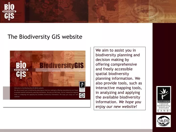
The Biodiversity GIS website We aim to assist you in biodiversity planning and decision making by offering comprehensive and freely accessible spatial biodiversity planning information. We also provide tools, such as interactive mapping tools, in analyzing and applying the available biodiversity information. We hope you enjoy our new website!
Projects • Here you can find • Background information about the project • Any associated reports • Contact information • Online maps • Metadata for layers which make up the maps • Shape files of the layers making up the maps • Direct links to online maps
Reports Maps available with information
Direct access to online map Metadata Zipped shape files
Toggle between legend and layers Map tools and tabs
Information/query tools Navigation tools Markup tools Saving and communication tools Advanced tools • Extract to Excel or GML • Download to Shape • Upload to Shape • Download markups to Shape • Upload GPS way points
Projects added in the last year • DWAF Indigenous Forest Patches • Eastern Cape Biodiversity Conservation Plan • Fine Scale Biodiversity Conservation Plans • Kwazulu Natal Land Cover • Vegetation Map of South Africa • City of Cape Town Biodiversity Network • Ekapa Youth GIS and Urban Nature • List of Threatened Ecosystems for South Africa
Map information Online map
Services • Here you can find the following tools • Municipality Biodiversity Plan Index • Species Distribution Mapping • Land Use Decision Support • Tutorials on: • Online mapping system • GIS introduction • Using GPS • Useful links
Municipality Biodiversity Plan Index Species Distribution Mapping Land Use Decision Support