Download
1 / 23
240 likes | 450 Vues
Photo-based Data Collection From field data collection to final reports. GeoSpatial Experts, Inc . Founded in 2001 World leader in photo mapping software for business.

E N D
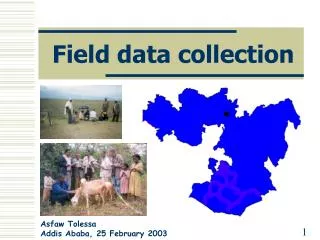
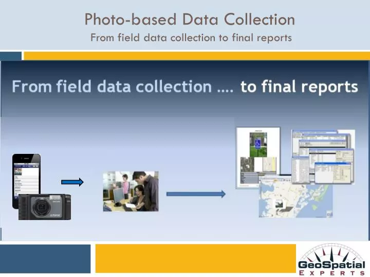
Photo-based Data Collection From field data collection to final reports
GeoSpatial Experts, Inc. • Founded in 2001 • World leader in photo mapping software for business. • GPS-Photo Link, introduced in 2002, has provided the most advanced photo mapping, attribute mapping, and photo-based data editing capabilities available. • GeoJot, introduced in 2011, pioneered the use of smartphones and tablets for field photo-based data collection and automated transfer. • GeoJot+ , introduced in 2012, and based on both GPS-Photo Link and GeoJot provides an integrated solution from field data collection to final reports.
Photo-based Compliance Management Assessment, Action Planning, Proof of Performance
Mapped photos help solve business problems: • Speed mandated compliance milestones • Provide mission critical information • Provide visual, complete, accurate information • Provide time sensitive, actionable information • Speed revenue & cash flow • Improve staff effectiveness • Meet project deadlines • Reduce project expenses
Field Photo / Data Collection • A complete asset identification system: • Photographs • Barcodes • Descriptive Attributes • Data QA/QC • Mapped locations and reports • Input into Database
Photo Attribute Collection: Municipal Sign Inventory Extensive data captured for each mapped photo Attribute Attribute Value
Photo-based ComplianceSituation Assessment Attribute Attribute Value
Photo Attribute Collection Preliminary Damage Assessment (PDA) Photo Attribute Attribute value
End User Output: Watermarked photos Values Watermarked on Photos Attribute Attribute Value
GeoJot+ Core: Standard Reports • Reports • Photos • Data • Maps
GeoJot+ Core: Condensed Sheet Reports Reports with photos, data, & maps
End user Output: RDBMS & Systems Integration • Database-ready data for:Oracle, SQL Server, IBM DB2, MS Access. • Photo-data ready for enterprise systems: SAP, asset management, ESRI Enterprise GeoDatabase,IBM Maximo
GeoJot+ Core: Output for Every User Need • Watermarked Photos • Web Pages • ArcGIS Shape Files & Geodatabases • ArcGIS Explorer files • Google Earth files • RDBMS files • Management & Client Reports
Create attribute lists on the desktop using the GeoJot+ Core: List Editor
GeoSpatial Experts, Inc. • Founded in 2001 • World leader in photo mapping software for business. • GPS-Photo Link, introduced in 2002, has provided the most advanced photo mapping, attribute mapping, and photo-based data editing capabilities available. • GeoJot, introduced in 2011, pioneered the use of smartphones and tablets for field photo-based data collection and automated transfer. • GeoJot+ , introduced in 2012, and based on both GPS-Photo Link and GeoJot provides an integrated solution from field data collection to final reports.
Contact Infomation John Clark Director, Business Development John.Clark@GeoSpatialExperts.com office: 303 255.2908 cell: 720 431.8550