Download
1 / 40
450 likes | 715 Vues
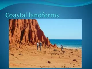
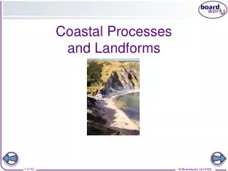
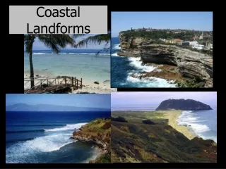
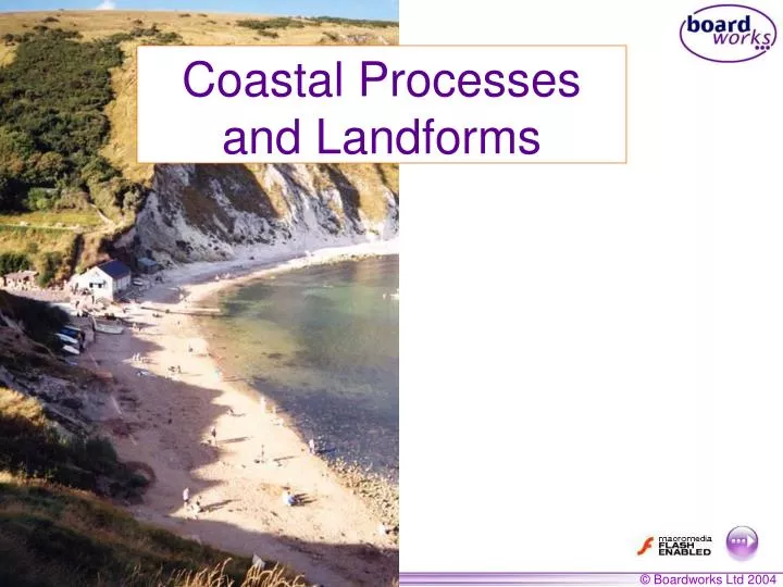
Coastal Processes and Landforms . Why are waves generally larger in the south west than in the south east?. Wave energy depends on the fetch , the strength of the wind and the length of time over which the wind has blown. fetch = the distance over which the wind has blown.

E N D
Why are waves generally larger in the south west than in the south east? Wave energy depends on the fetch, the strength of the wind and the length of time over which the wind has blown. fetch = the distance over which the wind has blown Look at an atlas or a wall map to find out the largest fetch around the British Isles.
Why do waves break? wavelength the bottom of the wave touches the sand, slows down and the top of the wave topples over
Swash and backwash Backwash Swash Note: Backwash is always at right angles to the beach
Waves can be destructive or constructive. When a wave breaks, water is washed up the beach - this is called the swash. Then the water runs back down the beach - this is called the backwash. With a constructive wave, the swash is stronger than the backwash. With a destructive wave, the backwash is stronger than the swash.
Types of waves Backwash stronger than swash Destructive Waves Swash stronger than backwash Constructive Waves
Processes of erosion Corrosion Hydraulic action Processes of erosion Abrasion Attrition
Attrition Material carried by the waves bump into each other and so are smoothed and broken down into smaller particles. Hydraulic action This process involves the force of water against the coast. The waves enter cracks (faults) in the coastline and compress the air within the crack. When the wave retreats, the air in the crack expands quickly causing a minor explosion. This process is repeated continuously. Corrosion This is the chemical action of sea water. The acids in the salt water slowly dissolve rocks on the coast. Limestone and chalk are particularly prone to this process. Abrasion/Corrasion This is the process by which the coast is worn down by material carried by the waves. Waves throw these particles against the rock, sometimes at high velocity.
Landforms of coastal erosion 1) Headlands and Bays 2) Cliffs and Wave Cut Platforms 3) Caves, Arches, Stacks and Stumps
An example of headlands and bays on the Dorset coastline… chalk clay Swanage Bay limestone
Wave-cut platform The waves attack the base of the cliff through the processes of abrasion, corrosion, hydraulic action and attrition. Over time the cliff will be undercut and a wave-cut notch is formed. Eventually the cliff becomes unstable and collapses. Further cliff retreat will form a wave-cut platform.
Caves, arches, stacks and stumps Match the image with the most appropriate label. A B C D 1 3 2 4 1. The waves erode FAULTS (cracks) in the headland. 2. The waves eventually erode through the headland to form an ARCH. 3. The arch becomes unsupported and collapses to form a STACK. 4. A STUMP is formed from the collapsed stack.
If these photos were taken of one headland over time, which of these landforms would be the first to be formed?
Longshore drift Direction of movement Backwash is always at right angles to the beach swash Backwash This movement of sediment along the coastline is calledlongshore drift.
Landforms of coastal deposition • Beaches • Spits • Tombolos and Bars
Spit formation Why is the spit curved? The wind direction changes and moves the spit inland. In storm conditions the spit may be breached. Why doesn’t the spit grow across the estuary to form a bar? The river’s current stops deposition across the estuary.
Tombolos and bars The mainland is joined to the Isle of Portland. If a spit joins the mainland to an island it is called a tombolo. This diagram show the tombolo – Chesil Beach.
Chesil beach Chesil Beach Isle of Portland
Tombolos and bars If a spit joins one part of the mainland to another it is called a bar. For example, there is a bar at Orford Ness in Devon.
Human Intervention Humans are affected by the retreat of the cliff (loss of land, housing, etc.) They erect sea defences which stop the erosion (groynes).
How do groynes work? Groynes trap the sand which is carried along the coast by longshore drift. The sand acts as a natural protection against the force of the waves. The waves break on the beach and not the cliffs.
c) Points for Groynes construction: • It protects the coastline and preserves peoples: property • Groynes encourage a beach to grow which can help tourism and bring money to the area • Against: Groynes • Looks very ugly • Very expensive to build • No guarantee it will last forever • Some people suffer if groynes are built and sediment is trapped . • Divide the beach up into unnatural sections
Explain the processes that have caused this cliff to collapse. C C
8 Coastal Landscapes and Processes (a) Study Figure 12a, on the insert, a photograph of Flam borough Head on the east coast of England. Figure 12b is a sketch of the photograph. Figure 12b (i) On Figure 12b, mark with an arrow and label three coastal features shown in Figure 12a.
Ans 4) Headlands and Bays form along DISCORDANT coastlines where rocks outcrop at 90o to the coast 2. Here there are alternate bands of resistant and less resistant rock 3. Where there is soft rock (e.g. clay), erosion is rapid - and bays are formed (indent in coastline) 4. Where there is more resistant rock (e.g. chalk), erosion is much slower -headlands are formed as the harder rock is left sticking out into the sea 5. Exposed headlands then become vulnerable to destructive waves but help to shelter neighbouring bays. Bays and Headlands
d)What is a spit formation? SPIT = is a hooked shaped landform which typically runs along a coastline formed where a river estuary meets the coast. It is formed by the process of Longshore Drift bringing material along the coastline in a zig-zag fashion. A saltmarsh often forms behind the spit as the sediment can build up here in shallower waters.
Key Ideas Waves are the result of the wind blowing over the sea. They break as they approach land. Swash and backwash describe the movement of a wave on the beach. Fetch is the distance that the wind has travelled. Sub-aerial processes such as weathering and mass movement occur on the cliff face. Coastal processes of erosion include hydraulic action, attrition, corrosion and solution. Landforms created by erosion include headlands and bays, caves, arches, stacks and stumps. Longshore drift is a method of coastal transport. Landforms created by deposition include beaches, spits, tombolos and bars.