Download
1 / 19
190 likes | 472 Vues
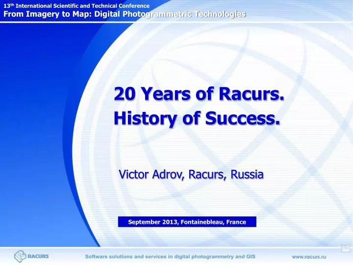
20 Years of Racurs. History of Success. 13 th International Scientific and Technical Conference From Imagery to Map: Digital Photogrammetric Technologies. Victor Adrov, Racurs, Russia. September 20 13 , Fontainebleau, France. RACURS & PHOTOMOD.

E N D
20 Years of Racurs. History of Success. 13th International Scientific and Technical Conference From Imagery to Map: Digital Photogrammetric Technologies Victor Adrov, Racurs, Russia September 2013, Fontainebleau, France
RACURS & PHOTOMOD Racurs company's business mission is to provide the world-wide geospatial community with advanced and cost-effective digital photogrammetry solutions and services for creation of wide range of output products from the available remote sensing data. 1993 –Racurs Company foundation 1994 −selling of the first commercial license of DPS PHOTOMOD 2000 – creation of the Production Department 2004 – first distribution of space remote sensing data 2009 – newPHOTOMOD 5.* platform Scope of activity: Development of DPSPHOTOMOD and its promotion on the world-wide market Promotion of supplementary Geoinformatics software products Satellite imagery distribution Production of photogrammetric service
RACURS milestones: 1993-1996. Trademarks. 1993. Racurs company foundation 1995. ISPRS workshop in Russia. First public mentioning of PHOTOMOD name
RACURS milestones: 1993-1996. First partners and clients 1993. Participation in the 1st Forum on Exchange of Technologies between East and West, France. Partnership with Continental HighTech Services (France). 1995. 1st PHOTOMOD license was sold in Russia to SurgutNIPINeft 1996. 1st Dealership Agreement for PHOTOMOD was signed with company PROGIS (Austria) “...during PHOTOMOD practical applications we gained an insight into its great potential for both amateurish and professional use and clear advantages over other known PC-oriented products in respect of possible operations with DTM and the degree of automatization of main photogrammetric procedures.” (PROGIS Seminar, February 1996, Austria)
RACURS milestones: 1993-1996. PHOTOMOD structure 1996. PHOTOMOD, version 1.5 PHOTOMOD - main module for interior/relative/absolute orientation of stereopair, reference data input, 3D measurements; PHOTOMOD DTM - automatic DTM generation and edition, orthorectification, contour lines; PHOTOMOD VectOr - creation, edition and export of vector lines; PHOTOMOD StereoDraw - creation, edition and export of vector lines in stereo mode. PHOTOMOD ScanCorrect - additional module for compensation of geometric inaccuracy of flatbed scanners PHOTOMOD main module PHOTOMOD DTM module PHOTOMOD StereoDraw module Terrestrial imagery processing PHOTOMOD VectOr module
History of PHOTOMOD development 1993Company RACURS foundation. 1994 First commercial version. Single pair orientation, stereo display, correlation based image matching. 1995Official registration of PHOTOMOD software. PHOTOMOD DTM: TIN, DEM, contours and orthophoto generation, PHOTOMOD VectOr: monoplotting over orthophoto. 1996 PHOTOMOD StereoDraw: On-screen 3D stereo plotting. First international distributors. 1997PHOTOMOD trade mark registration. PHOTOMOD ScanCorrect: Desktop scanners calibration. PHOTOMOD system is certified by State Land Use Committee of Russian Federation. 1998 On-line 3D features coding. RACURS Co. becomes a sustaining member of ISPRS. 1999 Versions 2.*. PHOTOMOD AT: aerial triangulation and block adjustment. New PHOTOMOD VectOr module. 2000 Further development: graphic interface for adjustment results analysis, compressed images processing, etc. New web site www.racurs.ru. 2001 Version 3.0. Distributed network projects, pushbroom scanner images processing, etc. 2002 Version 3.11. Automatic interior orientation, new PHOTOMOD Mosaic module. 2003 Version 3.5. Network ideology, development of block processing approach. 2004 Version 3.6. Editing tie points in many windows. QuickBird, EROS, SPOT 5 support etc. 2005 Version 3.8. PHOTOMOD GeoMosaic for external images processing. 2006 Versions 4.0-4.2. Fully automated tie points measurements. Stereoblocks and monoblocks. 2007 Version 4.3 Bundle adjustment. Support of Kompsat 2 and ADS 40. Fast TIN creation algorithm. New pan-sharpening algorithms. Satellite images in GeoMosaic. 2008 Version 4.4 Field Survey module. GPS support. 3D objects while exporting to AutoCAD. Satellite images in PHOTOMOD StereoLink. 2009 Version 5.0. New level of automation and productivity. 2010-2012 Versions 5.*. “Dense” DTM, GPGPU technology support, distributed processing, 3D-Mod module, VisionMap A3 project processing,Canopus-B, Pleiades, etc modern satellite imagery processing. 2013 PHOTOMOD Conveyor, new methods of 3D models creation, more automation.
Hands-off processes in PHOTOMOD software DTM extraction and filtering Orthomosaic seam lines and color balancing Block layout Phototriangulation
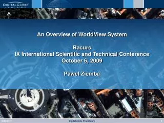
2004 2001 Processing of satellite imagery in PHOTOMOD 2010 -… Full support of new satellites sensors – 1 month before/after launching 2009 PHOTOMOD supports PHOTOMOD doesn’t support
PHOTOMOD in the world PHOTOMOD users –600+companies in the world, 300+ - in Russia Workplaces – 6000+ PHOTOMOD is used in 70countries
PHOTOMOD distributors GeoInfo Services /Malaysia Parnas / Latvia CiS GmbH / Germany SmartSpatio Technologies /China GISINFO / Ukraine Geodis BRNO / Chech Rep. Acuvec / Canada InfoMap d.o.o. / Serbia & BIH SIGMAGEO/ Portugal/ Spain MapWorld Technologies/ India Galantis / USA EUROBIT / Italy Geosatelites / Nicaragua WorkvisionScientekCorp. / Taiwan Yanniris Yannis / Greece Paksoy Teknik / Turkey Nama Pardaz Rayaneh / Iran GIS-Sofia Ltd. /Bulgaria Geomatica Ingenieria / Colombia Simon Kaplo Engineering / Syria MediaData Communication/ Indonesia Chan Chau Co. / Vietnam Navayuga Middle East / U.A.E. Geokoncept / Ecuador Hayson Geospatial / Australia GPS Agrimensora / Brazil
PHOTOMOD development. Automated dense 3D models www.racurs.ru
PHOTOMOD Conveyor. Distributed processing Joint product:RACURSand СТТ Group (Russia) • Preconditions for the development of highly- efficient conveyor system for orthomosaics creation: • Choice of the most required final product of photogrammetric processing of the remote space data • Creation of a technology focusing on one final product (orthomosaics) and giving up the universality • Experience in application of complete automation of basic photogrammetric operations • Experience in realization of the efficient distributed processing focused on the computational clusters • Development of hardware and software • Offer to the customers of the optimized total solution that includes software and special hardware Productivity of the system on specialized hybrid computational cluster: close to 1000 000 sq kmorthmosaics of highly-qualityper 24 hoursbased on SVHR satellite sensors data • Input data: • Satellite images withRPC coefficients • DTMs • Output data: • Seamless orthomosaic • Orthophoto sheets Complete automation of the operations
Photogrammetric works in Racurs company Photogrammetric service for clients was launched in 2000. Production department has completed tens commercial photogrammetric projects by orders of Russian and foreign companies. This experience is taken into account in PHOTOMOD software development. Example of one project done in Racurs. BD Topo Project (France).Topographic database creation (2005-2006) Camera Focal length =153.972 mm Scanning resolution - 28 microns Classifier - 133 codes Required accuracy of 3D feature extraction: 1 m Made in RACURS: 25 blocks of aerial images, total area ~ 25000 km2
Racurs conferences. History Sites of holding: 2001. Irkutsk, Russia 2002. St. Petersburg, Russia 2003. Golitcino, Russia 2004. Minsk, Belarus 2005. Jurmala, Latvia 2006. Becici,Montenegro 2007. Nessebar, Bulgaria 2008. Porec, Croatia 2009. Attica, Greece 2010. Gaeta, Italy 2011. Tossa de Mar, Spain 2012. Algarve, Portugal 2013. Fontainebleau, France