Download
1 / 40

E N D
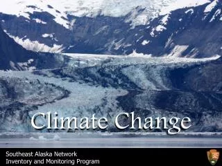
Climate change Features and factors
RADIATIVE FORCING In climate science, radiative forcing is loosely defined as the change in net irradiance at atmospheric boundaries between different layers of the atmosphere, namely the troposphere and the stratosphere (the tropopause). Net irradiance is the difference between the incoming radiation energy and the outgoing radiation energy in a given climate system and is measured in Watts per square meter. The change is computed based on "unperturbed" values, defined by the Intergovernmental Panel on Climate Change (IPCC) as the measured difference relative to a base period. For radiativeforcings for the industrial era, it is customary to take the year 1750 as the starting point. A positive forcing (more incoming energy) tends to warm the system, while a negative forcing (more outgoing energy) tends to cool it. Possible sources of radiative forcing are changes in insolation (incident solar radiation), or the effects of variations in the amount of radiatively active gases and aerosols present. Because the IPCC regularly assesses the radiative forcing, it also has a more specific technical definition - see "IPCC usage" section.
Australia temperature trend Australian mean temperatures are calculated from a country-wide network of about 100 high-quality, mostly rural, observing stations. The Bureau of Meteorology has undertaken extensive data rehabilitation to ensure that the temperature records from these sites have not been compromised by changes in site location, exposure or instrumentation over time.
Climate change projections What will happen in the future is often based on trends from the past. Projections are based on probability and climate modelling. Projected outcomes
The Heat or Energy Budget & Greenhouse effect Global Atmospheric Circulation Water • What are the mechanics of the systems? • Whare are the spatial and temporal variations in the systems? • How do these relate to climate change? Land The climate system Air The four main natural systems associated with the climate system Life The Sun The Carbon Cycle The Hydrological Cycle
The Carbon Cycle • Characteristics of the cycle • Spatial/Time Variations – Carbon storages or sinks and carbon exchanges or fluxes, seasonal and annual rates of change. • Imbalances between the sources and sinks within the cycle. • Anthropogenic carbon sources.
Anthropogenic carbon outputFrom WWW.GAPMINDER.ORG United States Australia Russia China India
Anthropogenic Carbon According to IPCC’s Third Assessment Report: • ‘There is new and stronger evidence that most of the warming observed over the past 50 years is attributable to human activities. • Human influences are expected to continue to change atmospheric composition throughout the 21st century.’ The greenhouse gas making the largest contribution from human activities is carbon dioxide (CO2). It is released by burning fossil fuels and biomass as a fuel; from the burning, for example, of forests during land clearance; and by certain industrial and resource extraction processes. • ‘Emissions of CO2 due to fossil fuel burning are virtually certain to be the dominant influence on the trends in atmospheric CO2 concentration during the 21st century. • Global average temperatures and sea level are projected to rise under all (…) scenarios.’
Atmospheric circulation • Characteristics of global circulation • Spatial/time Variations – Location of high and low pressure systems. Prevailing winds and seasonal movements in wind and pressure systems. • Changes associated with climate cycles and climate change.
Ice ages and warm periods Identify and describe a period or periods in the Earth’s past history when climates were much colder than they are today. Include information on the patterns of precipitation and temperature during this period and the types of climatic conditions experienced by different regions.
It is a long-term change in the climate system • It is a shift (trend) in the characteristics of the heat budget, atmospheric circulation, the carbon cycle and the hydrological cycle. • It is evidence of past climates and their changes. • It is projected future changes in the climate system based on the use of trends and modelling.
Climate cycles and Oscillations • They include el nino/la nina, Pacific decadal cycle, Indian Ocean Dipole, North Atlantic oscillation. • They vary from positive to negative phases which means above or below average rainfall for the affected regions. For example the la nina phase is when the SOI is positive and above average rain across northern and eastern Australia is predicted. • They are driven by changes in air pressure patterns and changes in ocean temperatures. • An increase in the frequency or intensity of the cycle is an indicator of climate change. • The cycles themselves are indicators of longer term climate variability whereas seasonal variations are short term variations. • It is important to distinguish between climate variability and climate change.
El Nino La Nina 2006-2007 was a prolonged drought across Eastern Australia The SOI is a measure of air pressure over the Pacific Ocean. Positive phases in the index indicate the La Nina Phase. Negative phases are associated with El Nino. La Nina is the normal or above average rainfall period for Northern and Eastern Australia.
Human impacts and actions Enhanced greenhouse effect
Does this map show the impact of climate change on sustainability of agriculture?
General impacts of climate change explain the impact of climate change upon spatial patterns in the natural and cultural environments In this chart we see the application of scenarios to the issue of climate change. Potentially this syllabus point could include projected as well as current impacts
Now its time to ask the questions http://webarchive.nationalarchives.gov.uk/20100623194820/http://www.actoncopenhagen.decc.gov.uk/content/en/embeds/flash/4-degrees-large-map-final http://www.climatechange.gov.au/climate-change/myths/science.aspx