Download
1 / 54
550 likes | 708 Vues
Frascati meeting. July 4-5th, 2011 Barcelona Joan.Maso@uab.cat. Frascati. A 2 days event. Objectives. Define/Refine the requirements (WP2) Quality Elicitation and Encoding (WP3.1+WP6.1) Define/Refine the Pilot Cases (WP7) Review other WP to give to this 3 teams some context.

E N D
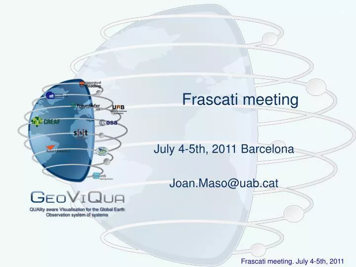
Frascati meeting July 4-5th, 2011 Barcelona Joan.Maso@uab.cat QUAlity aware VIsualisation for the Global Earth Observation system of systems
Frascati Frascati meeting. July 4-5th, 2011
A 2 days event. Objectives • Define/Refine the requirements (WP2) • Quality Elicitation and Encoding (WP3.1+WP6.1) • Define/Refine the Pilot Cases (WP7) • Review other WP to give to this 3 teams some context Frascati meeting. July 4-5th, 2011
A 2 days event. Timeline • July 4th: Opening plenary • GEOLabel • Requirements plenary • Split sessions introduction • Social dinner • July 5th, Morning: Split sessions • Requirements for data quality visualization (WP2) • Pilot case studies (WP7) • Quality Elicitation and Encoding (WP3.1+WP6.1) • July 5th, Afternoon: Closing Plenary • Summary of the spit sessions with focus on requirements • Future plans for search (WP4) and visualization (WP5) • Dissemination activities (WP8) Frascati meeting. July 4-5th, 2011
A 2 days event. Detailed timeline • July 4th: Opening plenary • Welcome • Introduction of new participants (15') • Core WP description and GeoLabel (1h) • Miscellanea topics (15') • Requirements plenary (1h) • Split sessions introduction (30m) • Social dinner • July 5th, Morning: Split sessions • Requirements for data quality visualization (WP2) (4h) • Pilot case studies (WP7) (1:30h) • Quality Elicitation and Encoding (WP3.1+WP6.1) (1h) • July 5th, Afternoon: Closing Plenary • Motions to the PTB (15') • Requirements for data quality visualization WP2 (60'). Summary of split session and much more • Quality Elicitation and Encoding WP3.1+WP6.1 (15'). Summary of split session • Pilot case studies WP7 (15'). Summary of split session • Future plans for WP4: Enhanced geo-search components (15'). • Future plans for WP5: Quality aware visualization components (15'). • Dissemination activities (past and future) (WP8) (15'). • AOB Frascati meeting. July 4-5th, 2011
Agenda last minute items • The agenda for today: • http://twiki.geoviqua.org/twiki/bin/view/ GeoViQuaIntranet / PTBMeeting02 • Is there any last minute items to be included in the agenda? • Who is taking minutes? Frascati meeting. July 4-5th, 2011
Introductory comments and motivation. July 4-5th, 2011 Barcelona Joan.Maso@uab.cat QUAlity aware VIsualisation for the Global Earth Observation system of systems
Problems with the use of spatial data Quality is important. Purchasing costs and reuse are not so important. Frascati meeting. July 4-5th, 2011
Effects of the problems • Problems in converting or integrating data increases uncertainties. Frascati meeting. July 4-5th, 2011
Pick the one with better quality Frascati meeting. July 4-5th, 2011
Swedish Technology Journal • “Short wheelbase and minimal overhang at the front and rear, combined with high ground clearance makes it extremely well suited to continue the drive where the road ends. Indeed the … …Niva outperformthe Porsche Cayenne, which in comparison is clumsy as an elephant with a backpack in a supermarket”. • (Teknikens värld, 2006) Comment: • “If it is the terrain capabilities that is evaluated, the Niva fulfils the quality requirements better than the Porsche.” Frascati meeting. July 4-5th, 2011
Sentinel 3, big quality images, netCDF • Soon there will be availability of synthetic Sentinel 3 imagery. Each image/pass will be ~100Gb big. ESA SAFE format that is a folder with several netCDF files. Quality information by pixel introduces an problem: huge qualityinformation set. • Possible dataset in a pilot case? Jon… http://www.resc.rdg.ac.uk/trac/ncWMS/ Frascati meeting. July 4-5th, 2011
MERMAID • MERMAID, • MERis • MAtchup • In-situ • Database • Complement MERIS with in-situ sensors and some quality flags to filter. • Possible dataset in a pilot case? Veronica… http://hermes.acri.fr/mermaid/home/home.php Frascati meeting. July 4-5th, 2011
Google Earth Engine is not the same as the Google Earth Desktop and Browser Viewer 1,000-machine remote sensing processing cloud or more. Largest geospatial platform ever created Google is loading ALL Landsat and MODIS data into the system with other sets coming in the future So far access has only been granted to 4 scientific teams worldwide (January 2011) Unscientific benchmark: a 15,000 hour job completed in less than 24 hours Is this the opportunity to collaborate with Google that Veronica has been looking for? Could we generate a pilot case in the cloud with this huge dataset? This topic was in the initial call Google Earth Engine • 14 Frascati meeting. July 4-5th, 2011
SSES: Standard in SST • SSES (Single Sensor Error Statistics) • Defines principles that need to be based on quantitative analysis and be documented • Compliant with QA4EO. Derivation of quality indicator (i.e.SSES) to be traceable, i.e. documented and available. But… need common reference. includes QC of reference data • SSES are to provide users with a common uncertainty estimate in comparison to the agreed reference source • SSTs should be the best estimate prior to SSES production. Responsibility of the SST producer • SSES are for users NOT for producers • Content: • A bias (not a correction term) and a standard deviation reflecting the local accuracy (at pixel) of the SST estimate. Application of SSES is consistent with the product definition (skin; sub-skin) • Could we participate in this initiative? We could do that at several levels in WP3, WP5, WP7. Who want to lead this? https://www.ghrsst.org/ghrsst-science/science-team-groups/stval-wg/sses-common-principles/ Frascati meeting. July 4-5th, 2011
Extraction from categorical variables Metadata extraction Best practices quality encoding Direct extraction from continuous variables User feedback Quality elicitation Validation Mobile Solutions Search & Visualization Prototypes Start Quality recommendations Data ready Quality parameterization Pilot cases User & technical requirements to CoP User & technical solutions to CoP Workshops GeoLabel Proposals evaluation Final document Time is running. Clock is ticking December 2013 February 2011 January 2012 January 2013 2014 Frascati meeting. July 4-5th, 2011
Project general structure Joan Masó (CREAF) QUAlity aware VIsualisation for the Global Earth Observation system of systems
Quality Elicitation C R O S S S B A Dissemination Communitybuilding Geo-search Validation Pilot case studies Visualisation Standards GEO S&T Label The aim GeoViQua will provide a set of scientifically developed software components and services that facilitate the creation, search and visualization of quality informationon EO data integrated and validated in the GEOSS Common Infrastructure. Frascati meeting. July 4-5th, 2011
Project objectives • 1. Provision of innovative tools to enhance the current infrastructure capability. • GeoViQua’s major technical innovation is search and visualization tools for the community which communicate and exploit data quality information from GEOSS catalogues. • 2. Development of the GEOLabel. • GEOLabel requirements are identified (Work Package WP2), integrated with components (WP6), validated and applied into pilot cases (WP7), and disseminated to the community (WP8). It will be completed in collaboration with the GEO task ST-09-02. • 3. Harmonization, exploitation and dissemination of project outputs. • A careful validation process is conducted in collaboration with a number of communities of practice and standards committees to ensure that the project contributes effectively to the GCI architecture. Collaboration to AIP will be continuous. Frascati meeting. July 4-5th, 2011
GEO Label This is a GEOSS project!!! Frascati meeting. July 4-5th, 2011
Elicit from metadata Elicit from provenance Quantify (CAL/VAL, in situ) User feedback Standard encoding Quality vocabularies Elicitation derivation Encoding Link to data Embed in data Quality visualisation Quality based search GEO Web Portals and mobile devices Search and Visualisation Embedding and linking GEO Label The role of quality • Quality information based on metadata and provenance information describing the processing and quality control applied to data. • Quality information also based on quantitative assessment of the uncertainty associated to data (QA4EO): Develop the GEOLabel. • Quality information based on user feedback related to user view of data utility in the form of subjective qualitative statements and reviewing mechanisms. Frascati meeting. July 4-5th, 2011
From GEOSS-Centrism to User-Centrism Delivery of solutions to end users • Enhanced geo-search tools • Quality-aware catalogue service • Quality-aware catalogue client • Quality aware visualisation components • Integrate of quality information • Show the quality information • Not only for GEOPortal and GCI. • Generic quality methodologies for GIS and RS • Components for map browsers, virtual globes, GIS and RS Data quality elicitation mechanism Enhanced geo-search tools Quality aware visualisation tools Dissemination and Capacity Building Frascati meeting. July 4-5th, 2011
Work Packages WP1: Project management Components WP3: Data quality elicitation mechanism WP8: Dissemination and Capacity Building WP6: Delivery of solutions to end users WP2: Requirements for data quality visualisation WP4: Enhanced geo-search tools WP5: Quality aware visualisation tools Constrained by harmonised by validated in limits WP7: Pilot case studies Frascati meeting. July 4-5th, 2011
Miscellanea topics QUAlity aware VIsualisation for the Global Earth Observation system of systems
JSTARS Especial Issue participation • Special Issue of IEEE J-STARS on Interoperability architectures and arrangements for multi-disciplinary Earth Observation systems and applications • Papers are solicited for a Special Issue of IEEE J-STARS on Interoperability architectures and arrangements for multi-disciplinary Earth Observation systems and applications. • The papers considered for this special issue will address recent breakthroughs in science and technology useful for implementing multi-disciplinary interoperability. Papers are being solicited in (but not limited to) the following areas: • Comprehensive and inclusive solutions for multi-disciplinary Earth Observation capabilities, addressing: • The System of Systems approach for Earth Observation resources cooperation; • Multi-disciplinary Interoperability Arrangements for Earth Observation resource (data and services) discovery, access, processing, and use; the service-oriented science; • Multi-disciplinary Interoperability Arrangements for cooperation between environmental models, model-based systems, and Earth Observation sensors; • The GEOSS “Model Web” approach. • The benefits and outcomes of holistic approaches and multi-disciplinary advances for important Societal Benefit Areas, including: • Climate; Biodiversity; Ecosystems; Water; Drought; Agriculture; Health; Weather; Disasters. • Multi-disciplinary initiatives or pilots developing operational frameworks by applying interoperability arrangements and SoS? solutions for Earth Observation resources. • GEOSS Common Infrastructure (GCI) and Architecture Implementation Pilots (AIP), WMO Information Systems (WIS), National and International Spatial Data Infrastructure initiatives e.g. INSPIRE, the Global Monitoring for Environment and Security (GMES) initiative, CEOS infrastructure. • Manuscript submission deadline: Extended: 1 Octuber 2011 • More info at: http://www.grss-ieee.org/wp-content/uploads/2011/04/Call-for-Papers-newJ-STARS_April2011.pdf • Internal suggestion can be shared at: • http://twiki.grumets.uab.es/twiki/bin/view/GeoViQua/JSTARSSpecialIssue Frascati meeting. July 4-5th, 2011
AIP4 Participation • We have been reconsidering our participation on the AIP4 after knowing the new approach of AIP4, completely focus on providing real data to GEOSS and some tutorials to do that. It is part of a bigger recommendation that comes from ADC and it is so called "sprint to plenary": Let's populate GEOSS infrastructure before the next GEO plenary (in November if I remember correctly). • Finally respond to the call with coordinated effort to produce a tutorial on data quality. The team is formed by GeoViQua, QA4EO and ESIP IQ cluster. • Currently this means: CREAF (Joan Masó), ASTON (Dan Cornford) and NASA (Gregory Leptoukh) with Veronica Guidetti (as an observer) • An small team is enough to keep contact with AIP4 and wait to a new AIP5 where our project can contribute in a clearer way. • Our response was the second to be received. Now ~20 • You can join the group and contribute • http://twiki.grumets.uab.es/twiki/bin/view/Quality/AIP4QualityTutorial • http://collabedit.com/npbat Frascati meeting. July 4-5th, 2011
AIP4 Participation • 1. Motivation • 1.1 What is data quality? • 1.2 What are the benefits of providing data quality? • traceability • subsequent processing (discuss L0->L1->L2 ... ->L4) and decision making • data integration • 2. A producer view on data quality • 2.1 What elements of data quality are most useful to what sort of users • review use requirements from GeoViQua and beyond • - maybe incorporate QA4EO workshop feedback • (at the last minute - aim to the present the tutorial at the QA4EO meeting 18-20 Oct 2011) • ISO19115 and all that, including some shortcomings • 2.2 How to produce useful data quality information, with a focus on accuracy • basics of measurement uncertainty, QA4EO • how to think about reality, how to define it, statistical measures of data quality • what tools are available to create quantitative data quality information - statistical methods • links to Cal/Val and the need to continuously monitor data quality • statistical validation of quantitative measures • 2.3 How to encode data quality information • existing methods: • ISO19139 (XML implementation of metadata) in practice. • other quality representations (ISO 19157), Dublin Core, O&M (ISO19156) • provide a list of useful quality indicators and measures, including ISO19157 • UncertML and encoding of quantitative quality information - why use UncertML • 2.4 Real example ## based on the AIP Activity 1 Priority Observations (previously called data-CORE) • choosing the right indicator/s and encoding it in a metadata record • making sure this information is available to the user • recording this information in the GCI • 3. A consumer view on using data quality • how to retrieve quality information in the GEOPortal • how to interpret data quality measures and other quality information • how to compare quality indicators and choose the dataset that is fit for purpose • how can quality information be used in further analysis • which kind of consumers are we targeting ? (GEOSS should work for scientists but also for "policy-makers", users not generally experts in using EO data < L3...On the other hand, those guys too have requirements on data accuracy, authenticity, traceability etc) • 3.1 Real use case ## for retrieving and comparing datasets • - possibly using the UncertWeb JRC Biodiversity work Frascati meeting. July 4-5th, 2011
Align EuroGEOSS with our project. • I have been approached by Jay Pearlman (IEEE) (that is in CC) and coordination of one WP of the EUROGEOSS (another FP7 project still active) to know if we are going to provide a set of quality indicators and, more important, best practices on encoding quality parameters in an standard way. • The answer is yes: we have an activity in WP6.1 ready to start lead by AST with exactly this title (and connected with WP3.1). In fact some of the discussions we had some days ago in QI are pointing in this direction. • The optimum situation will be that we have this best practices ready in September. Then EUROGEOSS will take this recommendations and best practices and will implement them in EUROGEOSS. Since EUROGEOSS uses GI-Cat (Stefano is also in CC), and GI-Cat will be used in GeoViQua to implement quality search everything seems to fit magically on its place. • Dan said: "Sounds good" • Current status • Pending ACTION: Organize a telecon to generate a couple of milestones to synchronize both projects (Dan, Stefano and Joan at least could be needed) Frascati meeting. July 4-5th, 2011
Modifications to the DoW • A new page with modifications to the DoW has been created. • Current content: • Modifications on the teams • Page 42: New participant for the CREAF: PaulaDiaz • Page 44: New participant for the UAB: EvaSevillanoMarco • Page 45: New participant for 52N: DanielNuest • Page 48: New participant for the CNR: LorenzoBigagli • Page 49: New participants for ASTON: VictoriaRadtchenko, MichailVrettas • Page 50: New participant for UREAD: KevinYang • Other modifications • Page 58: B.2.3.5 Subcontracting. We already know that the subcontracting to Sapienza Consulting cost less that stated in the DoW? but we are still waiting for the signature between ESA and SC to confirm that. • Vojko Bratina (EC) have access and will be notified soon. • http://twiki.grumets.uab.es/twiki/bin/view/GeoViQuaIntranet/DoWModifications Frascati meeting. July 4-5th, 2011
GEOLabel QUAlity aware VIsualisation for the Global Earth Observation system of systems
GEOLabel idea has been evolving over the time 3 years ago: GEO is creating a infrastructure that connects users and data. Stimulate producers to register new datasets. Producer registered datasets will receive a GEOLabel that will always be attached with the dataset. Climatic atlas of the Iberian Peninsula: A GEOSS dataset 2 years ago: The GEO Label is intended to “assist the user to assess the scientific relevance, quality, acceptance and societal needs of the components” (ST-09-02 Task Team, 2010). 1 year ago: Mark datasets form the GEOSS data core A lot of parallel ideas out there This is something to stimulate producer not toscare/alienate him: reveal uncertainties is scary Make compatible user feedback with producer Veronica Guidetti is leading the discussions with the working small team formed by: Dan Cornford, Stefano Nativi, Victoria Radtchenko, JoanMaso and Alaitz Zabala. If you want to actively participate add your name in the twiki page and email Veronica Guidetti. This activity is considered a WP6 activity in GeoViQua except if some practical test has to be made (and then will be WP7). http://twiki.grumets.uab.es/twiki/bin/view/Quality/GeoLabel GEOLabel Onsrud H, J Campbell1, B Loenen2 (2010) Towards Voluntary Interoperable Open Access Licenses for the Global Earth Observation System of Systems (GEOSS) International Journal of Spatial Data Infrastructures Research, 2010, Vol. 5, 194-215 http://ijsdir.jrc.ec.europa.eu/index.php/ijsdir/article/viewFile/168/203 Frascati meeting. July 4-5th, 2011
GEO Label GEOLabel • What is it? • The GEO Label is intended to “assist the user to assess the scientific relevance, quality, acceptance and societal needs of the components” (ST-09-02 Task Team, 2010). • Purposes? • be a quality indicator for GEOSS geospatial data and datasets • Problem: Usability depends on data application; there is no defined threshold. • improve user recognition and trust in validated datasets. • Problem: who is going to certify this? • assist in searching by providing users with visual clues of dataset quality and relevance. • provide accreditation, provenance, monitoring • increase visibility of EO data • Possible shape? • Certification label • A pointer to • quality report (QI) and provenance • a certificate. Frascati meeting. July 4-5th, 2011
GEOLabel Workshop • Workshop about the GEOLabel • Attendance • small ~30 people • by invitation • by abstract • Present different alternatives in first part • Debate the different alternatives • We need • a good facilitator • invite • some governmental agencies like EEA, EPA • Producers: ESA, NASA… • EC • a date and a place Frascati meeting. July 4-5th, 2011
Requirements plenary QUAlity aware VIsualisation for the Global Earth Observation system of systems
Split sessions introduction • Aston University (Dan Cornford) • Quality Elicitation and Encoding WP3.1+WP6.1 (10'). • Presentation of what we are going to do tomorrow morning. Motivation and cry for help • UAB (Miquel Ninyerola / Pere Serra) • Pilot case studies WP7 (10'). • Presentation of what we are going to do tomorrow morning. Motivation and cry for help • Fraunhofer (Thorsten Reitz) • Intro to WP2 split session (10'), perhaps including how we intend to deal with the plenary input Frascati meeting. July 4-5th, 2011
Thank you! The meeting is adjourned Dinner at 20:30 We will reconvene tomorrow at 9:00 QUAlity aware VIsualisation for the Global Earth Observation system of systems
Social dinner Somewhere in Frascati QUAlity aware VIsualisation for the Global Earth Observation system of systems
July 5th, Morning Split sessions QUAlity aware VIsualisation for the Global Earth Observation system of systems
Room A P A P A P A P July 5th, Morning: Split sessions • Requirements for data quality visualization (WP2) (4h) • Pilot case studies (WP7) (1:30h) • Quality Elicitation and Encoding (WP3.1+WP6.1) (1h) 9:00 10:00 Coffee 11:00 12:00 13:00 Frascati meeting. July 4-5th, 2011
Closing plenary Motions to the PTB QUAlity aware VIsualisation for the Global Earth Observation system of systems
Row call • 6.5.7 Rules of Voting • Ordinary and extraordinary meetings of the Project Technical Board shall constitute a quorum if more than two thirds (2/3) of its representatives are present or duly represented by proxy. • Are we at least 10/3=7? Frascati meeting. July 4-5th, 2011
Motion • Motion to the PTB to approve an amendment to the CA to allow PTB to decide exceptional topics with electronic vote. • Currently only the PMB can do that. • Add to "6.5.3 Meetings" • "The Project Technical Board may in extraordinary cases take decisions after consulting with all members via e-mail (electronic vote). All such votes shall be confirmed in writing." • Add to "6.5.7 Rules of Voting" • "In electronic votes all members will be considered for quorum and proxies will not be allowed" • Discussion: • Motion: Joan Masó (CREAF) • Second: a no-PMB member? • Is there any objection to the unanimous consent? Frascati meeting. July 4-5th, 2011
Motion • Motion to the PTB to set a liaison with CEN/TC287 (Contact person: Martin Ford). • The CEN is the European Standardization body and the TC287 is the Technical Committee for geographical information. • Benefits: • a repository of public deliverables maintain after the project ends • participation in CEN events. • It has been done with EC support • Cost 0EUR • Discussion: • Motion: Dan ? • Second: • Is there any objection to the unanimous consent? Frascati meeting. July 4-5th, 2011
Motion • The PTB recommends the PMB to organize the next face2face meeting in Istanbul (November 2011) immediately after the GEO Plenary. • PMB has to decide on "Project Technical Board dates and places" • EGIDA project is planning something similar • Some GeoViQuans will travel there anyway • EC is preparing a big presence in the GEO Exhibition and will like it. • Some additional workshop could be organized (ours our form other projects) • Activities in WP4 and WP5 will be ready to start. • Discussion: • Motion: Joan Masó (CREAF) • Second: • Is there any objection to the unanimous consent? Frascati meeting. July 4-5th, 2011
Motion • Motion to the PTB to involve IEEE in the requirements gathering process and interviews • Contact person: Jay Pearlman • I propose a cost sharing • Participants with less that 5 entries in JIRA (1st July 2011) will contribute proportionally to PM in WP2 • Other participants will contribute proportional to PM/2 in WP2 • Discussion: This is an open possibility that after the split sessions seems urgent/unnecessary? • Motion: FRANK ? • Second: • Is there any objection to the unanimous consent? Frascati meeting. July 4-5th, 2011
Requirements for data quality visualization WP2 (60'). Summary of split session and much more QUAlity aware VIsualisation for the Global Earth Observation system of systems
Quality Elicitation and Encoding WP3.1+WP6.1 (15'). Summary of split session QUAlity aware VIsualisation for the Global Earth Observation system of systems
Pilot case studies WP7 (15'). Summary of split session QUAlity aware VIsualisation for the Global Earth Observation system of systems
Future plans for WP4: Enhanced geo-search components (15'). QUAlity aware VIsualisation for the Global Earth Observation system of systems
Future plans for WP5: Quality aware visualization components (15'). QUAlity aware VIsualisation for the Global Earth Observation system of systems