Download
1 / 41
460 likes | 704 Vues
Coastal Processes Compression : Air is trapped between the waves and a cliff. This is compressed & driven into cracks in the rocks causing great pressure . As the wave retreats it results in sudden decompression. This activity weakens the rocks.

E N D
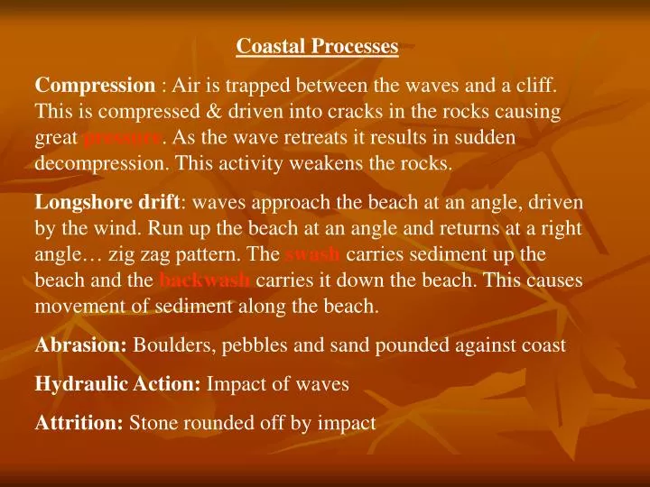
Coastal Processes Compression : Air is trapped between the waves and a cliff. This is compressed & driven into cracks in the rocks causing great pressure. As the wave retreats it results in sudden decompression. This activity weakens the rocks. Longshore drift: waves approach the beach at an angle, driven by the wind. Run up the beach at an angle and returns at a right angle… zig zag pattern. The swash carries sediment up the beach and the backwashcarries it down the beach. This causes movement of sediment along the beach. Abrasion: Boulders, pebbles and sand pounded against coast Hydraulic Action: Impact of waves Attrition: Stone rounded off by impact
Glacial Processes Plucking: Meltwater penetrates cracks in the rock. This freezes & expands weakening and fracturing the rock. The galcier attaches itself to this rock and as it moves it pull or plucks the rock away. Assisted by freez thaw action. Abrasion: Rocks attached to side & bed of the galcier scour, scrape & polish the surfaces they come in contact with. These cut scratches & grooves in the bedrock, called striae, which indicate the direction of movement of the galcier. Basal slip: The sliding movement of a glacier over its rock flour. (rocks crushed by the glacier) Freeze-thaw: Breaking of rock due to repeated freezing of water
Mass Movement • Soil Creep: Movement of soil down slope • Gravity • Solifluction – swelling of soil, moves soil particles • Frost heave – ice crystals move soil • Earth Flows: Saturated Soil • Lahars or Mud Flows: Large and Rapid, triggered by ice melts by volcanic eruptions • Slumping: Cliff edge collapses, rotational movement
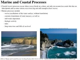
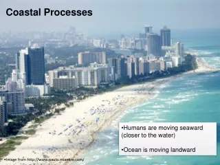
Coastal Processes • Coastline – line where sea and land meet • Shore – Area between low and high water mark • Divided into foreshore and backshore • Waves – product of friction between wind and water • Size and power of wave depends on the fetch(length of open sea a wave travels over) and the power of the wind • Therefore waves stronger on Atlantic coast than Irish sea coast
As waves approach shore it gets shallower so friction with the bottom increases • This slows the bottom so the top spills over breaking the wave • Swash rushes up the beach away from the sea • Backwash comes back towards the sea
Wave types • Destructive – high energy, 10+ p/m • Break rapidly, plunging vertically, capable of breaking of large amounts of rock, up to 25 tonnes of pressure per metre squared, erodes coastline • Constructive – low waves that break gentler, -8 p/m, occur on shore with gentle gradient, swash spread over large area so backwash is weak, leads to more material being deposited than eroded
Wave Refraction • This causes the waves to bend as they approach the shore • Friction with the bottom near the coast causes the wave to slow down • Wave in deep water stays at original speed • This causes wave to bend or refract and hit the coast line at an angle • On headlands the wave slows down in front and waves swing around to attack the sides eroding them • Little energy left for the bay so deposition occurs there
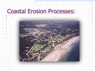
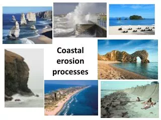
Coastal Erosion • Depends on the type of Rock – Hard or Soft • Wave strength – destructive v constructive • Shape of the coastline- wave refraction focuses energy on headlands • Slope of shore – gently sloping shores cause waves to break further out so they lose energy • Erosion greater when soft rock lies underneath hard rock, where rocks are well jointed or when strata dip towards the sea • Rising sea levels increase erosion – expected to rise by 20-25 cm in next 30 yrs in Ireland
Cliffs and Wave Cut Platforms • Cliff is a vertical slope on the coastline as a result of erosion • E.g. Cliffs of Moher • Wave energy at its greatest when high steep destructive waves hit the land and erode it through hydraulic action and abrasion and compression • A notch is cut at high water mark creating an overhang • When overhang develops it will eventually collapse and a cliff is formed • Cliff retreats inland and increases in height and material collects at the foot of cliff
This is worn down by attrition and some used to build a wave built terrace As the cliff retreats inland it exposes rock underneath with a gentle seaward slope called a wave cut platform If this platform gets too big the waves lose all there energy before reaching the cliff the cliff becomes inactive and erosion ceases to occur This can be seen by vegetation growing on the cliff and debris collecting at the bottom Vertical cliffs occur in areas of uniform rock or where strata dip inland
Bays and Headlands • Coasts rarely worn back evenly due to differential erosion as a result to differing types of rock resistance • Less resistant rock forms bays while resistant rock forms headlands • E.g. Galway Bay, Wicklow Head • Mostly caused by hydraulic action, particularly where the rock has joints and bedding planes • Air compression also adds to the erosive power as does abrasion and solution • Wave refraction erodes the headlands and makes them more pronounced while bays are protected from high energy waves and are the scene of sea deposition forming beaches
Sea caves, Arches and Stacks • On headlands wave refraction opens up joints, faults or other weaknesses to form sea caves mainly through abrasion, Hydraulic action and compression • If the cave is extended all the way through a headland a bridge like feature called a sea arch is formed – this can also happen from caves eroding back to back • If arch walls widen and roof is weathered it can collapse forming a sea stack • If stack is eroded down to sea level its known as a sea stump
Transportation • Materials broken down by erosion are reduced in size by attrition until able to be transported • Sediments moved up and down beaches by breaking waves • The water that rushes up a beach is known as the swash and the water returning to the sea is known as the backwash • Sediments moved by process known as longshore drift • Waves reach beach at an angle and so swash is at an angle but backwash returns at right angles • This process is repeated.
Beaches • Result of low energy constructive waves • Created when amount of material deposited is greater then material eroded • Beaches consist of boulders, pebbles, sand, shingle, mud etc • Some comes from sea erosion but most transported by streams • Beaches are gently sloping between LWM and HWM and can vary in length • Most beaches have a foreshore and backshore • Backshore has steeper slope, coarser material and is only reached in highest tides or storm conditions
The foreshore is lower, gentle gradient and consists of sand, mud and shell particles • Storm beaches are ridges of large stones thrown up by strong waves back beyond reach of normal waves • Berms – ridges of coarse material that indicate the high tide level of constructive waves • Ridges and runnels develop on seaward edge of foreshore and run parallel to sea where the waves break • Sand dunes develop inland where there is plenty of sand and prevailing wind comes from the sea • Sand blown inland and is trapped to form beginning of sand dune • Dunes unstable and will continually migrate unless consolidated by marram grass e.g. Youghal, Ventry
Sandspits and Tombolos Sandspits are long narrow ridges of sand and shingle that are attached to land on one side Formed by longshore drift when coast changes direction sharply Sediments carried off shore and deposited on sea bed building up to form spit Continues to grow as long as deposition is greater than erosion Sand dunes may from on sheltered landward side and beach formed on seaward side End can often be recurved due to change in wave direction Salt marsh can also develop on the landward side E.g. Strandhill co sligo Tombolo is a spit that connects an island to the shore e.g. Howth linked to Sutton Island
Lagoons and Salt Marshes • Lagoon is small body of water cut off or almost cut off from open sea • Land cutting it off known as a bay mouth bar • Can be created by sandspit sealing off a entire bay or offshore bar migrating towards land • Offshore bar in parallel ridge of sand that forms off shore • Occurs on shallow gently sloping coasts so waves break further out and deposit material • It is increase in height by constructive waves and longshore drift • Can be moved forwards by waves breaking over it to form a lagoon E.g.Our Lady’s Island Lake, Wexford
Salt marshes often develop in these lagoons • Mud and sand deposited by the sea and alluvium deposited by rivers result in infilling and lagoon becomes shallower • Area becomes colonised by salt loving plants • This increased rate of deposition and builds up to form marsh that is exposed permanently above normal tide • E.g. Backstrand in Tramore, and Bull Island in Dublin