Download
1 / 32
320 likes | 545 Vues
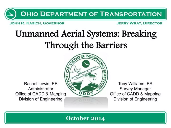
October 2014. Unmanned Aerial Systems: Breaking Through the Barriers. Rachel Lewis, PE Administrator Office of CADD & Mapping Division of Engineering. Tony Williams, PS Survey Manager Office of CADD & Mapping Division of Engineering. UAS History at ODOT. District 2 Efforts

E N D
October 2014 Unmanned Aerial Systems: Breaking Through the Barriers Rachel Lewis, PE Administrator Office of CADD & Mapping Division of Engineering Tony Williams, PS Survey Manager Office of CADD & Mapping Division of Engineering
UAS History at ODOT • District 2 Efforts • Swinglet CAM by Sensefly • 12 mega pixel camera • 1.1 pound total weight • 2.5 feet wingspan OTEC 2014
UAS History at ODOT District 2 Efforts (continued) OTEC 2014
UAS History at ODOT • District 2 Efforts (continued) • COAs and Flights • Over 15 Active COA’s • 30+ Flights performed (mostly rural bridges and culverts) • 15 Hours Flight Time logged • 1 Emergency for tornado damage assessment. • Preliminary data analysis and processing techniques established OTEC 2014
UAS History at ODOT District 2 Efforts (continued) OTEC 2014
UAS History at ODOT • District 2 Efforts (continued) • Determined/Suggested Uses • Good tool for GIS Professionals • Inventory collection & Infrastructure mapping • Inventory Assessment & Performance monitoring • Possible applications to support design, construction, and maintenance OTEC 2014
UAS History at ODOT • Ohio/Indiana UAS Center & Test Complex • Established in 2013, initially in an effort to secure Federal Grant for 1 of 6 UAS Test sites • http://www.dot.state.oh.us/Divisions/uas/Pages/default.aspx • Grant was awarded to others OTEC 2014
Current Initiatives and Direction • Catalyze opportunities • Support flight operations • Acquire FAA authority • Business Attraction • Commercialization Centers • Investment Capital • R&D • Training • Commercial Collaboration • Grants • Operations • R&D • Capability Development • Grants UASC State & Fed Agencies Universities Colleges Economic Develop. Agencies Industry • Ohio/Indiana UAS Center & Test Complex (continued) • Strategy: OTEC 2014
Current Initiatives and Direction • Ohio/Indiana UAS Center & Test Complex (continued) • Aerostat (Blimp) • http://www.dispatch.com/content/stories/science/2014/07/20/blimp-in-a-box.html OTEC 2014
Current Initiatives and Direction • Springfield, Wilmington • Ohio MOAs • Indiana Restricted Airspace • Muscatatuck & NCMR • Ohio/Indiana UAS Center & Test Complex (continued) • Airspace and Ranges OTEC 2014
Current Initiatives and Direction • ODOT CADD & Mapping Services • Researching options for funding equipment purchases • Analyze Sensors for best surveying and mapping accuracy • Analyze Sensors for other applications such as emergency response, inspections, and uses for other agencies • Research and analyze current data processing and future processing capabilities OTEC 2014
Current Initiatives and Direction • ODOT CADD & Mapping Services (continued) • Use traditional surveys to evaluate and establish acceptable levels of accuracies and data precision • Develop best practices, specifications, and work flow for placing UAS equipment into transportation infrastructure environment OTEC 2014
Current Initiatives and Direction • ODOT CADD & Mapping Services (continued) • Develop processes for data & report sharing with UAS Center, other Ohio Agencies, and other DOTs. • Set up shared services, modeling current practices, with other State agencies. OTEC 2014
Future Initiatives and Direction • Aerostat • Traffic Counts • Emergency Management • Surveillance • “Blimp in Trunk” capabilities OTEC 2014
Future Initiatives and Direction • Fixed Wing UAS OTEC 2014
Future Initiatives and Direction • Sample Data OTEC 2014
Future Initiatives and Direction • Fixed Wing UAS Possible DOT Applications • Environmental • Planning Level Mapping & Feasibility Studies • Geotech • Construction Monitoring • Critical Infrastructure mapping for Homeland Security • Asset Inventory OTEC 2014
Future Initiatives and Direction Rotor UAS OTEC 2014
Future Initiatives and Direction • Rotor UAS • Bridge Inspection • Sign Inspection • Asset Inventory • Geotech • Crash Investigation & Forensic Mapping • Construction Inspection • Infrastructure Monitoring • Dam Inspection OTEC 2014
Future Initiatives and Direction • Sample Data Bridge Pylon (50feet in elevation) – interior inspection OTEC 2014
Future Initiatives and Direction • Sample Data Construction Equipment Inspection OTEC 2014
Future Initiatives and Direction • Sample Data Inspection of power lines (dangerous and tall) OTEC 2014
Future Initiatives and Direction • Sample Data Bridge Inspection OTEC 2014
Future Initiatives and Direction • Deployment to Other State Agencies • Develop standards • Develop Deployment Strategies • How do we combine data sets & leverage all data to move us to 3D design and modeling. • How do we efficiently and effectively data share with other offices and agencies. OTEC 2014
Moving us Into the Future • Obstacles • COAs and Regulations • Average of 12 UAS crashes per year and countless close calls OTEC 2014
Moving us Into the Future • ODOT, Test Center, and Others • Agriculture • Secure Facility Surveillance • First Responder/Fire/Police • Resource Survey Opportunities • University Research OTEC 2014
Precision Agriculture • Early Capabilities • Crop Assessment • Blight detection • Track invasive insect species • Precision Insecticide control • Precision fertilization • Moisture detection • Harvest-ready detection • Yield Estimates • Insurance Evidence • Early Collaborations • ODA • AFRL • OSU • Multiple Industry Partners • COAs in process/operation – 6 • Sinclair CC • Southern CC • Clark State CC OTEC 2014
Secure Facility Surveillance • Early Capabilities • Surveillance of facility boundaries • Locate and identify contraband • Document facility intrusion/intruder • Integrated into Operations Center • Support pursuit and arrest • Increased deterrence • Increased operational situational awareness • Early Collaborations • ODRC • UDRI • WSRI • Trident • COAs/Waivers in Process - 7 OTEC 2014
First Responder/Fire/Police • Early Capabilities • Document Crime Scene/Disaster Area • Establish Event Situational Awareness • Document Accident • Monitor traffic flow/alternative routes • Restore Communications • Detect and locate CBRN hazards • Track active shooter • Locate & monitor Illegal drug production • Event Situational Awareness • Public address • Early Collaborators • Ohio Fire Chief • ODPS • Ohio EMA • UDRI • Muscatatuck • COAs/Waivers in Progress - 6 • U of Cincinnati • Montgomery County • U. of Toledo • Sinclair CC • WSRI OTEC 2014
Resource Survey Opportunity • Early Capabilities • Inspect infrastructure • Survey construction projects • Monitor tree harvest/poaching • Monitor drilling sites compliance • Excavation monitoring • Project monitoring & assessment • Assess water quality & effluence • Track invasive species • Inspect amusement park rides • Property Survey and monitoring • Early Collaborations • ODOT • ODNR • ODA • Woolpert • Merrill • COAs in Progress – 8 • Cleveland Metro Parks • Survey & Mapping Inc. OTEC 2014
University Research Key Areas of Research • Modeling and Simulation • Human/Machine Interface • Sensors • Data Management & Processing • Dynamic Modeling • Detect and Avoid • Cooperative Control • Position, Navigation, and Timing • Spectrum Management, Antenna Design • GPS Robustness • Data Link security COAs in process - 3 OTEC 2014
Moving us Into the Future • Ohio is in the UAS spotlight • Other DOTs are watching Ohio • Transportation Research Board • Continue collaborations with universities, the Test Center, other agencies, and other survey and UAS technology developers. OTEC 2014