Download
1 / 12
120 likes | 124 Vues
Learn about GEOGLAM, the Group on Earth Observations Global Agricultural Monitoring Initiative, which aims to improve global agricultural monitoring by integrating satellite observations with ground-based measurements for reliable and timely crop monitoring information.

E N D
Indian Support to GEOGLAM Activities Committee on Earth Observation Satellites • Shibendu S. Ray, MNCFC/MoA&FW • CEOS WGCapD-8 Annual Meeting • Agenda Item 37 • Working Group on • Capacity Building & Data Democracy • Indian Institute of Remote Sensing • Indian Space Research Organisation • Dehradun, India • March 06th – 08th, 2019
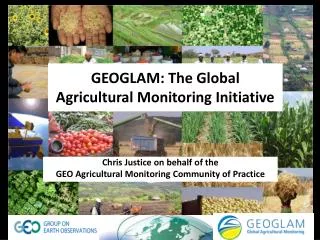
GEOGLAM GEOGLAM is the Group on Earth Observations Global Agricultural Monitoring Initiative. It was initially launched by the Group of Twenty (G20) Agriculture Ministers in June 2011, in Paris. The G20 Ministerial Declaration states that GEOGLAM "will strengthen global agricultural monitoring by improving the use of remote sensing tools for crop production projections and weather forecasting". By providing coordinated Earth observations from satellites and integrating them with ground-based and other in-situ measurements, the initiative will contribute to generating reliable, accurate, timely and sustained crop monitoring information and yield forecasts.
SAC (ISRO) • India’s Contribution - Early Stages (2012-2015) • Preparation of GEOGLAM Project Document, Action Pan and participation in Meetings • Task Lead and Hosting of GEOGLAM Secretariat • Preparation of Project Document and Implementation Plan for AsiaRiCE • Hosting6th GEOSS Asia-Pacific Symposium: “Accelerating Inter-linkages in the Asia Pacific Region for Global Earth Observations”, Feb. 25-27, 2013, Ahmedabad, India. • Preparation of Best Practices Document
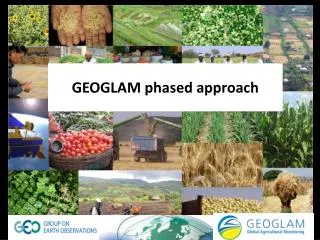
3 core components and 3 cross-cutting components • GEOGLAM: Components GEOGLAM Implementation Planning meeting, June, 2017, FAO, Rome
GEOGLAM developed the Crop Monitor reports which provide global crop condition assessments in support of the FAO: AMIS market monitoring activities, for four major crops, Rice, Wheat, Maize and Soybean • GEOGLAM: Global Monitoring System: • AMIS: Crop Monitor MNCFC provides monthly inputs for the portal and the report, participates in monthly Telecon
Asia-Rice is the work of an ad hoc team of stakeholders with an interest in the development of an Asian Rice Crop Estimation & Monitoring (Asia-RiCE) component for the GEO Global Agricultural Monitoring (GEOGLAM) initiative. • GEOGLAM: Regional Monitoring System: AsiaRiCE Partners Source: SAC, ISRO Rice Transplanting Pattern Mapping: FASAL Project • Both ISRO and MNCFC are partners to AsiaRiCE. • Contributed to development of Implementation Plan: Phase I & II • Participate in Telecon
8 Field Crops (Rice, Wheat, Cotton, Rapeseed & Mustard, Sugarcane, Sorghum, Pulses and Jute): FASAL Project • 7 Horticultural Crops (Potato, Onion, Tomato, Chilli, Mango, Banana and Citrus): CHAMAN Project • National, State and District Level estimates (all major districts covered) • Block level estimates for major crops started • Multiple forecasts, but all forecasts pre-harvest • Crop Area using all major types of satellite data (Resourcesat: AWiFS, LISS III & LISS IV, Cartosat, Sentinel 1&2 and Landsat) • Classification: ISODATA, MXL, Hierarchical • Yield using multiple approaches: Meteorological, Empirical Remote Sensing, Crop Simulation Modes, LUE Models, Selected CCE data • Partners: 19 State Agriculture Departments, 15 State Remote Sensing Centres, 23 State Remote Sensing Centres, 46 Agromet Feld Units (SAUs), 8 ICAR Centres, ISRO (3 Centres), IMD & IEG • National Monitoring System: • FASAL & CHAMAN
ISRO Provided Three-date RISAT-1 data (Jan-Mar. 2014) for Rice crop in S.E. Asia (Vietnam, Indonesia, Thailand) • AWiFS Data for JECAM sites in South Fork Watershed Iowa state USA and Red River watershed, Canada • GEOGLAM: EO Data Acquisition & Dissemination Coordination : CEOS Vietnam North Vietnam South • GEOGLAM/JECAM/Asia-RiCESeminar Sept. 2018, Taiwan. GEOGLAM CEOS Meeting, Ispra, Italy, April, 2018
Two day ISPRS-GEOGLAM-ISRS International Tutorial on ‘Advances in Remote Sensing for Agriculture’, where there were 110 young researchers participating from 13 countries. The tutorials were on i) SAR for Rice, ii) Fire products from Satellite iii) UAV Applications, and iv) Machine Learning. • One-day ISRO-ISRS-ACRS-GEOGLAM-ISPRS-WG-III10-Pre-symposium-tutorial was on Agricultural Monitoring, October 2017 • GEOGLAM: Capacity Building for EO Utilization
Capacity Building @ MNCFC • National Training Prgrammes • One week Training Programmes on ‘Basics of Remote Sensing & GIS and Applications in Agriculture’ for the officials state Agricultural Departments and IMD (~75 participants) • More than 50 on-the-job and on-site 2-day programmes for 18 states for GT Collection for state agriculture and horticulture department officials • Training Workshops on Technology for PMFBY, 2016 • Regular Half-Day Training Programmes for NSSO Officials • Training Workshops on New Drought Manual, 2016 • International Training Programmes • Two week training for Fiji Government officials, June, 2014. • One Week FAO Sponsored Study Tour by Agriculture Ministry Officials, Afghanistan, during October, 2015 • One Week Training for University of Philippines Researchers, April, 2019 (Planned) • M. Tech Dissertations • 5 M. Tech Dissertations on RS & GIS • Internship Programme: • 1-3 Months paid internship for students
International Workshop (ISPRS-GEOGLAM-ISRS) on “Earth Observations for Agricultural Monitoring”, during 18-20 February, 2019 in New Delhi, India • 298 scientists/researchers participated from 27 countries, 79 organizations • Commemorating 50 Years of Remote sensing in India • 3 Plenary Sessions, 7 Technical sessions, 1 Industry Session, Poster Sessions and Exhibition • Supported by MoA&FW, ISRO, MoES& AIC • GEOGLAM International Workshop • A special GEOGLAM Session in the Asian Conference on Remote Sensing during October, 2017 in New Delhi
Proposed Activities in 2019 • Capacity Building on use of SAR for Rice, jointly by MNCFC, ISRO-IIRS (WGCapD), GEOGLAM and AsiaRiCE (possibly SARI) for participants of Asia-Pacific Countries (May be in Oct/Nov, 2019) • Taking up two JECAM (Joint Experiment for Crop Assessment and Monitoring) sites in India, one for Rice and one for Soybean. Thank you. • Mahalanobis National Crop Forecast Centre • Ministry of Agriculture & Farmers’ Welfare, New Delhi • Web: www.ncfc.gov.in; Email: shibendu.ncfc@nic.in