Download
1 / 21
210 likes | 297 Vues
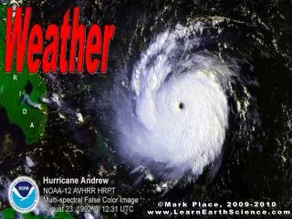
Weekly Weather Briefing “Dry & Very Warm Week then Wet Weekend?” NWS Albuquerque April 7, 2014. Most Recent Temperatures. Today’s Max Temp Departure from Normal. Today’s Forecast Max Temperature. Warmest Days Wed/Thu, Coolest Today. Maximum temperature departure from normal.

E N D
Weekly Weather Briefing “Dry & Very Warm Week then Wet Weekend?” NWS Albuquerque April 7, 2014
Warmest Days Wed/Thu, Coolest Today Maximum temperature departure from normal. Monday, April 7TH Thursday, April 10TH
Wind & Humidity at a Glance Surface to 10kft Mean Wind Speed (kts) WED - THU Surface to 10kft Mean Relative Humidity
Upper Level Forecast Chart(Image is Moisture) Tonight Tonight: Clearing with winds decreasing. Cold in Valleys with lows below due to the development of temperature inversions.
Upper Level Forecast Chart(Image is Moisture) Tuesday Tuesday: Sunny with light winds thanks to a ridge of high pressure. Warmer, with highs reaching above normal for the first time since last Wednesday.
Upper Level Forecast Chart(Image is Moisture) Wednesday ? Wednesday: Warm, with well above normal highs. Breezy to locally windy afternoon with potential for critical fire weather conditions as the ridge breaks-down.
Upper Level Forecast Chart(Image is Moisture) Thursday ? Thursday: Bone-dry westerly flow resulting in more potential for critical fire weather conditions. Highs continuing well above normal.
Upper Level Forecast Chart(Image is Moisture) Friday Friday: Dry westerly flow with above normal temperatures persisting. Watching a storm system moving east toward Southern California and the Mexican Baja.
Upper Level Forecast Chart(Image is Moisture) Weekend Outlook Saturday Sunday Weekend: At this time, weekend system looks to be relatively “moisture-starved”. Wetting precipitation may be hard to come-by. A backdoor cold front will cool-off the Eastern Plains Sunday and may bring some precipitation to the NE quarter
6-10 Day Precip Outlook: April 13-17 http://www.cpcpara.ncep.noaa.gov/
Week at Glance Hazards & Impacts Outlook Tonight Tuesday Wednesday-Thursday (fire weather) Friday Weekend (high mountain snow/thunderstorms ?) None MinorSignificant Synopsis A ridge of high pressure will bring dry weather and above normal temperatures through late week. Westerly winds will strengthen starting Wednesday afternoon with the potential for fire weather concerns extending into Thursday. The coming weekend will feature unsettled weather with the potential for precipitation.
Weekly SST Departures (oC) for the Last Four Weeks Current Previous During the last four weeks, changes in equatorial SST anomalies were mostly positive across the Pacific, except near the coast of South America.
SST Outlook: NCEP Coupled Forecast System (CFS.v2 ) Issued April 7, 2014 The CFS.v2 ensemble mean (black dashed line) predicts El Niño starting in April-June (AMJ) 2014. March 24 April 7 El Niño El Niño
As always… Stay up to date… weather.gov/abq Facebook @NWSAlbuquerque & #nmwx NOAA Weather Radio Favorite Media Outlet mobile.weather.gov NMroads.com