Download
1 / 19
190 likes | 314 Vues
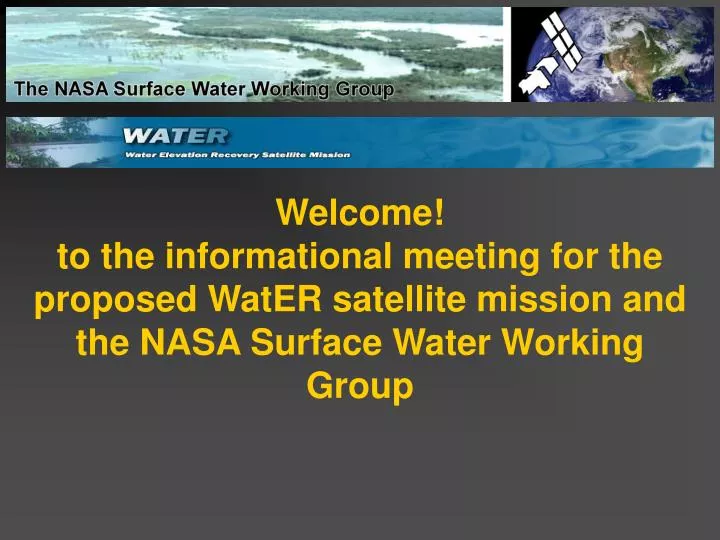
Welcome! to the informational meeting for the proposed WatER satellite mission and the NASA Surface Water Working Group. Agenda: 1. Introductions 2. Status of WatER 3. Future Directions for the SWWG 4. Questions and Discusion. We welcome everyone to join and participate in WatER and the SWWG!.

E N D
Welcome!to the informational meeting for the proposed WatER satellite mission and the NASA Surface Water Working Group
Agenda:1. Introductions2. Status of WatER3. Future Directions for the SWWG4. Questions and Discusion We welcome everyone to join and participate in WatER and the SWWG!
1. Introductions Doug Alsdorf, U.S. WaTER PI, Chair SWWG, alsdorf.1@osu.edu Nelly Mognard, EU WatER PI, nelly.mognard@cnes.fr Ernesto Rodriguez, JPL Engineer of KaRIN and over 150 participants from more than 20 countries, world wide The WatER mission has received seed funding from: the Ohio State University, CNES, JPL, and the Terrestrial Hydrology Program at NASA The SWWG is funded by NASA’s Terrestrial Hydrology Program www.legos.obs-mip.fr/recherches/missions/waterwww.geology.ohio-state.edu/water www.geology.ohio-state.edu/swwg Have a look at the WatER poster – our thanks to WatER participant, Natalie Johnson
1. Introductions • What is WatER? • WatER is a swath based radar interferometer designed to acquire measurements that will answer this question: • “Where is water stored on Earth’s land surfaces, and how does this storage vary in space and time?”
“The ability to measure, monitor, and forecast the U.S. and global supplies of fresh water is another high-priority concern. Agencies, through the NSTC (National Science and Technology Council), should develop a coordinated, multi-year plan to improve research to understand the processes that control water availability and quality, and to collect and make available the data needed to ensure an adequate water supply for the Nation's future.” 2004 http://www.whitehouse.gov/omb/memoranda/fy04/m04-23.pdf “The ability to measure, monitor and forecast U.S. and global supplies of fresh water is important because agencies are developing a coordinated, multi-year plan through the NSTC to improve research to understand the processes that control water availability and quality, and to collect and make available the data needed to ensure an adequate water supply for the future. Significant progress on this plan, including stakeholder input, is expected during the next two years.” 2005 http://www.un.org/Depts/dhl/resguide/r58.htm
“Decides that the goals of the Decade should be a greater focus on water related issues at all levels and on the implementation of water-related programmes and projects, while striving to ensure the participation and involvement of women in water-related development efforts, and the furtherance of cooperation at all levels, in order to help to achieve internationally agreed water-related goals contained in Agenda 21,1 the Programme for the Further Implementation of Agenda 21,2 the United Nations Millennium Declaration5 and the Johannesburg Plan of Implementation,3 and, as appropriate, those identified during the twelfth and thirteenth sessions of the Commission on Sustainable Development;” http://www.un.org/Depts/dhl/resguide/r58.htm “Does the United States have enough water? We do not know.” “What should we do? Use modern science and technology to determine how much water is currently available in our rivers, lakes, reservoirs, and aquifers, how much water is likely to be available in future decades at current or projected rates of use and improve our understanding of the nation’s water resources and their natural variability.” 6:15 PM This room, Thursday USGS 6:15 PM 3001, Thursday NASA’s M. Cleave http://www.ostp.gov/NSTC/html/swaqreport_2-1-05.pdf
2. Status of WatER www.geology.ohio-state.edu/water www.legos.obs-mip.fr/recherches/missions/water
2. Status of WatER • Status of ESA Proposal • March 2006 meeting in Venice at “15 Years of Progress in Radar Altimetry Symposium” • Announcement of Sub-Groups • Science: Paul Bates Pascal Kosuth, Larry Smith • Technology: Richard Bamler, Bruno Cugny, Ernesto Rodriguez • Applications: Dennis Lettenmaier, Stefan Niemeyer, Bob Su • Charges to Sub-Groups • Science: Determine the spatial and temporal sampling resolutions necessary for answering specific science questions. Identify those science questions. (i.e., virtual mission). A longer term and broader charge would be to identify those water cycle models capable of dealing with the enormous volumes of data that will come from WatER. If none are found, then the subgroup needs to define how to create the models. What are the costs involved in such models; what are the computational requirements; who are our colleagues in the modeling community? This charge extends to ensuring that WatER data will be used to constrain climate models, not just water cycle models.
2. Status of WatER • Charges to Sub-Groups: Technology: • Determine costs for technology, launch, mission control and data processing. JPL and CNES each have their own costings for the mission and will be the major members of this subgroup, but with additional people, we increase our chances of avoiding mistakes. Also, an independent assessment of the feasibility of the technology is desired. We're hoping for something like a panel review, but done internally before the full 200+ page proposal is due at ESA and NASA. (This assumes that WatER will pass the first rounds of review.) • Determine what is needed to establish pre- and post-raw data processing centers. The DLR, JPL, and/or CNES will probably want to have their own ground segments that process the raw radar echoes and turn them into height maps. But, WatER will need a center that will take these height maps and turn them into storage change maps and into discharge maps, i.e., hydrologically useful products. Because the mission will collect over a peta-byte of data, we need something far bigger than one PI and a couple of grad students! The technology subgroup needs to identify how this center would operate, funding sources beyond our space agencies (we need buy-in from other agencies), what the computational needs are (supercomputers or clusters of pc's), timeline for center development (it must be operational well before the mission is launched), and who is going to do the data processing.
2. Status of WatER • Charges to Sub-Groups: Applications • This mission needs to reach out to water management teams, particularly for those governments dealing with severe resource problems. Also, we need to involve the health community (water borne diseases, e.g., malaria). So, the charge to this subgroup is to identify the myriad of water management programs, contact them for their initial support, determine their exact needs and work out possible solutions to fulfilling any needs. The subgroup will need to educate these managers because they will only be used to dealing with in-situ data of a high temporal resolution. The charge also includes identifying health and disease researchers and find out what they need.
Jason-1 2. Status of WatER • Status of NASA • Communicate our needs with program managers • e.g., Jared Entin • They talk with upper management • Invitation then to present to Division Directorate • Continue to talk to your congressional delegates • WatER Submission to NRC Decadal Panel • WatER is very compatible with submission, “Hydrosphere Mapper” • Townhall Meeting, Marriott Tuesday 7:30, lower level ballroom next to Mike Griffin’s 6:15 talk on NASA’s Moon & Beyond • Beyond Hydrology • Oceanographic Applications: • Calculation of ocean water slopes and sea surface topography for bathymetry, ocean circulation, and climate. We’ll need to discuss tidal aliasing issues while keeping our hydrologic focus. Adding this science will require a couple extra ground receiving stations. • Sea Ice Thickness: • Differences between sea ice and water surface allow ice-freeboard calculations, thus thickness. This option generally falls outside of the data acquisition mask, thus requires a little extra memory. Sea Surface Anomalies
Ice DEMs 2. Status of WatER • Beyond Hydrology • Topography of the Land • WatER will acquire a global DEM every 8 days (call it a weekly DEM of the Earth). Repeated measurements over a ~5 year mission lifetime permits centimeter scale elevation accuracies. Caveat: KaRIN is a near-nadir instrument, thus will not provide similar accuracies over high-relief terrain. Floodplains will be mapped very well! This comes at no cost. • Topography of the Ice • Low relief areas of ice sheets should be easily mapped by KaRIN. Costs are likely minimal. • Near Shore Ocean Surface • KaRIN’s acquisition mask includes the near shore areas, thus allowing sea surface topography. This comes at no cost.
Questions about WatER? We are very excited about WatER and the possibility of expanding to WATER, the Water And Terrestrial Elevation Recovery satellite mission. WATER would keep our surface water focus, while welcoming the additional science goals related to oceans, ice, and land surface elevation measurements. We welcome you to join and participate in WATER, please contact Nelly Mognard or Doug Alsdorf nelly.mognard@cnes.fr or alsdorf.1@osu.edu
3. Future Directions for the SWWG • Two founding goals: • To promote research and interactions for determining the feasibility of measuring water quantity from space. • Similarly, to identify water quality approaches. • In a truly collaborative fashion WatER is now established • Lets now turn the SWWG toward water quality issues.
3. Future Directions for the SWWG • A. Water Quality: Remote Measurements of Transported Constituents Erosion and deposition during the 1993 Mississippi River flooding destroyed these agricultural fields. Knowledge of transported sediment leads to better capability to predict floodplain deposition. “The Meeting of the Waters”. The Negro River (top, black) meets with the Solimoes River to form the Amazon River. Even this simple photo from a hand-held camera demonstrates that organic and sediment concentrations are remotely measurable.
3. Future Directions for the SWWG A collegial development of these water quality approaches, under the direction of the SWWG, would greatly promote individual efforts into the formation of a cohesive group. Essentially, a follow-on mission to WatER could be built upon these water quality issues. • A. Water Quality: Remote Measurements of Temperature The quality of aquatic habitats depends, in part, on the temperature of the water. • B. Enhance Modeling Capabilities for Petabytes of Data:this is a long-term project • Future satellite missions will generate petabytes of data (e.g., WatER), but essentially, no model is yet available that can assimilate, calibrate, or validate such a quantity of data on surface water storage change and discharge (at least not on a weekly time-scale). Therefore, a future activity of the SWWG is to promote such awareness through working group meetings and special sessions at international meetings (e.g., Fall AGU).
3. Future Directions for the SWWG • C. Interactions with THPs other working groups, particularly field activities • The SWWG integration would initially follow as a piggy-back experiment utilizing existing infrastructures. Still, longer term plans with fully developed in-situ studies are required and will be built from a series of SWWG meetings. • D. Web-Based Initiatives • We are in the process of building interactive web pages for contact information gathering, web-based dialogues, a list server, a job postings page, and a page for posting links and PDFs of published manuscripts. Ideally, these developments could also be used as educational tools. • E. Broaden Our Membership • Freshwater Ecology - global • mapping threats to aquatic ecosystems such as the locations of dams, road crossings at streams, and other man-made locations where exotic species can be introduced • mapping of exotic plant species in the water (hyacinth, bamboo) • mapping of riparian zones, particularly gap locations where pollutants might be introduced to the ecosystem • determining the natural hydrologic regime and degrees of impairment. • Water Borne Diseases (Seasonal mappings of water bodies) • CUAHSI, GEWEX, etc?
3. Future Directions for the SWWG • Future Meetings: • Early 2006 – Sunday night to Monday (arrive Sunday, fly out Monday night). Chicago is an easy destination, but weather? Joint with AMNH Freshwater Ecology Group • Joint with THPs other working groups for field campaign discussions • Joint with CAtchment-scale Hydrologic Modeling and Data Assimilation (CAHMDA)
Questions about the SWWG? We welcome you to join and participate in the SWWG! Please contact Doug Alsdorf alsdorf.1@osu.edu