Download
1 / 61
610 likes | 898 Vues
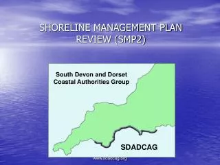
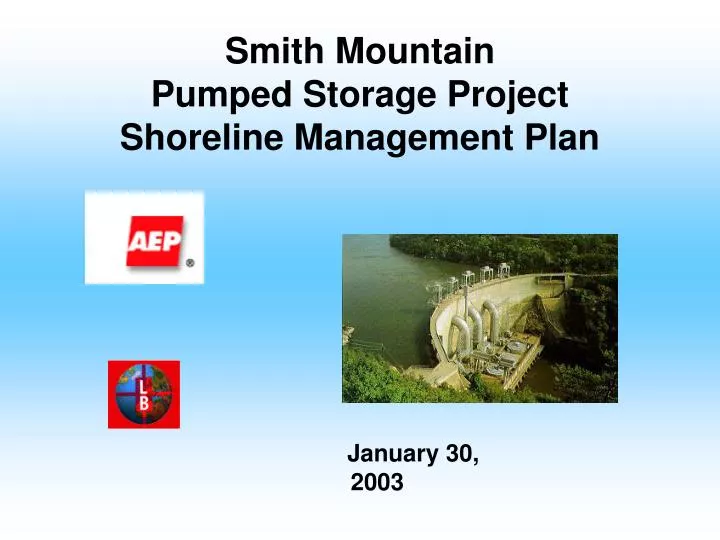
Smith Mountain Pumped Storage Project Shoreline Management Plan January 30, 2003 Agenda Review of mapping with new parameters Finalize classifications, parameters, and regulations Additional items Shoreline stabilization requirements Vegetation removal guidelines Schedule

E N D
Smith Mountain Pumped Storage ProjectShoreline Management Plan January 30, 2003
Agenda • Review of mapping with new parameters • Finalize classifications, parameters, and regulations • Additional items • Shoreline stabilization requirements • Vegetation removal guidelines • Schedule Smith Mountain Project Shoreline Management Plan
Classifications • High Density Commercial - Project lands and waters where individuals or for profit entities operate facilities as a place of business. Within the project boundaries those facilities may include where boats can be launched, retrieved or docked, as well as obtain petroleum. Outside the project boundaries associated facilities could include provisions for food services, convenience retailing including petroleum dispensing, dry storage of watercraft and where other activities customarily associated with marinas, campgrounds, private recreation areas and private clubs take place. The high use commercial classification includes facilities that would be expected to incur heavy amounts of boat traffic, such as marinas. Smith Mountain Project Shoreline Management Plan
Classifications • Multi-Use Residential - Project lands and waters where boats can be launched, retrieved or docked for the purpose of providing private access to the lake for specific residential properties including: • Multi-family dwellings (e.g. apartments, townhouses, condominiums). • Subdivision access lots that serve single-family type dwellings that are located within a parcel of land with waterfrontage that has been subdivided into individual lots regardless of the number of slips. Smith Mountain Project Shoreline Management Plan
Classifications • Public Use - Project lands and waters where facilities are operated by non-profit organizations and/or governmental entities and that support various public recreational amenities or areas that are used for the public good. Examples of the public use classification include public access areas, and state, district, county and city parks that adjoin the project boundary, water intake areas, lake clean-up facilities and other similar public use type endeavors. Smith Mountain Project Shoreline Management Plan
Classifications • Low Density Use • Low Density Commercial - Project lands and waters where individuals or for profit entities operate facilities as a place of business. Within the project boundaries, those facilities may include where boats can be docked for short periods of time by customers. Long term storage or launching of boats from these facilities is not allowed. For operations outside the project boundaries, associated facilities could include provisions for food services, convenience retailing and restaurants or private clubs. The low density use commercial classification includes facilities that would be expected to incur relatively small amounts of boat traffic, such as access docks for convenience stores, restaurants, or shopping areas. Smith Mountain Project Shoreline Management Plan
Classifications • Low Density Use • Low Density Multi-Use - Project lands and waters that support apartments, townhouses, and condominiums and off water or common lot access for small developments. A multi-slip common dock in this area would be limited to 10 or fewer slips. • Single Family-Type Residential - Project lands and waters that support private facilities for waterfront landowners, . This classification may include, among other things, piers, boat docks, and floaters. Smith Mountain Project Shoreline Management Plan
Classifications • Impact Minimization Zone - Project lands and waters that have specifically-identified importance from an environmental, scenic, or cultural standpoint. Development within these areas would be limited, but possible, based on a review of the related plans including mitigation for any impacts to resources. • Conservation/Environmental - Areas with specific resources that need protection include but are not limited to recreational opportunities, scenic beauty, water quality, fish and wildlife habitat, and wetlands. The Conservation/Environmental classification includes areas around the lakes that are particularly important to protect and enhance these various resources around the Lakes. In these areas, development inside the project boundary is prohibited. Smith Mountain Project Shoreline Management Plan
Parameters • High Density Commercial • Coves and main channel areas with a width of more than 500 feet shoreline to shoreline. • Existing watercraft density that is less dense than 15 acres per boat (Densities are based on the boat density study that identified the location of watercraft on peak use days.). • Area within 1/2 mile from facility must be less than 50 percent developed (including single family docks) as measured by shoreline dock density. • Shoreline with existing commercial facilities. • Shoreline within 3/4 mile of the Hales Ford Bridge. Smith Mountain Project Shoreline Management Plan
Parameters • Multi-Use Residential • Coves and main channel areas with a width of more than 500 feet shoreline to shoreline. • Existing watercraft density that is less dense than 15 acres per boat on the water adjacent to the proposed development or where the entrance to the cove is less dense than 12 acres per boat. • Shoreline with existing multi-use type facilities Smith Mountain Project Shoreline Management Plan
Parameters • Public Use • Coves and main channel areas with a width of more than 500 feet shoreline to shoreline. • Existing watercraft density that is less dense than 15 acres per boat. • Shoreline currently designated as public recreation. • Areas identified for future public use. Smith Mountain Project Shoreline Management Plan
Parameters • Low Density Use • Existing watercraft density that is less dense than 12 acres per boat on the water adjacent to the residence. • Areas not otherwise classified that have a county zoning of residential. • Shoreline with existing single family docks and piers. Smith Mountain Project Shoreline Management Plan
Parameters • Impact Minimization Zone • Wetlands that span less than 100 feet of linear shoreline. • Areas classified as large woody debris. The definition of large woody debris areas is "Areas of large downed trees with a density of more than 5 trees greater than 10 inches in diameter per 100 linear feet of shoreline." • Areas within 100 feet of a known cultural resource site contained in the VA SHPO files. • Undeveloped islands. • Area adjacent to Smith Mountain Wildlife Management Area • Areas identified as scenic (the Cliffs and Smith Mountain) • Areas with existing watercraft density that is more dense than 12 acres per boat. Smith Mountain Project Shoreline Management Plan
Parameters • Conservation/Environmental • Large wetland areas (e.g. 100 ft. or more of continuous shoreline length), • Areas identified by the Virginia Natural Heritage Program as important natural communities. • Important nursery areas for juvenile striped bass. • Areas within designated restriction zones such as between the boat barriers upstream of the project dams and the dams themselves. Smith Mountain Project Shoreline Management Plan
Classification Summary High-density commercial 16.01 miles High-density multi-use 68.48 miles Public use 15.52 miles Low-density use 416.10 miles Impact minimization zone 36.24 miles Conservation 37.91 miles Smith Mountain Project Shoreline Management Plan
High Density Commercial Regulations 1. All shoreline distances are measured at the 795-contour line National Geodetic Vertical Datum (NGVD) for Smith Mountain Lake and the 600-foot contour NGVD for Leesville Lake. These respective contours are hereafter referred to as base elevation. Verifying the location of the base elevation and all appropriate distances is the responsibility of the applicant. 2. The project boundary for Smith Mountain Lake is the 800-foot contour NGVD and for Leesville Lake is the 620-foot contour NGVD. These respective contours are hereafter referred to as the project boundary. 3. All docks shall meet all local, state and federal requirements. Smith Mountain Project Shoreline Management Plan
High Density Commercial Regulations 4. Any dredging that occurs must meet all state, federal, county, and AEP dredging requirements. Any dredging that occurs without proper approvals could be subject to a fine. 5. Docks may not exceed a maximum of 1/3 cove width or 100 feet in length, whichever is less, as measured from the base elevation. 6. The dock owners will sign an acknowledgement when obtaining their dock permit that water depths may not be adequate for accessing the lake during times of low inflow or drought or for any other reason the reservoir is drawn down. Smith Mountain Project Shoreline Management Plan
High Density Commercial Regulations 7. The maximum size of dock structures located within the base elevation, including slip area, shall be 5,000 square feet. 8. The minimum distance between groups of dock slips shall be 60 feet. 9. No pier / dock shall be constructed within the line of sight of two navigational aids. 10. Structures located between the project boundary and the base elevation shall be limited to a structure that provides access to the dock. This includes a stairway, ramp or landing that connects the dock to the land. The maximum width of this structure shall be six feet. Smith Mountain Project Shoreline Management Plan
High Density Commercial Regulations 11. Facilities must be in compliance with Virginia Department of Health, Marina Regulations and provide sanitation facilities for pump-out, dump stations and bathroom facilities. 12. All structures located within the project boundary must be located within the extended side lot lines and must maintain a setback of at least 200 feet from extended or actual side lot lines. This setback may be reduced if adjacent to an existing commercial use and an easement/agreement is obtained from the adjacent property owner and the easement/agreement is recorded. The setback may not be reduced to less than 60 feet from the extended side lot line. Smith Mountain Project Shoreline Management Plan
High Density Commercial Regulations 13. There shall be no enclosures located within the project boundary. 14. The maximum height, as measured from the base elevation to the highest point on the structure, shall be 16 feet for a structure with a flat roof and 26 feet for a structure with a pitched roof. Roofs shall only be allowed on floating docks at Leesville Lake. The water elevation at Smith Mountain Lake can rise up to and occasionally over 800-foot contour NGVD as measured at the dam. At Leesville Lake, the water elevation can rise up to and occasionally over 620-foot contour NGVD as measured at the dam. This is to be taken into consideration when designing the overall height of the boat dock. The boat dock may have a roof but no additional roofs or roofed areas shall be allowed to create a second story. If a flat roof is constructed, public access to the roof will be prohibited. Smith Mountain Project Shoreline Management Plan
High Density Commercial Regulations 15. White reflective tape or white reflectors are required on each furthermost waterward corner of the dock and every 20 feet on both sides of the dock. 16. Existing non-conforming structures may be maintained and repaired up to a total of 50% of the total physical structure or assessed structure value whichever is greater, but the non-conformity may not be increased. If more than 50% of the total physical structure or structure value is replaced, it must meet the new requirements. Smith Mountain Project Shoreline Management Plan
High-Density Multi-use Regulations Community dock option 1. All shoreline distances are measured at the 795-contour line National Geodetic Vertical Datum (NGVD) for Smith Mountain Lake and the 600-foot contour NGVD for Leesville Lake. These respective contours are hereafter referred to as base elevation. Verifying the location of the base elevation and all appropriate distances is the responsibility of the applicant. 2. The project boundary for Smith Mountain Lake is the 800-foot contour NGVD and for Leesville Lake is the 620-foot contour NGVD. These respective contours are hereafter referred to as the project boundary. 3. All docks shall meet all local, state and federal requirements. Smith Mountain Project Shoreline Management Plan
High-Density Multi-use Regulations Community dock option 4. The docks shall not exceed a maximum of 1/3 cove width or 100 feet in length, whichever is less, as measured from the base elevation. Verifying the location of the base elevation is the responsibility of the landowner. 5. Any dredging that occurs must meet all state, federal, county, and AEP dredging requirements. Any dredging that occurs without proper approvals could be subject to a fine. 6. No pier/dock shall be constructed within the line of sight of two navigational aids. Smith Mountain Project Shoreline Management Plan
High-Density Multi-use Regulations Community dock option 7. The dock owner will sign an acknowledgement when obtaining their dock permit that water depths may not be adequate for accessing the lake during times of low inflow or drought or for any other reason the reservoir is drawn down. 8. The maximum size of dock structures located within the base elevation, including slip area, is 5,000 square feet. 9. Structures located between the project boundary and the base elevation shall be limited to a structure that provides access to the dock. This includes a stairway, ramp or landing that connects the dock to the land. The maximum width of this structure shall be six feet. Smith Mountain Project Shoreline Management Plan
High-Density Multi-use Regulations Community dock option 10. A maximum of one watercraft slip per housing unit will be considered for approval. 11. All structures located within the project boundary must be located within the extended side lot lines and must maintain a setback of at least 100 feet from extended side lot lines. The structure may extend over the extended lot lines if the owner owns the land underneath in fee. 12. The minimum distance between groups of dock slips shall be 60 feet. Smith Mountain Project Shoreline Management Plan
High-Density Multi-use Regulations Community dock option 13. The facilities must meet Virginia Department of Health, Marina Regulations and provide any required sanitation facilities for pump-outs, dump stations and bathroom facilities for any users of slips to serve dwellings located a distance greater than 1000' from the dock slip. Any sanitation facilities much be located outside the project boundary. 14. Enclosures on the dock shall not be allowed. A screened area is considered an enclosure. Smith Mountain Project Shoreline Management Plan
High-Density Multi-use Regulations Community dock option 15. The maximum height, as measured from the base elevation to highest point on the structure, shall be 16 feet for a structure with a flat roof and 26 feet for a structure with a pitched roof. Roofs shall only be allowed on floating docks at Leesville Lake. The water elevation at Smith Mountain Lake can rise up to and occasionally over 800-foot contour NGVD as measured at the dam. At Leesville Lake, the water elevation can rise up to and occasionally over 620-foot contour NGVD as measured at the dam. This is to be taken into consideration when designing the overall height of the boat dock. The boat dock may have a roof but no additional roofs or roofed areas shall be allowed to create a second story. 16. Slips shall be constructed in conjunction with the construction of respective housing units. Smith Mountain Project Shoreline Management Plan
High-Density Multi-use Regulations Community dock option 17. White reflective tape or white reflectors are required on each furthermost waterward corner of the dock and every 20 feet on both sides of the dock. 18. Existing non-conforming structures may be maintained and repaired up to 50% of the total physical structure or structure value, whichever is greater, but the non-conformity may not be increased. If more than 50% of the total physical structure or structure value is replaced, it must meet the new requirements. Smith Mountain Project Shoreline Management Plan
High-Density Multi-use Regulations Courtesy dock and ramp option 1. All shoreline distances are measured at the base elevations. Verifying the location of the base elevation and all appropriate distances is the responsibility of the applicant. 2. The project boundary for Smith Mountain Lake is the 800-foot contour NGVD and for Leesville Lake is the 620-foot contour NGVD. These respective contours are hereafter referred to as the project boundary. 3. Docks must meet all local, state and federal requirements. 4. Docks shall not exceed a maximum of 1/3 cove width or 80 feet in length, whichever is less, as measured from the base elevation. Smith Mountain Project Shoreline Management Plan
High-Density Multi-use Regulations Courtesy dock and ramp option 5. No pier/dock shall be constructed within the line of sight of two navigational aids. 6. The dock owners will sign an acknowledgement when obtaining their dock permit that water depths may not be adequate for accessing the lake during times of low inflow or drought or for any other reason the reservoir is drawn down. 7. The maximum size of courtesy dock structures located within the base elevation, including slip area, shall be 480 square feet. 8. No enclosures shall be allowed on the dock. A screened area is considered an enclosure. Smith Mountain Project Shoreline Management Plan
High-Density Multi-use Regulations Courtesy dock and ramp option 9. The courtesy dock must be floating or an uncovered pier. 10. A ramp lane is to measure twelve feet wide and have the required length to be functional. 11. Boat ramp construction shall meet all local, state, and federal requirements. 12. Ramps shall be constructed of reinforced concrete with a minimum thickness of four inches. 13. Ramps and courtesy dock shall not be located closer than 100 feet to any side lot line. Smith Mountain Project Shoreline Management Plan
Public Use Regulations Multi-slip docks 1. All shoreline distances are measured at the 795-foot contour line National Geodetic Vertical Datum (NGVD) for Smith Mountain Lake and the 600-foot contour NGVD for Leesville Lake. These respective contours are hereafter referred to as base elevation. Verifying the location of the base elevation and all appropriate distances is the responsibility of the applicant. 2. The project boundary for Smith Mountain Lake is the 800-foot contour NGVD and for Leesville Lake is the 620-foot contour NGVD. These respective contours are hereafter referred to as the project boundary. 3. All Docks shall meet all local, state and federal requirements. Smith Mountain Project Shoreline Management Plan
Public Use Regulations Multi-slip docks 4. Any dredging that occurs must meet all state, federal, county, and AEP dredging requirements. Any dredging that occurs without proper approvals could be subject to a fine. 5. The docks shall not exceed a maximum of 1/3 cove width or 100 feet in length, whichever is less, as measured from the base elevations. 6. No pier/dock shall be constructed within the line of sight of two navigational aids. 7. The dock owner will sign an acknowledgement when obtaining their dock permit that water depths may not be adequate for accessing the lake during times of low inflow or drought or for any other reason the reservoir is drawn down. Smith Mountain Project Shoreline Management Plan
Public Use Regulations Multi-slip docks 8. The maximum size of dock structures located within the base elevations, including slip area, shall be 2,500 square feet. 9. Structures located between the project boundary and the base elevation shall be limited to a structure that provides access to the dock. This includes a stairway, ramp or landing that connects the dock to the land. The maximum width of this structure shall be six feet. Fishing piers may be allowed. 10. All structures located within the project boundary must be located within the extended side lot lines and must maintain a setback of at least 30 feet from extended side lot lines. Smith Mountain Project Shoreline Management Plan
Public Use Regulations Multi-slip docks 11. No enclosures shall be allowed within the project boundary for a public use facility. A screened area is considered an enclosure. 12. Only floating docks or uncovered piers shall be considered for public use areas. 13. White reflective tape or white reflectors are required on each furthermost waterward corner of the dock and every 20 feet on both sides of the dock. 14. Existing non-conforming structures may be maintained and repaired up to 50% of the total physical structure or structure value, but the non-conformity may not be increased. If more than 50% of the total physical structure or structure value is replaced (whichever is greater), it shall meet the new requirements. Smith Mountain Project Shoreline Management Plan
Public Use Regulations Courtesy dock and ramp 1. Courtesy docks shall meet all local, state and federal requirements. 2. Courtesy docks shall not exceed a maximum of 1/3 cove width or 80 feet in length, whichever is less, as measured from 795-foot contour NGVD. Verifying the location of 795-foot contour NGVD is the responsibility of the landowner. 3. The dock owners shall sign an acknowledgement when obtaining their dock permit that water depths may not be adequate for accessing the lake during times of low inflow or drought or for any other reason the reservoir is drawn down. 4. The maximum size of dock structures located within 795-foot contour NGVD, including slip area, is 480 square feet. Smith Mountain Project Shoreline Management Plan
Public Use Regulations Courtesy dock and ramp 5. No enclosures shallbe allowed on the courtesy dock. A screened area is considered an enclosure. 6. The courtesy dock shall be floating or an uncovered pier. 7. A ramp lane shall measure twelve feet wide and have the required length to be functional. 8. Boat ramp construction shall meet all local, state, and federal requirements. Smith Mountain Project Shoreline Management Plan
Public Use Regulations Courtesy dock and ramp 9. Ramps shall be constructed of reinforced concrete with a minimum thickness of four inches. 10. Ramps and courtesy docks shall not be located closer than 100 feet to any side lot line. Smith Mountain Project Shoreline Management Plan
Low-density Use Regulations Single Family Residential 1. All shoreline distances are measured at the 795-foot contour line National Geodetic Vertical Datum (NGVD) for Smith Mountain Lake and the 600-foot contour NGVD for Leesville Lake. These respective contours are hereafter referred to as base elevation. Verifying the location of the base elevation and all appropriate distances is the responsibility of the applicant. 2. The project boundary for Smith Mountain Lake is the 800-foot contour NGVD and for Leesville Lake is the 620-foot contour NGVD. These respective contours are hereafter referred to as the project boundary. 3. All docks shall meet all local, state and federal requirements. Smith Mountain Project Shoreline Management Plan
Low-density Use Regulations Single Family Residential 4. Docks may not exceed a maximum of 1/3 cove width or 80 feet in length, whichever is less, as measured from the base elevations. 5. Any dredging that occurs shall meet all state, federal, county, and AEP dredging requirements. Any dredging that occurs without proper approvals could be subject to a fine. 6. No pier/dock shall be constructed within the line of sight of two navigational aids. 7. The dock owners shall sign an acknowledgement when obtaining their dock permit that water depths may not be adequate for accessing the lake during times of low inflow or drought or for any other reason the reservoir is drawn down. Smith Mountain Project Shoreline Management Plan
Low-density Use Regulations Single Family Residential 8. The maximum size of dock structures located within the base elevation, including slip area, shall be 1,500 square feet. 9. Structures located between the project boundary and the base elevation shall be limited to a structure that provides access to the dock. This includes a stairway, ramp or landing that connects the dock to the land. The maximum width of this structure shall be six feet. Smith Mountain Project Shoreline Management Plan
Low-density Use Regulations Single Family Residential 10. The minimum water frontage required shall be 100 feet. Two adjoining shoreline lots having a total of 150 feet minimum shoreline may share a pier/dock. Shared piers/docks shall be located as close as possible to the shared side lot line. If a lot is subdivided prior to (date of implementation), then it does not have to meet the frontage requirement but the structure does have to meet setback requirements. 11. In some cases, a landowner may own substantially more than 100 linear feet of shoreline. In the event that a landowner would prefer additional structures, a minimum of 500 feet shall be maintained between each structure. However, only three slips total shall be considered for approval and all other setback requirements apply. Smith Mountain Project Shoreline Management Plan
Low-density Use Regulations Single Family Residential 12. A maximum of 3 watercraft slips per dock shall be considered for approval. 13. All structures located within the project boundary shall be located within the extended side lot lines and shall maintain a setback of at least 15 feet from extended side lot lines or in accordance with an approved subdivision plat. (Figure 3) 14. The maximum size of an enclosure on the dock shall be 64 square feet. These enclosures shall not be used for human habitation and shall not be equipped with fixtures such as sinks, showers, toilets, etc. The enclosure shall be located on the lower level of the dock. A screened area is considered an enclosure. Smith Mountain Project Shoreline Management Plan
Low-density Use Regulations Single Family Residential 15. The maximum height, as measured from the base elevation to the highest point on the structure, shall be 16 feet for a structure with a flat roof and 19 feet for a structure with a pitched roof. Roofs shall only be allowed on floating docks at Leesville Lake. The water elevation at Smith Mountain Lake can rise up to and occasionally over 800-foot contour NGVD as measured at the dam. At Leesville Lake, the water elevation can rise up to and occasionally over 620-foot contour NGVD as measured at the dam. This is to be taken into consideration when designing the overall height of the boat dock. The boat dock may have a roof but no additional roofs or roofed areas shall be allowed to create a second story. Smith Mountain Project Shoreline Management Plan
Low-density Use Regulations Single Family Residential 16. Existing non-conforming structures may be maintained and repaired up to 50% of the total physical structure or structure value, whichever is greater, but the non-conformity may not be increased. If more than 50% of the total physical structure or structure value is replaced, it shall meet the new requirements. Smith Mountain Project Shoreline Management Plan
Low-density Use Regulations Low Density Multi-use 1. All shoreline distances are measured at the base elevations. Verifying the location of the base elevation and all appropriate distances is the responsibility of the applicant. 2. The project boundary for Smith Mountain Lake is the 800-foot contour NGVD and for Leesville Lake is the 620-foot contour NGVD. These respective contours are hereafter referred to as the project boundary. 3. Docks shall meet all local, state and federal requirements. 4. Docks shall not exceed a maximum of 1/3 cove width or 80 feet in length whichever is less, as measured from the base elevation . Smith Mountain Project Shoreline Management Plan
Low-density Use Regulations Low Density Multi-use 5. Any dredging that occurs shall meet all state, federal, county, and AEP dredging requirements. Any dredging that occurs without proper approvals could be subject to a fine. 6. No pier/dock shall be constructed within the line of sight of two navigational aids. 7. The dock owner shall sign an acknowledgement when obtaining their dock permit that water depths may not be adequate for accessing the lake during times of low inflow or drought or for any other reason the reservoir is drawn down. 8. The maximum size of dock structures located within the base elevation, including slip area, shall be 5,000 square feet. Smith Mountain Project Shoreline Management Plan
Low-density Use Regulations Low Density Multi-use 9. Structures located between the project boundary and the base elevation shall be limited to a structure that provides access to the dock. This includes a stairway, ramp or landing that connects the dock to the land. The maximum width of this structure shall be six feet. 10. A maximum of 1 watercraft slip per housing unit shall be considered for approval. 11. All structures located within the project boundary shall be located within the extended side lot lines and shall maintain a setback of at least 30 feet from extended side lot lines. Smith Mountain Project Shoreline Management Plan
Low-density Use Regulations Low Density Multi-use 12. Enclosures on the dock are not allowed. A screened area is considered an enclosure. 13. The maximum height, as measured from the base elevation to highest point on the structure, shall be 16 feet for a structure with a flat roof and 26 feet for a structure with a pitched roof. Roofs shall only be allowed on floating docks at Leesville Lake. The water elevation at Smith Mountain Lake can rise up to and occasionally over 800-foot contour NGVD as measured at the dam. At Leesville Lake, the water elevation can rise up to and occasionally over 620-foot contour NGVD as measured at the dam. This is to be taken into consideration when designing the overall height of the boat dock. The boat dock may have a roof but no additional roofs or roofed areas shall be allowed to create a second story. Smith Mountain Project Shoreline Management Plan
Low-density Use Regulations Low Density Multi-use 14. Slips shall be constructed in conjunction with residential units. 15. White reflective tape or white reflectors are required on each furthermost waterward corner of the dock and every 20 feet on both sides of the dock. 16. Existing non-conforming structures may be maintained and repaired up to 50% of the total physical structure or structure value, whichever is greater, but the non-conformity may not be increased. If more than 50% of the total physical structure or structure value is replaced, it shall meet the new requirements. 17. A low density multi-use dock shall be limited to no more than 3 slips per 100' of shoreline and shall not exceed a total of ten slips. These slips shall be grouped together on one dock structure. Low Density Commercial 1. All shoreline distances are measured at the base elevation. Verifying the location of the base elevation and all appropriate distances is the responsibility of the applicant. 2. The project boundary for Smith Mountain Lake is the 800-foot contour NGVD and for Leesville Lake is the 620-foot contour NGVD. These respective contours are hereafter referred to as the project boundary. 3. Docks shall meet all local, state and federal requirements. 4. Any dredging that occurs shall meet all state, federal, county, and AEP dredging requirements. Any dredging that occurs without proper approvals could be subject to a fine. 5. Docks shall not exceed a maximum of 1/3 cove width or 80 feet in length, whichever is less, as measured from the base elevation. 6. The dock owners shall sign an acknowledgement when obtaining their dock permit that water depths may not be adequate for accessing the lake during times of low inflow or drought or for any other reason the reservoir is drawn down. 7. The maximum size of dock structures located within the base elevation, including slip area, shall be 5,000 square feet. 8. Structures located between the project boundary and the base elevation shall be limited to a structure that provides access to the dock. This includes a stairway, ramp or landing that connects the dock to the land. The maximum width of this structure shall be six feet. 9. All structures located within the project boundary shall be located within the extended side lot lines and shall maintain a setback of at least 30 feet from extended or actual side lot lines. 10. No enclosures shall be located within the project boundary. 11. The maximum height, as measured from the base elevation to highest point on the structure, shall be 16 feet for a structure with a flat roof and 26 feet for a structure with a pitched roof. Roofs shall only be allowed on floating docks at Leesville. The water elevation at Smith Mountain Lake can rise up to and occasionally over 800 foot contour NGVD as measured at the dam. At Leesville Lake, the water elevation can rise up to and occasionally over 620 foot contour NGVD as measured at the dam. This is to be taken into consideration when designing the overall height of the boat dock. The boat dock may have a roof but no additional roofs or roofed areas shall be allowed to create a second story. 12. White reflective tape or white reflectors are required on each furthermost waterward corner of the dock and every 20 feet on both sides of the dock. 13. Existing non-conforming structures may be maintained and repaired up to a total of 50% of the total physical structure or assessed structure value, whichever is greater, but the non-conformity may not be increased. If more than 50% of the total physical structure or structure value is replaced, it shall meet the new requirements. 14. A low density commercial dock shall be limited to no more than 3 slips per 100' of shoreline and shall not exceed a total of ten slips. These slips shall be grouped together on one dock structure. Smith Mountain Project Shoreline Management Plan