Download
1 / 54
590 likes | 1.16k Vues
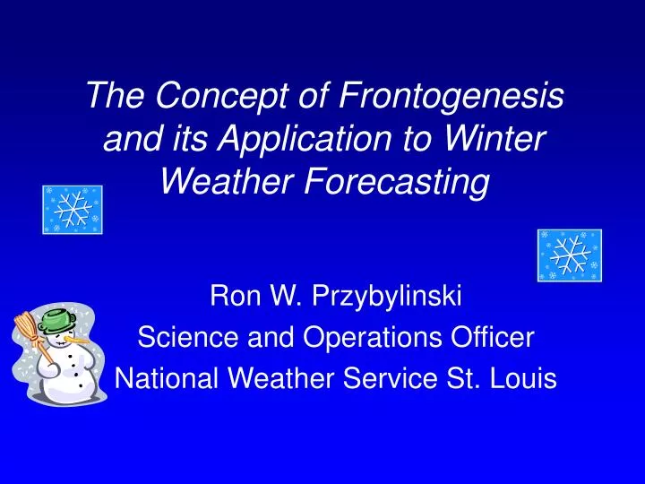
The Concept of Frontogenesis and its Application to Winter Weather Forecasting . Ron W. Przybylinski Science and Operations Officer National Weather Service St. Louis. Definition of Frontogenesis.

E N D
The Concept of Frontogenesis and its Application to Winter Weather Forecasting Ron W. Przybylinski Science and Operations Officer National Weather Service St. Louis
Definition of Frontogenesis • Frontogenesis refers to the change in the magnitude and orientation of the temperature gradient at a level or layer (e.g. 850 – 700 mb) due to the directional and speed changes in the wind field (e.g. convergence and divergence).- Increasein the horizontal thermal gradient with time. • Frontolysis – simply defined as a decrease in the horizontal thermal gradient with time. • We will discuss these concepts in terms of QG theory.
Quasi-geostrophic Theory • QG theory is limited to - diagnosing vertical motion on the synoptic-scale (extratropical cyclones / large troughs and ridges in the baroclinic westerlies (scales of 1000 – 10000 km). • QG frontogenesis – does help to diagnose a synoptic-scale environment which may be supportive or non-supportive of mesoscale processes. • Frontogenesis (using total wind) can help diagnose features on scales of 100 – 500 km (e.g. banded precipitation structures).
Factors Causing Frontogenesis/Frontolysis • Four factors which can effect the horizontal thermal gradient resulting in frontogenesis or frontolysis. • Shear • Confluence/Difluence • Tilting • Diabatic Heating
1.Shear Initially: Shearedwind field applied toa uniform thermalgradient (warm – leftside; cold – right side) At time T+1: shearedwind field acts to rotate the thermalgradient. Example: in the vicinity of a cold front south of a surface Low pressure area.
2. Confluence / Difluence Left: Confluent wind fieldapplied to the thermal gradient. At T + 1 the windacted to increase the thermal gradient – thusfrontogenetic. Right: Diffluent wind fieldapplied to the thermal gradient. At T + 1 thewind acted to decreasethe thermal gradient – thus frontolytic. Example: Opposing thermal advection patterns on eitherside of a quasi-stationary boundary (low-levels).
3. Tilting In these cases, the temperature gradient is inthe vertical as opposed tothe horizontal in the preceding examples. Thetemperature gradient is being tilting by the verticalmotion field. Left: Differential verticalmotion acting to increasethe thermal gradient, frontogenetically.Right: Differential vertical motion is acting to decrease thethermal gradient, acting frontolytically. Example: Indirect thermal circulation with cold air rising andand warm air sinking (exit region of an upper-level jet).
4. Diabatic Heating Diabatic Heating can actfrontogenetically (top) or frontolytically (bottom). Top example: (cold air on left;warm air on right) indicates a a situation where cloud cover islimiting radiational warming on the left, while cloud- free area onright heats up.(Thermal gradient strengthens) Bottom example: (cold air on leftwarm air on the right). The sunis warming the cold air while cloudcover limits radiational warming (frontolytic). Example: stratus clouds form on north side of cold front.
Deformation Deformation (shearing- stretching) of the wind can act fronotogenetically or frontolytically andis included in terms 1 and 2. Key – angle between the isotherms and axis of dilitation (Dilitation – is oriented parallel to the stretching caused bythe deformation field). (LEFT SIDE) If the angle is less than 45º the wind field is acting frontogenetically (increase in the thermal gradient).(RIGHT SIDE) If the angle is greater than 45º the wind field is acting frontolytically (decrease in the thermal gradient. Streamline analysis is a good tool for detecting deformation zones
Development of the Frontogenetical Circulation When the temperature gradient strengthens, the geostrophic wind aloft and at low-levels must respond to maintain thermal wind balance. Winds aloft cut to the north / winds below cut to the south creating regions of div / con. Upward (downward) motions develops across the southern (northern) part of the plane respectively. The development of a direct thermal circulation acts to weaken the temperature gradient and frontal zone.
Development of the Frontogenetical circulation cont’ Another way of looking at frontogenesis which implies vertical motion through forcing / response. When geostrophic and hydrostatic balance is disturbed, QG theorystates that the atmosphere responds to the disturbance (forcing) through ageostrophic circulations which attempts to restore the thermal wind balance (the response). N S Thermally Direct Circulation Geostrophic frontogenesis causes A frontolytic response (warm air rising / cold air sinking) Note: QG frontogenesis – is limited to forcing on the synoptic scale.
Direct thermal circulations and Jet Streaks Direct thermal circulations typically develop in the ‘entrance region’ of an upper- level jet streak (250 – 300 mb). The result of the forcing, or response is frontolytic. Warm air rises and cools / cold air sinks and warms – weakening the temperature gradient. Since ULJ streaks inherently occur in a baroclinic environment which implies thermal wind shear, it follows that geostrophic frontogenesisand frontolysis are associated with jet streaks. N S
Summary: Frontogenetical Circulation • Frontogenetical circulations typically result in one band • of precipitation which is parallel to the frontal zone. - The strength of the circulation can be affected by the ambient static stability. - Grumm and Nicosia (1997, NWD) found in their studies that a weakly stable environment in the presence of frontogenesis lead to one band of heavy precipitation. However they discovered that a greater instability resultedin classic CSI bands of precipitation.
Our Study of Frontogenesis Frontogenesis can occur in a variety of environments. Our study of frontogenetical forcing looks at those events which occur upstream (west) of a long wave trough in nearly zonal (west-northwest) flow. Ray Wolf (SOO / WFO DVN), Dave Skerritt (Forecaster / WFO OAX, and myself examined four mesoscale single banded snow events across the Midwest. Preliminary findings:- Two of the four events occurred during the month of January, one event in December while a fourth event occurred in the month of April.
Preliminary findings cont’ - The upper-level jet (ULJ) (300 mb) was located just northeast of the banded precipitation (right entrance region of the 300 and 500 mb jets). - Embedded within the longwave pattern, a 500 mb shortwave trough was located between 1000 to 1500 km downstream (east) of the single banded snow structure. - Mean upper-level flow varied from 280 to 300° - In all four events, there was an absence of a vorticity maximum or differential positive vorticity advection upstream of the banded precipitation structure. - At 850 mb level, the single banded precipitation feature evolved in a region of neutral to moderate warm advection. Stronger warm advection was located 500 to 1500 km west or west-southwest of the single band of precipitation.
Preliminary Findings cont’ - At the surface, a relatively strong area of high pressure was located immediately northeast of the single banded snow structure. Magnitudes of the high pressure center varied from 1028 to 1040 mb. - In two of the four cases, a weak inverted surface trough, oriented northeast – southwest, was identified preceding and during the period of snowfall. • In three of the four cases, the overall character of the snowfall pattern showed a single band of snow approximately 50 to 70 km wide and 200 to 300 km long. In the fourth case, multiple (2 – 3) large snow- bands were identified. - In the four cases surveyed, snowfall amounts with a single reflectivity band varied from 2 to as much as 6 inches.
The following preliminary conceptual model is based on the four cases we have studied.
The January 7, 1999 Snow Case This part of the presentation will key upon a snow event which occurred during the morning hours of 7 January 1999 across eastern Missouri and southwest sections of Illinois. An overview of the synoptic-scale environment will be followed by a survey of diagnostics and a sequence ofWSR-88D reflectivity imagery from Kansas City (KEAX)and St. Louis (KLSX) showing the precipitation structuresobserved during the morning of Jan 7, over the St. Louis area.
300 mb Analysis 0000 UTC, 7 Jan 1999 • Two shortwave (s/w)troughs were identified inthe mean longwave pattern. • 1st s/w extended acrossthe New England region. • 2nd s/w extended fromthe western Great Lakesthrough northwestArkansas. -300 mb Upper-level jet (ULJ) core stretched from eastern Montana througheastern Ohio.-High-level moisture (hatched area) extended from northern California through west-central Illinois (right entrance region of ULJ).
500 mb Analysis 0000 UTC 7 Jan 1999 -Similar to the 300 mbpattern, two shortwavetroughs were identifiedwithin the mean long-wave pattern.-1st s/w extended acrossthe New England region.-2nd s/w stretched fromthe western Great Lakesregion throughsouthwest Missouri. -The 500 mb jet extended from central Nebraska through northern New England region with a 100 kt core across eastern IA – western IL.500 mb moisture stretched from Wyoming through northern New Englandregion.
700 mb Analysis 0000 UTC Jan 7, 1999 -Similar to the 300 and500 mb patterns, twos/w troughs were notedat this level.1st s/w stretched acrossthe New England region.2nd s/w extended fromthe Great Lakes throughsouthwest Missouri. -The 700 mb pattern revealed a 50 kt jet extending from northwest Iowathrough southern New England.Moisture at this level stretched from the northern Rockies through theeastern seaboard.
850 mb Analysis 0000 UTC Jan 7, 1999 -An 850 mb troughextended from the GreatLakes region througheastern Kansas.-Strongest cold advectionextended from the western Great Lakes through the lower Missouri Valley region.-Weak warm advectionwas noted across theSouthern Plains. -850 mb jet (40 kts) extended from southern Illinois through central Pennsylvania.-850 mb moisture was located east of the trough while a second area ofmoisture stretched from western Nebraska through northeast Kansas.
0600 UTC Surface Analysis, January 7, 2000 -Strong area of high pressure(1040 mb+) extended acrossmuch of the Upper and Mid-Mississippi Valley regions.-Weak surface cold frontstretched from easternKentucky to southeastOklahoma.-Surface dewpoints acrossMissouri and Kansas rangedfrom the single digits to themid-teens. -South of the cold front, surface dewpoints varied from the mid and upper 30s.
WSR-88D reflectivity image (0.5° slice) at 0629 UTC (01/07/99) from Pleasant Hill MO (KEAX). Reflectivity imagery showed a single bandedsnow pattern extending from far northeast Kansas to central Missouri. Asecondary weaker band, parallel to the larger band, extended across far northwest Missouri.
WSR-88D reflectivity image (0.5°slice) at 0904 UTC (01/07/99) fromSt. Louis MO (KLSX). About 2.5 hours after the KEAXreflectivity image, beginnings of thesingle banded snow pattern can beseen from KLSX. Light snow wasreported over parts of central Missouri at this time. The precipitation pattern to thesoutheast of St. Louis at this timeis part of a larger precipitation pattern and where snowfall wasevaporating (not reaching thesurface).
WSR-88D reflectivity image(0.5° slice) at 1101 UTC(01/07/99) from KLSX. The banded snow patternidentified earlier west to southof St. Louis, lost definition at thistime. However, parts of the single banded pattern can be seen from just east of JeffersonCity (JEF) MO to 60 nm southeastof St. Louis. Other smaller banded structureswere noted east of St. Louis.Light snow continued to fall overparts of central to northeast Missouri at this time.
The 1115 UTC (10.7m) satellite imagery showed the coldest temperaturesand highest cloud tops across the southern third of Missouri. The precipitation was falling north of this region where cloud top temperaturesranged from –15 to -35°C. The coldest cloud tops persisted across southern Missouri through 1600 UTC.
WSR-88D reflectivity image(0.5° slice) at 1200 UTC (01/07/99) from KLSX. At this time, small multiple bandedstructures can be seen from farnortheast Missouri through south-central Illinois. Light snow was not reaching the surface with these smaller banded structures. Parts of the larger banded snowstructure identified earlier from central Missouri southwest Illinois can still be detected at thistime from 50 nm east of JEF to farsouthwest Illinois (near ChesterIL).Light snow continued to fall acrossparts of central Missouri at this time.
1200 UTC UA Analysis – 300 mb Analysis - 300 mb UA analysiscontinued To show thepersistent Mean troughfrom the eastern GreatLakes through the Gulfcoast states. - One s/w trough stretched from Lake Huron through northernGeorgia while a weakerimpulse was racingacross the westernGreat Lakes region. - 300 mb ULJ streak extended from southeast Minnesota through westernPennsylvania. Moisture and the region where the banded snow structures formed in the right entrance region of the 300 mb ULJ (Missouri – Illinois area).
500 mb Analysis 1200 UTC January 7, 1999 -Similar to the 300 mbanalysis, the mean long-wave trough extendedfrom the eastern GreatLakes through centralTennessee. -One s/w troughstretched from easternLake Huron througheastern Tennessee whileweaker s/w’s weredetected across thesouthern U.S. A strongers/w was also noted wellupstream over thenorthern Rockies. -The 500 mb jet streak (100 kts) extended from southern PA through easternIndiana. Moisture and the area of snow bands were noted again in theright entrance region of the 500 mb jet.
850 mb Analysis 1200 UTC January 7, 1999 - Broad 850 mb troughextended from southeastQuebec through the New England region. - Strong cold advectionwas Noted across the eastern Great Lakes regionwhile warm advection stretched from the centralthrough southern Plainsregion. Weak warmadvection to neutral conditions prevailedacross Missouri and Illinois. - A large area of low-level moisture extended from Colorado through southernIllinois and eastward along the eastern seaboard. The snowfall across parts of central Missouri was occurring under weak warm advection.
1200 UTC 01/07/99 Sounding from Lincoln IL (ILX) The 1200 UTC ILX sounding showed a deep dry layer from 950 to near700 mb while a deep moist layer was identified above 700 mb. The ILX sounding was conditionally unstable above 600 mb. Very limited ice nucleation –crystal growth would have occurred between 600 and 550 mb. The vertical wind shear profile backing of the wind field at low-levels between the surface and 830 mb suggesting cold advection.
1200 UTC Jan 7, 1999 Sounding (Springfield MO) The SGF sounding showed a cold shallow layer of air within the lowest 50 mband a warm frontal zone above 950 mb. A dry layer was identified between840 and 680 mb while a deep moist layer was detected above 670 mb. Thesounding was conditionally unstable above 690 mb. Ice nucleation -crystal growth would have been limited to the very lower part of the moist layer above 680 mb (between -10 to -20° C).
2-D Petterssen Frontogenesis at 500 mb; 1200 UTC 7 Jan 1999This graphic generated by Saint Louis Univ. diagnostic program showsan axis of frontogenesis extending from eastern South Dakota throughsouthern Lake Michigan. The region of implied lift would extend alongthe southern part of this axis across southern Iowa –northern Missouriand into central Illinois.
2-D Petterssen Frontogenesis for 700 mb; 1200 UTC 7 Jan 1999. This plan view shows an axis of frontogenesis extending from northwest Iowathrough southeast Missouri – far southwest Illinois. The region of ‘impliedlift’ would stretch from southwest Iowa through south-central Missouri. At this time, snow was occurring across northwest through central Missouri – along the western side of the axis.
Cross-section of Conditional Symmetric Instability (CSI) for 1200 UTC; Jan 7,1999. The cross-section extends from 75 nm southeast of MSP to 100 nmwest of JAN. When comparing e and absolute geostrophic momentum (M) surfaces, the M surfaces showed a steeper slope compared to the e surfacesfrom 42° N to 38° N within the 350 – 600 mb layer. This area suggest the presence of CSI which gives credence to the smaller multiple bandedreflectivity structures seen from northeast Missouri through south-central Illinois on KLSX radar at 1200 UTC.
Cross-section of Equivalent Potential Vorticity (EPV) for 1200 UTC; Jan 7, 99.EPV cross-section end points similar to CSI cross-section. EPV is used todetermine location of CSI. If EPV < 0, then CSI is present. A deep layer (600 – 225 mb) of EPV < 0 extends from 42.5° N – 37.5° N. The depth andmagnitudes of EPV is similar to observations recorded by Nicosia and Grumm (1999). Multiple small banded reflectivity structures were seen on KLSX radar at 1200 UTC from northeast Missouri through south-central Illinois.
1200 UTC Surface Analysis January 7, 1999 • Large area of high pressure moved slowlyeastward into western Illinois – southeast Iowaat this time. A lightnortheast flow was observed across thenorthern half of Missouri. -An inverted surface trough extended from east-central Missourithrough far eastern Oklahoma. This troughwas a reflection of the upward vertical motion over Missouri. • Surface dewpoints across Missouri did not change from 0600 UTC remainingin the single digits to lower teens at 1200 UTC. Dewpoints across the LowerMississippi Valley region were 35°F or higher.
The 1315 UTC satellite imagery continued to show the coldest cloud topsacross the southern third of Missouri.
WSR-88D reflectivity image(0.5° slice) at 1317 UTC(01/07/99) from KLSX. The overall reflectivity pattern began to take on the characteristicof a frontogenetical banded structure. Three mesoscale bandsmake up the entire precipitation pattern. The overall pattern(18 dBZ +) extended from centralMissouri through south-westIllinois. Reflectivity values of24 dBZ + can be seen with twoof the banded structures acrosscentral Missouri. Comparing the IR satellite imageryto reflectivity pattern at this time,the coldest cloud tops continuedacross southern Missouri wherelittle if any precipitation was falling. However, cloud topswere starting to cool over central sections of the state.
WSR-88D reflectivity plan view(0.5° slice) at 1359 UTC (01/07/99)from KLSX. At this time, a large and wide mesoscale banded structure slowly became more defined fromCOU to STL. The 24 dBZ areaexpanded in areal coverage fromthe 1317 UTC reflectivity imageacross parts of central througheast-central Missouri. Note the relatively sharp reflectivity gradient along the southeast partof the overall reflectivity field - 40 to 50 km west of STL. Snow reduced visibilities at STL from 4 miles to ¾ mile between1300 and 1400 UTC.
WSR-88D reflectivity plan view(0.5° slice) at 1428 UTC fromKLSX. A single mesoscale bandedreflectivity pattern continued tobecome more defined at this timefrom 20 km west of Moberly Missouri (northwest of COU) toSTL. Reflectivity values of 24 dBZ+ extended from 40 km west of Moberly through theSTL area. The sharp reflectivity gradientalong the southern end of the bandcontinues to become more definedacross central and east-centralMissouri.
WSR-88D reflectivity plan view(0.5° slice) at 1458 UTC fromKLSX. A single mesoscale banded reflectivity pattern with values of24 dBZ + extended from Moberlyto north of STL. Reflectivity valuesof 29 dBZ were embedded withinthe larger band. Smaller - shortersnowbands were identified from50 km west of STL through theSTL area. Visibilities at STL and SUS were reduced to ½ mile in moderatesnowfall at 1500 UTC.
The 1515 UTC IR satellite image continued to show the coldest cloudtops extending across south central through southeast Missouri. Warmer cloud top temperatures of –15 to –30°C were noted across central Missouri through southwest Illinois where the mesoscale bandedstructures were identified.
WSR-88D reflectivity plan view(0.5° slice) at 1603 UTC from KLSX. At this time, a single mesoscalesnowband remained evidentfrom 30 km north of Mexico MOto just south of Carlinville IL. An area of 29 dBZ was indentifiedwithin the snowband. Smaller banded structures canbe seen across parts of southwestIllinois (50 to 80 km east of STL).
The animation is a sequence ofplan view reflectivity images (every 30 min) from KLSXbetween 1258 and 1600 UTC.The sequence of images showthe evolution of the single mesoscale snowband across central and eastern Missouri.
Time-series station plot for St. Louis – January 7, 1999. The plot showsthat snow reducing visibilities below 1 mile occurred between 1300 – 1400 UTC with ½ mile visibilities reported at 1500 UTC. The visibilitiesimproved after 1600 UTC.
Map of snowfall reports ending at 0000 UTC January 8, 1999. Theheaviest snowfall occurred across parts of east-central / northeastMissouri – into west-central Illinois. WSR-88D reflectivity imagery from KLSX showed single banded structures across this area from1300 – 1700 UTC.
Summary • The January 7, 1999 snow event occurred upstream from the mean500 mb long-wave trough in west-northwest flow. 2. The 300 mb ULJ core (130 kts) extended from central Minnesota through western Pennsylvania while the 500 mb jet core (100 kts) stretched from east-central Indiana through western Maryland. Missouri and Illinois was located in the right entrance region of both cores. Mid-high level moisture was also depicted on both fields. 3. Initial 500 mb analysis showed no discernable shortwave trough immediately upstream of Missouri. Absence of vorticity advection over the region. 4. The 850 mb analysis at 1200 UTC showed weak warm advection Over western Missouri through eastern Kansas and south across western Arkansas into eastern Oklahoma. Stronger warm advection was observed across west-central and southern High Plains region.