Download
1 / 18
200 likes | 362 Vues
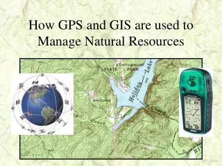
How GPS and GIS are used to Manage Natural Resources. Presentation Given By: Amanda Tydings. GPS – Global Positioning System What is it?. GPS consists of satellites which continuously orbit the Earth.

E N D
How GPS and GIS are used to Manage Natural Resources Presentation Given By: Amanda Tydings
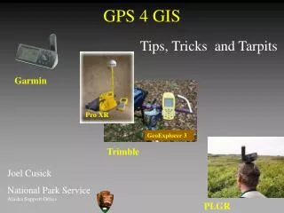
GPS – Global Positioning System What is it? • GPS consists of satellites which continuously orbit the Earth. • There is a network of ground stations used for monitoring and control of the satellites. • GPS provides users with accurate information on position, velocity, and time anywhere in the world.
Satellites • There are 24 satellites that continuously orbit the Earth at an altitude of 11,000 miles • Radio signals are sent from the satellites and are picked up by the GPS receivers. • GPS receivers must lock on to at least 3 satellite radio signals to properly navigate.
The Latitude/Longitude Grid • The Lat/Long grid consists of the same elements. The axis are the Equator running in an east/west circle around the globe, and the Prime Meridian which is a line running north and south through Greenwich England.
Accuracy • The accuracy of the receivers is dependent on the number and quality of the signals from the satellites. • Many factors can affect the accuracy of a GPS unit. These factors include proximity to buildings, canyons and trees. Even haze can prevent you from getting a good satellite signal. • Accuracy can be off by as much as 300 ft.
How to Use a GPS Receiver • Marking a waypoint • Finding a previously saved waypoint • Rate of travel
One can navigate back to a starting point or other predetermined locations with out the use of maps or any other equipment Navigation Search and Rescue Hiking Hunting Camping Fishing Practical Uses for GPS Receivers
GIS – Geographic Information System What is it? • GIS stores information about the world as a collection of layers and display this information as maps. • GIS technology can be used for scientific investigations, resource management, development planning and many other applications.
Layers • Layers can include stand delineation, demographics and census data, transportation, populated places, political boundaries, soils, surface water and aquifers and many more. • Geography is the glue that binds these layers together. • GIS is the tool that allows you to see the relationship between them.