Download
1 / 21
220 likes | 503 Vues
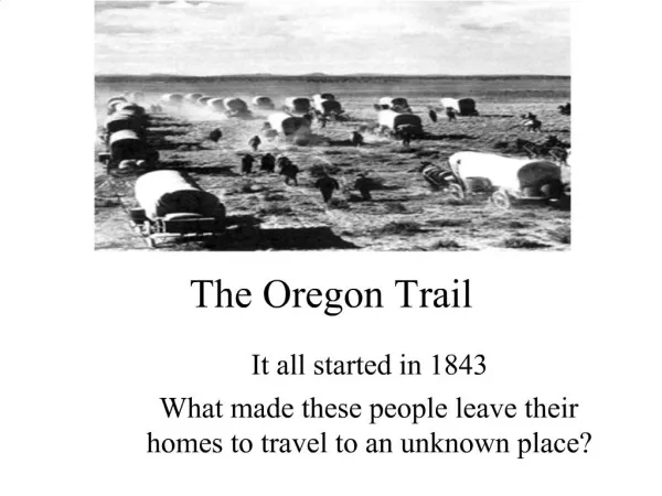
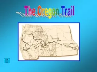
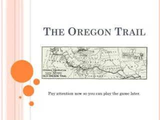
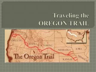
The Oregon Trail. A virtual tour along the landscape. Oregon Trail Map . The Oregon Trail. Pioneers: a.k.a. – Overlanders, parties, companies or teams (some groups: 1000) Traveled 2000 miles during summer months (April-Nov.) in 1830’s and ’40’s Young – adult males traveling w/ families

E N D
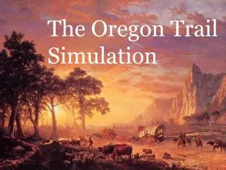
The Oregon Trail A virtual tour along the landscape
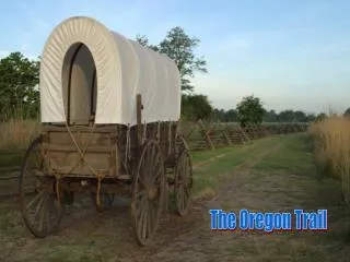
The Oregon Trail • Pioneers: a.k.a. – Overlanders, parties, companies or teams (some groups: 1000) • Traveled 2000 miles during summer months (April-Nov.) in 1830’s and ’40’s • Young – adult males traveling w/ families • Canvas Covered Wagons: clothes they wore, blankets, guns, ammo, knives, water canteen, blackened pot, sugar, salt, flour • Many started in Missouri then…
The Great Plains • Several hundred miles of wide, rolling prairies (“Carpet of fresh green grass”) • Native Amer. Territory • Buffalo • Violent Storms – Challenges? • Cooking was tough • Getting stuck in mud • Crossing streams • Soaked clothing and bedding
The Platte River • Relatively easy portion of journey – sluggish, shallow, ½ mile wide • Friendly interaction with Natives until 1954 • River crossings were difficult: Drownings, Quicksand • Dry, Dusty, Shadeless – Challenges? • Lips cracking, dry nostrils, sickness: Cholera • New animals, deceptive distances • Monotony: tensions, tempers, weariness, boredom = Fractures • Unpacking possessions to cross the river Fort Laramie – Cut supplies Independence Rock – “register of the desert”
Approaching the Foothills of the Rockies • Sweetwater River – O. Trail became more rugged (2-3 miles per hour) • Challenges? • Trees cut, boulders pried/pushed aside • Detours around deep gulches • Wagons tipped • Creek crossings: unload, disassemble and load Largest Mtn. Range in U.S. – snow capped peaks 3,000 ft. high – Passable?
Rocky Mountains – South Pass • Dry, Rocky terrain of wild sagebrush, precipitous hillsides and prickly pear but gradual assent – Challenges? • Wagon unloading, ropes, pulleys, worn animal hooves Also…Unpredictable weather in high passes (snowstorms) – Challenges • Slow travel, no grazing or hunting
The Great Basin • Northern most part, not a great descent (plains) but… • One of driest parts of journey – Challenges? • Water unattainable, impassable gorges Try Snake river but… • Difficult: deep, swift, submerged boulders • Many rafts capsized
Blue Mountains • Very steep but comforting…Last range, near destination and crossed them before • Challenges: • Similar to other mountains: ropes, pulleys, etc. • Health concerns: Very taxed at this point – susceptible to dysentery and exposed to cholera, measles and Mountain fever: • Sores on unwashed bodies Also, Heat exhaustion, children falling off wagons
Columbia River • Dalles settlement on south bank • VERY swift river, rapids – Challenges? • Stood still for days • Fall in – many settlers died here Barlow Road over Cascade mountains – Eastern slope – Not bad; Western slope: swampy and heavily forested • Used lines to slow wagons down slope
Willamette Valley • Lush, flat valley • On Barlow Road – cliff walls of valley were too high to cross: • Ferried river or • Native help • Most emigrants settled at the mouth of the river