Download
1 / 17
170 likes | 333 Vues
Worldwide Usage of Landsat. Total Landsat Scenes Delivered Since October 1, 2008. Over 2.4 million images available today Seven fold increase in scientific and educational users Data delivered to 180 countries Exceeded 1 million scenes delivered on August 17, 2009 .

E N D
Worldwide Usage of Landsat Total Landsat Scenes Delivered Since October 1, 2008 • Over 2.4 million images available today • Seven fold increase in scientific and educational users • Data delivered to 180 countries • Exceeded 1 million scenes delivered on August 17, 2009 Daily Average = 3,125 scenes of web-enabled data delivered
Bryant Cramer Associate Director for Geography, USGS U.S. Department of the Interior U.S. Geological Survey
A Long ViewLandsat provides the longest continuous record of global land surface conditions. The Landsat archive is an objective, comprehensive chronicle of the land. Appropriate technology for the missionLandsat is designed to provide the scientific data and tools necessary to support decision-makers in selecting wise land management strategies. Building for the FutureLandsat data continuity is required by law (Land Remote Sensing Policy Act of 1992).For future missions, an operational strategy rather than a research approach is most efficient. Outline 7
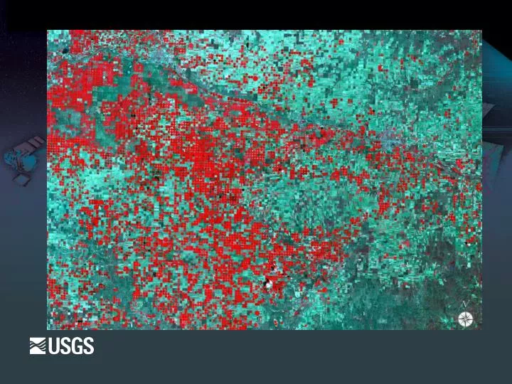
Origin of Landsat “… the time is now right and urgent to apply space technology towards the solution of many pressing natural resource problems being compounded by population and industrial growth.” Secretary of the Interior Stewart L. Udall, 1966 Bolivia Deforestation These images show the progression of deforestation in Bolivia from 1975 to 2003. This area lies northeast of Santa Cruz de la Sierra, Bolivia, in an area of tropical dry forest. Since the mid-1980s, the resettlement of people from the Altiplano (the Andean high plains) and a large agricultural development effort (the Tierras Baja project) has led to this area’s deforestation. 8
Landsat program: since 1972 The World’s Most Sophisticated Optical Observatories of the Earth The World’s Model for International Collaboration in Earth Observation Landsat 1 - 3 Multi-Spectral Scanner (MSS) 79 meter Return Beam Vidicon (RBV) 80/40 meter Landsat International Cooperator Stations Landsat 7 Enhanced Thematic Mapper Plus (ETM+) 30/15 meter Landsat International Cooperator Stations Landsat 4 - 5 Multi-Spectral Scanner (MSS) 79 meter Thematic Mapper (TM) 30 meter 37-year Archive of Global Data Modern Digital Silo EROS Center Sioux Falls, SD Department of the Interior is a Center of Expertise in Satellite Imaging and Land Science
Uses of Landsat Imagery Agriculture & Forestry Wildlife & Public Lands Commerce & Industry Regional, State, and Local Government Disaster Management International Economic Development National Security / Homeland Security Global Change Policy & Research 10
Medium Resolution: A broad but thorough perspective Land cover and disturbance year Persisting Nonforest 1995 Persisting Forest 1996 Water 1997 Pre-1985 1998 1985 1999 1986 2000 1987 2001 1988 2002 1989 2003 1990 2004 1991 2005 1992 2006 1993 2007 1994 • This figure shows all major land use changes and ecosystem disturbances between 1985 and present. Detected and mapped using Landsat imagery. 12
National Land Cover Dataset NLCD 2001 landcover.usgs.gov
Role in Global Change Research Impacts of land use and land cover change Carbon cycle dynamics Changes in ecosystem services, e.g., deforestation Monitoring climate-driven land dynamics Changes in snow and ice extent, e.g., glaciers Changes in fire frequency and severity Drought cycles Climate studies Human dimensions of global change Land-atmosphere interactions Land use modifications of weather and climate Essential Climate Variables (ECVs) - Terrestrial River discharge, Water use, Ground water, Lake levels, Snow cover, Glaciers and ice caps, Permafrost and seasonally-frozen ground, Albedo, Land cover (including vegetation type), Fraction of absorbed photosynthetically active radiation (fPAR), Leaf area index (LAI), Biomass, Fire disturbance, Soil moisture Landsat Remote Sensing of Global Change Landsat 7: Lena DeltaThe Lena River, some 2,800 miles long, is one of the largest rivers in the world. The Lena Delta Reserve, the most extensive protected wilderness area in Russia, is an important refuge and breeding grounds for many species of Siberian wildlife.Image taken 7/27/2000 14
Status of Landsats 5 and 7 Landsat 5 Launched in 1984; more than 26 years old Operating on several backup subsystem components Items of concern: Transmitters, Solar Arrays, Batteries… etc Landsat 7 Launched in 1999; suffered key sensor degradation in 2003 Each scene retains 75% of high-quality data Scenes are still good for some uses “as is” (with 25% missing along edges) Scenes filled in by ground system processing Items of concern: Gyroscopes
Landsat Data Continuity Mission (LDCM) NASA and USGS cooperation to ensure continuous availability of Landsat data. NASA: Procures satellite, instrument, and launch services Manages mission integration and post-launch system checkout Transfers satellite to USGS after on-orbit checkout Cooperates with USGS in ongoing data calibration/validation USGS: Procures ground station network, ground data archive and processing systems, and flight operations facility Coordinates with NASA on mission integration and system checkout Operates satellite and manages data archive and distribution Sponsors Landsat Science Team co-chaired by USGS and NASA Manages ongoing data calibration/validation Launch scheduled for December 2012
Continuing the Landsat mission to understand the earth The Earth behaves as a system in which oceans, atmosphere and land, and the living and non-living parts therein, are all connected. Global Change and the Earth System Steffen et al. 2005 landsat.usgs.gov