Download
1 / 34
340 likes | 499 Vues
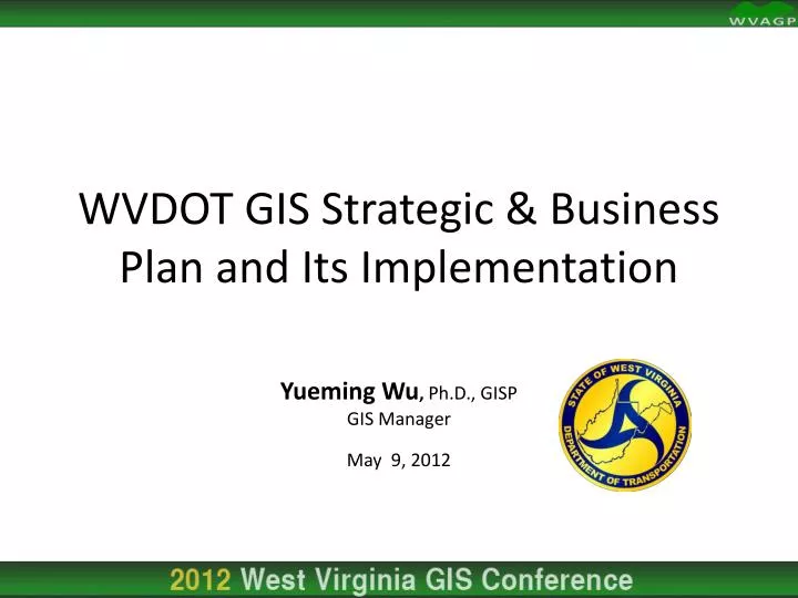
WVDOT GIS Strategic & Business Plan and Its Implementation. Yueming Wu , Ph.D., GISP GIS Manager May 9, 2012. Agenda. Introduction WVDOT Enterprise GIS Roadmap Status Update Future Work Questions & Answers. Introduction. History.

E N D
WVDOT GIS Strategic & Business Plan and Its Implementation Yueming Wu, Ph.D., GISP GIS Manager May 9, 2012
Agenda • Introduction • WVDOT Enterprise GIS Roadmap • Status Update • Future Work • Questions & Answers
History Historically the West Virginia Department of Transportation (WVDOT) has been utilizing geospatial (GIS, Remote Sensing, & GPS) technology for planning, analysis, and mapping purposes ever since the technology became available. In 2005 the WVDOT GIS Section was created to meet the growing needs for geospatial data and services in transportation. In 2007 the GIS Section was renamed as the GIS Unit and merged with the Highway Data Services (HDS) Unit, a program responsible for processing changes in roadway information, and the update and maintenance of the Roadway Inventory Log, to form the current Geospatial Transportation Information (GTI) Section.
Program Planning & Administration Division Geospatial Transportation Information (GTI) Section Highway Data Services Unit GIS Unit - Geospatial Data Management -Geospatial Services • Roadway Inventory Log • -Roadway Statistics • -Public Certified Mileage
GTI Mission & Vision Statements • Mission Statement • To improve customer service to the citizens of West Virginia by supplying the latest geospatial transportation information. • Vision Statement • The West Virginia Department of Transportation Geospatial Transportation Information (GTI) Section is committed to managing an enterprise Geospatial Information System that will improve the productivity of the West Virginia Department of Transportation, meet growing customer needs, and play a leading role in West Virginia’s geospatial community.
GIS Implementation • Esri Shop • Enterprise License Agreement (ELA) • Esri Technology • Staff • 7 GIS Professionals • 2 Cartographers • 1 GIS Coordinator at District 7 • Enterprise GIS • WVDOT Enterprise GIS Roadmap • Enterprise Resource Planning (ERP)/Asset Management System
Major GIS Projects in 2012 • Enterprise GIS Implementation • New Transportation GIS Data Model • District Level GIS Implementation • Workflow Manager • Transportation GIS Data Collection • (MS4, Railroad Crossings, Landslides, Outdoor Advertising, • Right-of-Way, Trails, Meta Data, etc.) • Highway Map Reproduction • Web Mapping Applications • (STIP, Park & Ride, Functional Classifications, etc.) • Mobile GIS Applications (MS4, etc.) • 3D GIS Application Development • GIS Portal Upgrade • ProjectWise Implementation • ERP/Asset Management System Implementation
Why? • Small Successes + Healthy Growth • Relatively New GIS Program • Copying Peers • Leveraging Professional Services • Then What? Sustainable Growth? • DOT’s Uniqueness • Growing Needs for Geospatial Technology? • Enterprise GIS? • Staff’s Skill Advancement? • Other Improvements?
How? • Goal • Guide the implementation of a sustainable EGIS • Project Initiated in October 2009 • Partnership with Esri • Enterprise License Agreement (ELA) • Technical Advisor • Online Survey • Information Assessment • Multiple Versions of Draft • Roadmap Delivered in March 2011
What? • Phased Approach • Suggestions • Best Practices • Four Phases • Phase I: Build enterprise GIS framework • Phase II: Application implementation & preparation for GIS integration for ERP applications • Phase III: Pilot new tools & applications • Phase IV: Roll out Highway Data Maintenance Solutions & ERP • Five Areas • Business Architecture • Data Architecture • Application Architecture • Technical Architecture • GIS Staffing
Current State (Now) Roll out Highway Data Maintenance Solutions and ERP to Production Application Implementation and Preparation for GIS integration with ERP Applications Build Enterprise GIS Framework Pilot New Tools and Applications Phase 1 Phase 2 Phase 3 Phase 4 Target State (Vision)
Recommended Workflow • 1. Project authorization from FHWA or other third parties. Information is entered in Primavera and notice is sent to the survey field crew to GPS project location. • 2. Field crew collects project location data and other pertinent data as necessary • 3. Data is replicated to the district office using either Web-based disconnected check-in or connected synchronization services for distributed geodatabase versions maintained in supported database platforms. Both types of replication offer two-way workflows necessary to support field crews • 4. Two-way replication is setup between the District Offices and Central Office Production geodatabase to keep geodatabases in sync. • 5. Esri’s Interoperability Extension or Feature Management Extension (FME) is used to provide interoperability between the geodatabase and MicrosStation DGN files for data exchange. For web services, MicroStation V8i can consume WMS. Both options should be available for users. • 6. Project Location Data is sent to Primavera. • 7. All business data within the ERP is linked to the roadway network LRS. • 8. Roadway Network LRS and event data in the production environment is maintained by Esri Highway Data Maintenance System. • 9. Data for Cartographic production (Federal, State, County and City Maps) is located in the • Publication geodatabase and managed by ESRI’s Production Mapping. • 10. Data is replicated one-way to the publication environment for Web Portal and File downloads. • 11. Data is replicated to the new Web Portal Publication Database. Data is projected to Web Mercator (Auxiliary Sphere) Projection before replication. • 12. Data and Maps are available for download via automated ETL.
Recommendations for Business Architecture Phase I Phase II Phase III Phase IV Develop GIS Steering Committee Define GIS Data Standards and Field Data Collection Procedures GIS Steering Committee Oversight and Support for ERP/GIS Rollout Implement Standards Identify GIS Champions in Business Units Define Business Units Data Roles and Responsibilities GIS Section and Business Champion continued work with Business Units on ERP/GIS Rollout Data Discovery Workshop with Business Units Define ERP/GIS Integration Requirements Define MicroStation Interoperability Requirements with Business units
Recommendations for Data Architecture Phase I Phase II Phase III Phase IV Develop Conceptual and Logical Data Models Pilot Physical Geodatabase Schema in Staging Environment Roll out Physical Geodatabase Schema to Production Environment Data Model Workshop Separate Database Environments – Create Staging and Publication Environments Develop QA/QC Procedures for Data Cleanup Data Cleanup Develop Common Base Maps Develop Data Caching Strategy Test Data Caching Strategy in Staging Environment Roll Out Data Caching Strategy in Production Environment Define Data Maintenance Workflows Develop Data Management Strategy –Versioning- Replication-Archiving Roll Out Versioning- Replication-Archiving in Production Environment Pilot Versioning-Replication-Archiving in Staging Environment Roll Out ETL Tools in Production Environment Automate ETL Tools Test ETL Tools in Staging Define ETL Tools Create Mosaic Datasets Test Mosaic Datasets in Staging Environment Roll Out Mosaic Datasets in Production Environment
Recommendations for Application Architecture Phase I Phase II Phase III Phase IV Design Templates for Official Maps in Production Mapping in Staging Environment – Pilot Production Mapping in Staging Environment Pilot Highway DataManagement Solution in Staging Environment Rollout Highway DataManagement Solution to Production Develop Mobile GIS Application Based on Data Collection Standards and Procedures Rollout Mobile GIS Applications Pilot Mobile GIS Applications Test Caching Strategies Pilot WMX in Staging Environment Rollout WMX in Production Environment Automate GIS & MicroStation Interoperability Workflows Pilot GIS & MicroStation Integration using Interoperability in Staging Environment Rollout GIS & CAD Integration using Interoperability Extension in Production Environment Discovery Workshop for SOA/ERP GIS Web Services and Mapping Applications Requirements Pilot GIS/ERP Integration Web Service/Mapping Applications in Staging Environment Rollout GIS/ERP Integration Web Services/Mapping Applications in Production Environment Rollout ERP/GIS Integration to Production Environment
Recommendations for Technical Architecture Phase I Phase II Phase III Phase IV Determine High Level ERP/GIS System Integration Requirements for Asset Management, Work Order Management, Safety Management, etc. System Architecture Workshop to Support ERP/GIS Integration Requirements Revisit System Architecture Requirements Integration Requirements Esri Enterprise Health Check Install WMX in Staging Environment Install WMX in Production Environment Install Image Server Extension in Staging Environment – Install Image Server Extension in Production Environment – Install Production Mapping in Staging Environment Install Production Mapping in Production Environment Install Interoperability extension in Staging Environment Install Interoperability extension in Production Environment
Recommendations for GIS Staffing Phase I Phase II Phase III Phase IV Hire GIS Database Administrator Hire GIS Developer
Revised Tasks for Business Architecture • Develop GIS Steering Committee • Identify GIS Champions in Business Units • Conduct Data Discovery workshop with business units to identify pockets of existing GIS data that should be maintained in the enterprise geodatabase.
Revised Tasks for Data Architecture • Conduct Transportation Data Model Workshop • Separate Database Environments • Create Staging and Publication Environment • Develop QA/QC Strategy for Data Clean-up • Develop Common Base Maps for Web Portal and Desktop • Develop Data Caching Strategy • Define Data Maintenance Workflows – RIL and LRS – WMX Workshop • Develop Data Management Strategy • Define ETL/Data Extraction Processes • Design and Create Mosaic Datasets
Revised Tasks for Application Architecture • Design Templates in Staging Environment • Test Caching Strategies using Image Server Extension in Staging Environment • Automate GIS & MicroStation Interoperability Workflows
Revised Tasks for Technical Architecture • Esri Enterprise Health Check – Initial System Enterprise Health Check with GIS and OT System and Network Administrators • Install WMX in Staging Environment • Install Production Mapping Solution in Staging Environment • Install Image Server extension in Staging Environment • Install Interoperability extension in Staging Environment
Business Architecture • Develop GIS Steering Committee • – In Progress • Identify GIS Champions in Business Units • - In Progress • Conduct Data Discovery workshop with business units to identify pockets of existing GIS data that should be maintained in the enterprise geodatabase. • – In Progress
Data Architecture • Conduct Transportation Data Model Workshop – Complete • Separate Database Environments – Complete • Create Staging and Publication Environment – Complete • Develop QA/QC Strategy for Data Clean-up – In Progress • Develop Common Base Maps for Web Portal and Desktop – Complete • Develop Data Caching Strategy – In Progress • Define Data Maintenance Workflows – RIL and LRS – WMX Workshop – In Progress • Develop Data Management Strategy - In Progress • Define ETL/Data Extraction Processes – In Progress • Design and Create Mosaic Datasets - In Progress
Application Architecture • Design Templates in Staging Environment • – In Progress • Test Caching Strategies using Image Server Extension in Staging Environment • - In Progress • Automate GIS & MicroStation Interoperability Workflows • – In Progress
Technical Architecture • Esri Enterprise Health Check – Initial System Enterprise Health Check with GIS and OT System and Network Administrators • - Complete • Install WMX in Staging Environment • - Complete • Install Production Mapping Solution in Staging Environment • - Complete • Install Image Server extension in Staging Environment • - Complete • Install Interoperability extension in Staging Environment • - Complete
Future Work • Complete Ongoing Tasks • Incorporate Ideas from the Upcoming Geospatial Strategic Plan by Cambridge Systematics/Transcend Spatial
Yueming Wu GIS Manager WVDOT (304) 558-7437 yueming.wu@wv.gov