Download
1 / 22
220 likes | 379 Vues
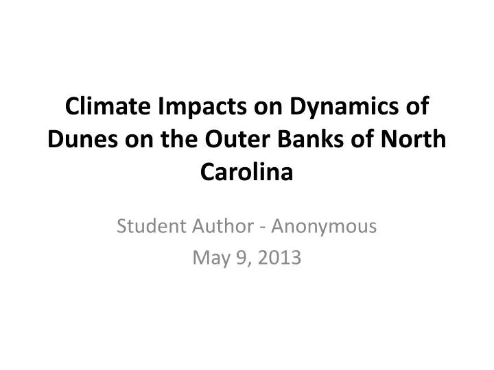
Climate Impacts on Dynamics of Dunes on the Outer Banks of North Carolina. Student Author - Anonymous May 9, 2013. Outer Banks Location and Dunes. Mitasova , 2013. Indices Which Possibly Influence W ind on NC Coast. North Atlantic Oscillation ( NAO)

E N D
Climate Impacts on Dynamics of Dunes on the Outer Banks of North Carolina Student Author - Anonymous May 9, 2013
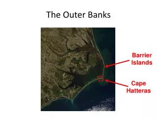
Outer Banks Location and Dunes Mitasova, 2013
Indices Which Possibly Influence Wind on NC Coast • North Atlantic Oscillation (NAO) • Pacific-North American teleconnection pattern (PNA) • Atlantic Meridional Oscillation (AMO) • Other indices may be discovered
Data • NARR (North American Regional Reanalysis) wind and precipitation data for 1971-2000. • NARCCAP (North American Regional Climate Change Assessment Program) output from WRFG run using CGCM3 boundary conditions (available for 1971-2000, 2041-2070)
Methods • Compare NARR monthly wind and precipitation data to dune movement using a combination of time series analysis and mapping for years 1998-1999 and 2007-2008. • Combined Empirical Orthogonal Function (CEOF) analysis to determine modes of variability for zonal and meridional winds (reanalysis, model simulation) over eastern coast of United States.
Jockey’s Ridge Policy • Allow natural dune movement, mimic natural processes to encourage movement in other directions to: • Correct disruption of natural processes by humans. • Protect, restore or enhance rare species. • Protect, restore or enhance archaeological finds. • Construct, maintain or improve park facilities. • Protect human health. • Sand moved once when encroaching on road, not planned for future management
Nag’s Head • Manages face dunes (dunes between ocean and land which protect local area from storm & other inundation) with combination of man made dunes and beach renourishment. • Spent $36 million in 2010 to widen 10 miles of shoreline. • Saved town from increased flooding damage during hurricane damage. • Maintenance plan with FEMA calls for renourishing beach after 5 years or 50% loss of new sand, whichever comes LATER.
Kitty Hawk • Has let nature take it’s course with respect to dunes, similar to Jockey’s Ridge. • Highway 12 and nearby beach renourished through state funds and a man-made dune was rebuilt as part of maintenance of the highway. • Much flooding during Hurricane Sandy, local community wants something done. • Special tax considered for those most affected by flooding to pay for study required for any funding for future projects.
Difference in Dune Management Outcomes South Nag’s Head, NC the day after Hurricane Sandy (left) compared to dune flattened by Hurricane Sandy in Kitty Hawk, NC (right).
Local Wind Climate • Regional winds blow from the southwest from March – August (MAMJJA season) while winds blow from the northeast from September – February (SONDJF season) and are slightly stronger than the MAMJJA winds (Pelletier et al, 2009).
Sand Movement in Nag’s Head Near Jockey’s Ridge Park 2008-2007 Elevation Wetter season, winds toward south 1999-1998 Elevation Drier season, winds towards NW.
March-August Season CEOF 1 Accounts for 25.5% variability. Correlation of 0.49 with Pacific-North American teleconnection pattern (PNA).
March-August Season CEOF 2 Accounts for 21.9% variability. Not correlated to any climate indices in this study.
March-August Season CEOF 3 Accounts for 15% variability. Correlated (but not significantly) with NAO (-0.382) and AMO (0.378).
September-February Season CEOF 1 Accounts for 28% variability. Not correlated with any climate indices in this study.
September-February Season CEOF 2 Accounts for 22% variability. Not correlated with any climate indices in this study.
September-February Season CEOF 3 Accounts for 21% variability. Correlated with ENSO 3.4 (-0.519), NAO (-0.516), PNA (-0.505) and AMO (-0.509).
Future Projections • The one NARCCAP model in this study did not simulate the time series found in the CEOF analysis of NARR data over 1979-2000. Therefore model projections not studied. • Examining trends in modes of variability from NARR reanalysis: • March-August: wind anomalies flow more towards north and northeast in near future if trends persist. • Climatological winds from southwest: stronger winds from southwest to northeast direction. • September-February: wind anomalies flow more towards south. • Climatological winds from northeast: stronger winds from northeast to south direction.
Conclusions • Winds currently from southwest in March-August and stonger winds from northeast in September-February. • Dunes currently moving slowly in a southward direction on an annual basis. • Following current trends, both of these seasons will see increased winds in their current direction. • Balance of these increased trends will determine direction of future dune movement on an annual time period.
Recommendations • More study needed on physical processes for modes of wind variability along the coast. • Physical processes can be tracked once they are known. • More study on which, if any, models capture these modes of variability well for the current time period. • Models which perform well can be used for future projections of winds to determine potential for current trends in wind variability to continue. • Balance between strength of winds in March-August and September – February seasons should be monitored closely. • This balance will control future dune movement on an annual basis.