Download
1 / 1
20 likes | 159 Vues
Rain Attenuation Retieval Using a Hitschfeld-Bordan Technique and the NASA ER-2 Doppler Radar E. Verónica Morales Irizarry*, Graduate Student Jessenia Merced González*, Undergraduate Student Dr. Sandra Cruz Pol*, Associate Professor *Department of Electrical Engineering.

E N D
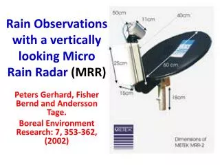
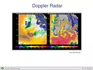
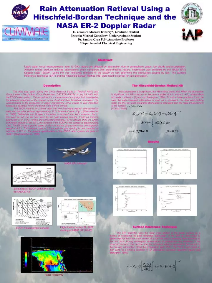
Rain Attenuation Retieval Using a Hitschfeld-Bordan Technique and the NASA ER-2 Doppler Radar E. Verónica Morales Irizarry*, Graduate Student Jessenia Merced González*, Undergraduate Student Dr. Sandra Cruz Pol*, Associate Professor *Department of Electrical Engineering Radar Reflectivity Results NASA ER-2 Aircraft Schematic of EDOP within the nose of NASA ER-2 Abstract Liquid water cloud measurements from 10 GHz radars are affected by attenuation due to atmospheric gases, ice clouds and precipitation. Airborne radars produce reduced attenuations when compared with ground-based radars. Information was collected by the NASA ER-2 Doppler radar (EDOP). Using the true reflectivity retrieved of the EDOP we can determine the attenuation caused by rain. The Surface Reference Technique (SRT) and the Hitschfeld-Bordan Method (HB) were used to correct for rain attenuation. Description The data was taken during the Cirrus Regional Study of Tropical Anvils and Cirrus Layers - Florida Area Cirrus Experiment (CRYSTAL-FACE) on July 29, 2002 with the EDOP radar system. This experiment is a measurement campaign that investigates the physical properties of the tropical cirrus cloud and their formation processes. The understanding of the production of upper tropospheric cirrus clouds is very important because is essential for the modeling of the Earth’s climate. The EDOP radar is an X-band radar with two fixed radar beams: one pointed at nadir and the other pointed approximately 33.5º forward of nadir (Fig.1) [Heymsfield et al., 1996]. Reflectivity and Doppler information is received from both antennas, but in this work we will use the data taken by the nadir pointed antenna. It has an antenna beamwidth of 3º in the vertical and horizontal directions. For an altitude of 20 km, which is the flight altitude of the ER-2, the footprint of the EDOP at the surface is approximately 1 km. The ER-2 has a ground speed of 210 m/s and the data system uses an integration period of 0.5 s. The transmit pulse is 0.5 µs and the gate spacing is over sampled at intervals of 37.5 m. The general specifications of the EDOP radar system are given in Table 1 [Heymsfield et al., 1996]. The Hitschfeld-Bordan Method HB If the attenuation is insignificant, the HB method works well. When the attenuation is significant, the HB solution can become unstable due to errors in k-Ze relationships and radar calibration [Iguchi and Meneghini, 1994]. To solve these problems it can be used the path-integrated attenuation is used as a constraint. For downward-looking radar, the two-way path-integrated attenuation is estimated from the radar measurement at the surface, [Li et al., 2001]. Surface Reference Technique The SRT algorithm uses the radar cross section of the ocean surface as a means of estimating the path integrated attenuation. In the SRT an initial value is determined for the radar cross section of a rain-free area in relatively close proximity to the rain cloud. During subsequent observations of precipitation any decrease in the observed surface cross section from the reference value is assumed to be a result of the two-way attenuation along the propagation path (PIA). The PIA for each beam is then used as a limiting condition in an attenuation correction algorithm [Iguchi and Meneghini, 1994]. Flight tracks on July 29, 2002 starting at 64800 UT (18:00) EDOP measurement concept