Download
1 / 40
400 likes | 617 Vues
G. P. S. Miles Logsdon, College of Ocean and Fishery Sciences Phil Hurvitz, Urban Design and Planning College of Forest Resources. The Global Position System. Basic Concepts. GPS U.S. government NAV igation S ystem with T ime A nd R anging NAVSTAR 24 satellites Russian syste

E N D
G. P. S. Miles Logsdon, College of Ocean and Fishery Sciences Phil Hurvitz, Urban Design and Planning College of Forest Resources The Global Position System
Basic Concepts • GPS • U.S. government • NAVigation System with Time And Ranging • NAVSTAR • 24 satellites • Russian syste • GLONASS
Geography • Location • index space: coordinates • Latitude-longitude • UTM • absolute v’s relative coordinates • 121 33’ 12” x 47 24’ 15” = absolute • 120km east and 40km north of Seattle
Position v’s Location • Position : GPS • coordinates that specify “where” • Location: maps • “where” with respect to know objects
Map Projections – later?? two Map Projections
Why use GPS (1) • Availability: • 1995, DoD NAVSTAR, civilian use foreseeable future • Accuracy: Factors • work with “primary” data sources • High inherent accuracy (2.5m medium-quality properly corrected receiver) • Time Corrected to 1/1 billionth of a second
Why use GPS (2) • Ease of use • stop and read a single coordinate = 20m accuracy (+/- 5m) real-time • 3-D data • horizontal (x & y) and altitude (z) • variances in z = horizontal * 2
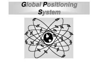
GPS SV Satellite Transmitter Specifications (1) • Radio wave transmission (~20cm) • Not good without direct view of sky (i.e. inside, underground, under canopy, precipitation • 24 solar-powered radio transmitters, 3 spares • “middle altitude”, 20,200km, below geosynchronous orbit
Satellite Transmitter Specifications (2) • Neither polar nor equatorial • each execute a single 12 hour orbit • 4 satellites in each of 6 orbital planes • speed of 3.87 km/sec ( 8,653 mph) • weigh ~ 1 ton with 27 feet of solar panels • Orbit tacks monitored by 4 base stations • Master control station in Colorado Springs • Each satellite monitored twice a day
u B A X Finding distance by measuring time • Almanac: predicted position of satellites • Constellation: set of satellites used • DOP: Dilution of Precision • PRN: Pseudo random noise code • Electromagnetic radiation (EM) 299,792.5 Km/sec << 7/100 of a second after 4:00 4:00 p.m. >> Receiver: Satellite: G J K E T Y U O W V W T D H K … G J K E T Y U O W ...
We can locate our position on the surface of a sphere • Satellite location Given 1 satellite …
We can locate our position on the intersection of 2 spheres (a circle) • Satellite location Given 2 satellites …
We can locate our position on the intersection of 3 spheres (2 points) • Satellite location Given 3 satellites …
We can locate our position on the intersection of 4 spheres (1 point) • Satellite location Given 4 satellites …
The point can be located on the earth’s surface • Satellite location
The precise location is determined • Satellite location
After the correct position is determined, the receiver’s clock is adjusted Adding or subtracting time will make the location more or less precise If the receiver’s clock is ahead, the position will be over-estimatedfor each signal • More on timing: Setting receiver clock
If the receiver’s clock is behind, the position will be under-estimatedfor each signal • More on timing
If the receiver’s clock is correct, the position will be properly estimatedfor each signal • More on timing
The receiver adds and subtracts time from simultaneous equations until the only possible (correct) position is located. The receiver’s clock becomes virtually as accurate as the atomic clocks in the SVs • More on timing
Sources of error: Dilution of precision (DOP) The best spread of satellites makes the best trilateration We want low DOP Satellites that are close to each other result in higher DOP: HDOP: horizontal DOP VDOP: vertical DOP PDOP: positional DOP (combination of HDOP & VDOP) TDOP: time DOP GDOP: geometric DOP (combination of PDOP & TDOP)
Major Factors of error • Satellite clock errors < 1 meter • Ephemeris errors (satellite position) < 1 meter • Receiver errors < 2 meters • Ionosphere errors (upper atmos.) < 2 meters • Troposphere errors (lower atmos.) < 2 meters • Multipath errors (bounced signals) ??? • “Selective Availability” signal transmission 0 - off (< 33m if on)
Error • Atmospheric • Light travels at 299,792,458 m/s only in a vacuum • Ionospheric effects: ionizing radioation • Tropospheric effects: water vapor • Light is “bent” or reflected • Clock • Receiver clock errors, mostly corrected by software in receiver • Satellite clock errors • Satellite time stamp errors • Time stamp errors are not correctable • SV timing & clocks are constantly monitored and corrected • Receiver • Power interrupts • On-board microprocessor failure • Firmware • Software • Blunders (user error)
Clock timing error factor introduced by the DOD Standard operation on the satellites. S/A changes the time stamp of the outgoing signals Calculated positions are erroneous SA causes locations to be in error up to 100 m Each satellite encrypts its own data separately Encryption keys shift frequently In the event of warfare, enemy forces cannot use the same accuracy as the US armed forces Military-grade have the ability to decrypt the time dithering,which lowers error to about 15 m from ~100 m uncorrected • Sources of error: Selective availability (S/A)
Recording Data • 180 fixes needed for maximum accuracy for a receiver and constellations • 1 fix every 3 seconds • You’ll need ~ 9 minutes
Map Projections, Coordinates, and Datums Projections Much Thanks: Denis Dean CSU
General types of map projections • Cylindrical • Conic • Azimuthal – sphere to plane • Miscellaneous
Map Projections – cont. Map Projection Properties Conformality, Shape is preserved Equaldistant Azimuths (directions) Scale Area
North American Datum 1927 – NAD27 • uses Clark 1866 Sphere • initial point, Meades Ranch Kansas • Historic data Geodetic Datum: The reference sphere North American Datum 1983 – NAD83 • uses GRS 1980 Sphere • preferred for North and South America • very common High Precision GPS Network - HPGN • uses GRS Sphere, but is refined often • created for GPS from military world wide • same as NAD83 Vertical datum: Mean Sea Level World Geodetic System 1984 – WGS84 • World wide accurate system • Widely used in world oceans, antartic • basically same as NAD84 Problems …… • Average Temperatures • Local riparian features • Seafloor • Gravitational changes • Earth’s rotation • Etc. etc. Much Thanks: Denis Dean CSU
Geodetic Datum: The reference sphere Much Thanks: Denis Dean CSU
Describes the shape of the surface which is being developed Form of a Projection Planner Cylindrical Conic Much Thanks: Denis Dean CSU
Case of a projections Describe how close the surface comes to the earth spheroid Tangent Touches the sphere Secant Cuts the sphere Ommissive Does not touch Much Thanks: Denis Dean CSU
Aspect of a Projection Describes where the surface of the earth spheroid comes in contact with the surface being developed. NORMAL Transverse Oblique Much Thanks: Denis Dean CSU
Winkel “tripel” projection (1921) – National Geographic standard Average the X and Y from the Aitoff and Equirectangular projections a modified planner, secant, normal aspect projections Robinson projection (1963) – Rand McNally. the “orthophanic projection (“right appearing”, or Pseudocylindrical Projection with Pole Line a secant Tangency at 38N-38S, normal aspect projections Much Thanks: Denis Dean CSU
Mercator Projection • Cylindrical, Tangent, and normal • Compression (distortion of the poles) Universal Transverse Mercator (UTM) Projection and Coordinate system • Cylindrical, secant (1950), and transverse • Identical to Guass-Kruger projection • USA uses Clarke 1866 spheroid • 60 zones, North sets of coordinates all positive • Coordinates in meters Much Thanks: Denis Dean CSU
Washington State Plane Coordinate System • Lambert Conformal Conic projections • North American Datum 1983 • Zones North and South • units - “often feet” for NAD 27, meters NAD83 Much Thanks: Denis Dean CSU
Coordinate Systems …. A system that allow you to use numeric values to identify any point in space … latitude/longitude, Universal Transverse Mercator, State Plane Coordinates Cartesian Coordinates – two axis crossing at right angles identifying position on a flat surface Spherical Coordinates – the angle between an axis (or axes) and a base line that runs through the origin point. Much Thanks: Denis Dean CSU
Import into GIS Uncorrected data
Import into GIS Differentially post-processed
Import into GIS Real-time corrected