Download
1 / 47
520 likes | 1.34k Vues
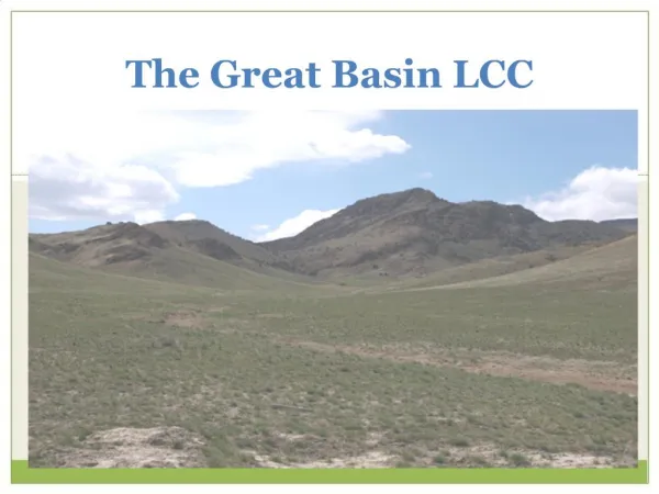
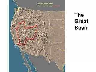
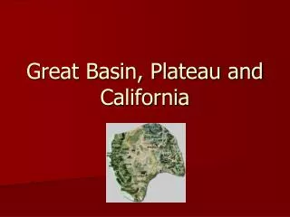
Great Basin. Early Adaptations Culture History Rock Art. The Great Basin. The Great Basin is an archaeological area that is geographically defined by: Most of the states of Nevada and Utah Southern inland California Southern Idaho Southwest Wyoming Southeast Oregon .

E N D
Great Basin Early Adaptations Culture History Rock Art
The Great Basin • The Great Basin is an archaeological area that is geographically defined by: • Most of the states of Nevada and Utah • Southern inland California • Southern Idaho • Southwest Wyoming • Southeast Oregon
The Great Basin Environment • A 400,000 sq mile desert between the Rocky Mountains and the Sierra Nevada with alternating high mountain ranges and deep valley basins. • Altitudinal and topographic variations in the occurrence of effective moisture gave rise to a series of biotically varied microenvironments that the native peoples exploited by ranging among them in a regular annual cycle, except in the most favored areas. • A demanding environment, one of the most rigorous in native North America.
Environment • Lower temperatures, higher rainfall, and denser vegetation in higher elevations. Dramatic fluctuations of precipitation, and thus food resources, from year to year. • Also changes caused by lake level shifts, treeline shifts, dune activity, earthquakes, and volcanoes. • Resource distribution was highly patchy and unpredictable, and surrounded by sparser environments.
Environment, con’d • Most extensive, productive distribution of resources in the foothill zone, with nut pines (e.g., pinon), sagebrush, mountain brush, mesquite beans, screwbean, some acorns, tubers, berries and other fruits, and deer and other game. • Hot and inhospitable deserts below the foothills, but also highly productive lakes and marshes with diverse plants and animals. Forests and meadows at higher elevations with deer, pronghorns, and bighorn sheep.
Human adaptations • Human adaptations to this unpredictable, harsh environment were based on highly flexible and mobile tiroad-spectrum gathering-hunting strategies except in the most favored areas (large lakes and marshes). • Group size, stability, and sedentism varied widely, depending on resource availability and technological adaptation. • While 80% of the sites are in the foothill zone, the densest, most sedentary, and complex populations around the rich lowland marshes, where many of the most famous sites occur (e.g., Danger and Hogup caves in Utah, and Hidden and Lovelock caves in Nevada).
Human adaptations • The same basic material culture inventory persisted for thousands of years: wooden digging stick; manos and metates; chipped stone projectile points, knives, and scrapers; sophisticated baskets, skin bags, cloaks, and fiber sandals; nets, decoys, basket traps. Roasting pits and above ground storage bins. • People managed their environment to increase its productivity (e.g., burning, damming, scattering wild seeds).
The Desert Archaic (c. 7500 BC to modern times in some areas) • Extinction of Ice Age megafauna, increasing aridity and heat, shrinking lakes and marshes, and localization of food resources led to emergence of the Desert Archaic c. 7500 BC in east and c. 5000 BC in west. • Emerge historically as the Numic-speaking Shoshone and Paiute.
Desert Archaic • A major adaptive shift characterized by: • Exploitation ofa far more diverse food base (from a Paleoindian hunting lifeway) and settlement pattern, with semi-permanent winter base camps with storage facilities. • Paleoindian concentration around great lakes (e.g. Great Salt Lake in Utah) gives way to a mobile life-way throughout a wide variety of environmental settings. Year-round hunting and foraging, with a growing focus on plant collecting. • An intensification of these trends after 3000 BC, with pinon nuts becoming a major element of the diet after AD 500. • In western Great Basin human coprolites from Lovelock and other caves used to reconstruct diet. • Bow and arrow, and some pottery, after AD 500.
Danger Cave, Utah • Located above the Great Salt Lake: • ca. 9000 B.C. began to be occupied. • Animals in variety were exploited • Plants (65 species) varied as well • Dry conditions favored preservation of organic artifacts: • Woven artifacts: • Nets, Textiles, Baskets • Wooden artifacts: • Arrows, Haftings, etc. • Effigies — split-wood mountain goat effigies
Excavations conducted at Danger Cave in 2002 http://www.dri.edu/Home/Features/text/prehistoric_plant.htm
Hogup Cave, Utah • Hogup Cave chronology gives a good long sequence (broken up into "units" or levels): • Unit I: • ca. 6400-350 B.C. • Conditions were moist • Unit II: • ca. 300 B.C.-A.D. 400 • Dry conditions • Desert tends to disperse population • Unit III: • ca. A.D. 400-1300 • Fairly moist conditions • This is the time of the florescence of the Fremont Culture (to be discussed momentarily) • Unit IV: • ca. A.D. 1300-1850 • Dry (note, coincidence of this and the "Little Ice Age"[?]) • The ethnic Shoshone occupy the area • With the exception of the Fremont, the archaic life way continues in most areas to the time of the historic Shoshone
Promontory Pegs: Used for traps http://www.nps.gov/gosp/research/prom_peg.htm
Hidden Cave, Nevada http://www.ccmuseum.org/Programs/hiddencave.htm
Lovelock Cave, Nevada Duck decoys http://www.mnsu.edu/emuseum/archaeology/sites/northamerica/lovelock_cave.html
White Dog Cave, Utah “Yeller” ca. 2400 BP Dody Fugate, Assistant Curator, Archaeological Research Collections Museum of Indian Arts and Culture
White Dog Cave, Utah “Spotty” ca. 2400 BP Dody Fugate, Assistant Curator, Archaeological Research Collections Museum of Indian Arts and Culture
Fremont Culture (AD 400-1300) • Sedentary horticultural communities in scattered farmsteads and small villages with some Southwest traits (pithouses, stone architecture, pottery, maize-beans-squash cultivation). • Large internal variation with uncertain origins, ethnic affiliations, and demise (though the demise is associated with the onset of the Little Ice Age. • Primarily in the eastern Great Basin (and the northern Southwest).
Fremont Characteristics include: • Maize-beans-squash cultivation with an important hunting-gathering component, which separates it from Southwest groups like the Anasazi. • Some small-scale ditch irrigation. • Settlements small, usually with only one or a few scattered houses. • Numerous limited activity ("camp") sites probably associated with hunting-gathering. • Pithouses and above ground storage facilities of adobe. • No kivas or community compounds, but some pueblo-like masonry structures adjacent to the Southwest.
Fremont Culture Reconstructed pit house
Fremont Characteristics include: • Pottery similar to that of the Anasazi. Unfired clay figurines. • Manos and trough metates. • Leather moccasins rather than fiber sandals of other Southwest traditions. • Coiled and twined baskets distinctive to this culture. • Horned and shield-bearing warriors in pictographs similar to those in northwest Plains.
Rock Art • Rock art appears in two forms; petroglyphs and pictographs. • Petroglyphs are made by chipping away the darker outside layer ( patina ) of rock with a stone, exposing the lighter natural color beneath. • Pictographs, on the other hand, are painted on the rock face using mineral and plant pigments. • The true meaning or intent of the artists in some rock art is not known, although some sites suggest hunting scenes, religious ceremonies, warfare and combat, fertility, birth, counting or calendars.
Ancestral Puebloan petroglyph, 'Inscription Rock', El Morro National Monument, New Mexico Ancestral Puebloan pictograph, Tlaloc Figure
Cultures, Styles, and Age of Rock Art • Many different cultures represented in Southwestern US rock art sites; however, four groups of peoples are most prevalent (Dates shown are approximate). • Archaic - 5,000 BC to 300 AD • Ancestral Puebloan - 300 AD to 1300 AD • Fremont - 500 AD to 1400 AD • Historic Tribes- 1400 AD to 1875 AD
Early Petroglyphs Pit and Groove Petroglyphs are older than 5000 years. Petroglyphs are dated by the amount of discoloration, “Desert Varnish", which has formed on the etching.
Desert Varnish • Some cliffs look like they've been painted. They have a dark red, brown, or black coating.
Later Petroglyphs (<2000 B.P.)Atlatl Rock, Valley of Fire, Nevada
Pictographs geometric pictograph http://www.petroglyphs.us/photographs_pictographs_mojave_desert_BTW.htm
Sources • http://www.dri.edu/Home/Features/text/prehistoric_plant.htm • http://www.nps.gov/gosp/research/prom_peg.htm • http://www.rockartimages.com/pages/2/index.htm • http://www.mnsu.edu/emuseum/prehistory/northamerica/linked/fremontrockart.html • http://museum.ceu.edu/people.htm • http://fhss.byu.edu/anthro/mopc/pages/Exhibitions/Kachinas/Fremont/fremont_cradle_page.htm • http://www.eduscapes.com/nature/rocvarnsh/index3.htm