Download
1 / 27
270 likes | 452 Vues
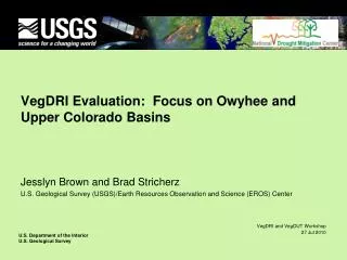
Vegetation Drought Response Index (VegDRI) A New Tool for Monitoring Vegetation Drought Stress at Local to National Scales Brian Wardlow National Drought Mitigation Center (NDMC) University of Nebraska-Lincoln Boise, ID July 27, 2010. VegDRI Project Team. NDMC

E N D
Vegetation Drought Response Index (VegDRI) A New Tool for Monitoring Vegetation Drought Stress at Local to National Scales Brian Wardlow National Drought Mitigation Center (NDMC) University of Nebraska-Lincoln Boise, ID July 27, 2010
VegDRI Project Team • NDMC • Brian Wardlow – remote sensing specialist / geographer • Tsegaye Tadesse – climatologist / data mining • Karin Callahan – remote sensing /GIS specialist • Chris Poulsen – GIS specialist • Eric Hunt – Ph.D. student (climatology and soil moisture) • Sharmistha Swain – Ph.D. student (remote sensing) • USGS • Jesslyn Brown – remote sensing specialist / geographer • Danny Howard – geospatial analyst
What is VegDRI? VegDRI is a new ‘hybrid’ drought index that integrates: - satellite-based observations of vegetation conditions - climate-based drought index data - biophysical characteristics of the environment to produce 1-km spatial resolution maps that depict ‘drought-related vegetation stress’and are regularly updated (currently at 2-week interval) during the growing season.
What is VegDRI? Modified version of the Palmer Drought Severity Index (PDSI) classification scheme.
VegDRI vs. U.S. Drought Monitor U.S. Drought Monitor Idaho– May 18, 2010 VegDRI Idaho – May 17, 2010 Goal of VegDRI Tool:National-level monitoring capabilities with local-scale information (i.e., county to sub-county level) regarding the level of drought stress on vegetation.
VegDRI - An Integrated Approach Climate Component Remote Sensing Component Biophysical Component + +
VegDRI - An Integrated Approach Climate Component Remote Sensing Component Biophysical Component + + • Role: Satellite-based observations provide information on the • spatial distribution and general condition of vegetation. • (+) Spatially detailed information about vegetation across large • geographic areas. • (-) Difficult to discriminate drought impacted areas from locations • under other types of environment stress (flooding, fire, hail, & • pests) or experiencing land use change.
VegDRI - An Integrated Approach Climate Component Remote Sensing Component Biophysical Component + + • Role: Climate-based drought index maps provide a ‘broad-scale’ measure • of dryness that can be used for interpretation of the vegetation stress • recorded in the satellite observations. • - Drought areas typified by below average vegetation conditions • recorded in the satellite data and drier than normal conditions in the climate data.
VegDRI - An Integrated Approach Climate Component Remote Sensing Component Biophysical Component + + Role: Different characteristics of the environment are considered that influence climate-vegetation interactions. - land use/land cover type - irrigation - soil available water capacity - elevation - ecological setting
Regression Tree Model (*) VegDRI Methodology 1. Historical Database Development Satellite Data Data Input Variables 2. Model Development 3. Map Generation 1) Percent Annual Seasonal Greenness (PASG) 2) Start of Season Anomaly (SOSA) Climate Data 1) Palmer Drought Severity Index (PDSI) 2) Standardized Precip. Index (SPI) 1-km VegDRI Map Biophysical Data • 1) land use/ cover type • soil available water • capacity (STATSGO) • ecoregion type • irrigation status • elevation (*) Models developed from a 20-year historical record (1989 – 2008) of bi-weekly climate and satellite observations at 2,200+ weather station locations. Biophysical variables are static over time.
Operational VegDRI Production • Information currently • available for North • Carolina: • - May 2009 to present • Production of a 20-year • historical record of • VegDRI maps in progress. • (1989 – 2008) • Weekly map updates • planned for 2010 in • experimental mode. • Future work to test the • production of a 250-m • resolution VegDRI • product is planned. • (*) Bi-weekly maps currently available.
USGS Drought Monitoring Viewer • Interactive map viewer that enables users to customize • their views of the VegDRI maps: • ‘pan’ and ‘zoom’ options • view VegDRI in relation to • map layers of other • information: • VegDRI • U.S. Drought Monitor • satellite-based vegetation • greenness • precipitation • stream flows http://gisdata.usgs.net/website/Drought_Monitoring/viewer.php
VegDRI Website and Products VegDRI products are available at the VegDRI page within the Monitoring section of the NDMC website. http://www.drought.unl.edu/vegdri/VegDRI_Main.htm
1. VegDRI Quick-View Maps(multiple spatial scales) National-level State-level Sub-state level
1. VegDRI Quick-View Maps (cont).(land cover type) Complete view ‘Forest view’ option for the eastern U.S.? Cropland view Rangeland view
2. VegDRI Area Statistics (% area)(currently available at state-level only) Specific tables available for cropland and rangeland. A forest table option can also be added. Summarize the % area of each VegDRI class for ‘current’ map and all prior dates in the growing season.
4. Change Maps • 3 Types: • Prior period • ex. – July 13, 2009 vs. Sep 27, 2009 • 2)Same period from the prior year • or a specific year in past • (* currently not available) • ex. – July 13, 2009 vs. Sep 13, 2008 • Historical average(* currently not available) • ex. – July 13, 2009 vs. average for July 13 (1989 • through 2008) VegDRI Change Map June 28 to July 12, 2010
5. Animations Goal: Visualize spatial and temporal changes in drought patterns across a specific year or multiple years.
6. VegDRI Map Viewer (in development) • Zoom in & pan across VegDRI maps • Overlay multiple layers of other • information • - county boundaries, rivers, roads, and • other boundaries (resource districts, • section lines) • - historical climate maps • - land cover maps • - U.S. Drought Monitor maps
6. VegDRI Map Viewer (in development) • Overlay • county boundaries • rivers & lakes • urban areas • roads • watersheds • Other Options • pan • zoom • annotate • submit comments • plot The user can customize their view of the VegDRI map and compare the VegDRI information to other historical climate information and drought impacts,.
6. VegDRI Map Viewer (in development) U.S. Drought Monitor VegDRI SPI • Layers of climate and drought information: • 20+ years of historical VegDRI (1989 – present) • Standardized Precipitation Index (SPI) • U.S. Drought Monitor (USDM) • Historical climate data for 3,000+ weather stations locations • Drought impacts from Drought Impact Reporter (DIR) • ‘Interactive’ option to view map comments or submit comments about specific • VegDRI map features.
7. Trend Lines (in development) Plots the average VegDRI values over the growing season for a specific geographic area (e.g., county) and land cover type (e.g., cropland and rangeland). Comparisons of VegDRI could be made between specific years and/or the long-term average condition.
VegDRI Evaluator Network Purpose: Establish a volunteer network of evaluators across the U.S. that provide periodic feedback regarding the accuracy of the VegDRI maps for their ‘local’ area. Goal: Collect ‘baseline’ information about VegDRI’s performance and better understand the index’s current strengths and weaknesses. Types of feedback: 1) qualitative: - visual observations - photos - impacts (e.g., cattle sales & feed surplus/deficits) 2) quantitative: - clip plot data (e.g., biomass) - rainfall measurements & variations - production (e.g., ‘How crop yield/forage production compared to the average.’) • ~150 Evaluators • farmers and ranchers • USDM authors • state climatologists • federal and state agencies • & organizations • (Ex. USDA, NOAA, • agriculture, & natural • resources) • University extension
Who is Using VegDRI? Examples… New Mexico Drought Status Report U.S. Drought Monitor authors National Weather Service Drought Reports - Kansas Arizona Drought Monitor Report
Possible Uses of VegDRI Information • Agricultural Producer Perspectives • Justify sub-county declarations for agricultural losses • (e.g., decreased crop yields and reduced forage). • Gauge agricultural conditions in other states to assist • in operational management decisions. • 3. Additional indicator of ‘fire risk’.
Thank you for your attention. For more information about VegDRI, please visit: http://drought.unl.edu/vegdri/VegDRI_Main.htm or contact Brian Wardlow at the NDMC: bwardlow2@unl.edu