Download
1 / 15
150 likes | 268 Vues
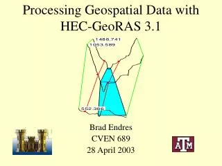
HEC-GEORAS on a small stream in North Branch, Clear Creek. Zhihao Wang Sep 2011. HEC-RAS perform one-dimensional steady and unsteady flow river hydraulics calculations HEC- GeoRAS pre- and/or post-process GIS data and HEC-RAS results for flood inundation mapping using ArcGIS .

E N D
HEC-GEORAS on a small stream in North Branch, Clear Creek Zhihao Wang Sep 2011
HEC-RAS • perform one-dimensional steady and unsteady flow river hydraulics calculations • HEC-GeoRAS • pre- and/or post-process GIS data and HEC-RAS results for flood inundation mapping using ArcGIS
HEC-GeoRAS creates a file of geometric data for import into HEC-RAS, and enables viewing of exported results from RAS. Pre-process Post-process
HEC-GeoRAS requires a DTM (digital terrain model) in the form of TIN or GRID. TIN of part of the North branch, Clear Creek
30mDEM 8mDEM, 23m z tolerance 8mDEM, 1m z tolerance
Create RAS layers: • Stream centerlines, Banks, Flow paths, Cross section cutlines, other optional layers • By creating empty layers and digitize manually Banks Stream centerlines Flow paths
Assign attributes to: • Stream centerlines (names, topology, length) • Flow paths (left/right/center) • Cross section cutlines (river/reach name, bank stations, elevation…)
Extract GIS data HEC-RAS geometric data
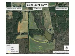
2-year scenario simulation results Conventional tillage No tillage Conservation tillage