Download
1 / 35
360 likes | 474 Vues
Information Governance and Management Strategies in the U.S . Forest Service. Peru Forest Sector Initiative Chuck Dull, Geospatial Information Officer (retired) August 21, 2012. Forest Service Organization. National Headquarters in Washington, DC 9 Regional Offices

E N D
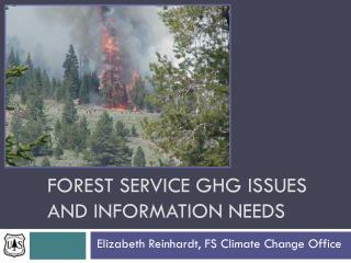
Information Governance and Management Strategies in the U.S. Forest Service Peru Forest Sector Initiative Chuck Dull, Geospatial Information Officer (retired) August 21, 2012
Forest Service Organization • National Headquarters in Washington, DC • 9 Regional Offices • 155 National Forests and 20 Grasslands • 600 Ranger Districts • 195 million acres (78.9 million hectares) • Research • 7 stations • 50 field offices • State and Private Forestry • Fire & Aviation • Forest Health Protection • International Programs
Forest Service – Infrastructure and use Our National Forests – Headwaters of the Nation • 860 million recreation days/yr • 3.4 billion board feet timber sales • 4,400 miles (7,100 k) of wild and scenic rivers • 7,700 miles (12,400 k) of scenic byways • 360,000 miles(580,000 k) of roads • 23,000 recreation sites • $21 billion worth of hunting & fishing to U.S. economy • 60 million Americans drink clean water originating in • Watersheds from National Forests and Grasslands
Geospatial Data Users Forest Service Personnel • Approximately 30,000 employees • Positions include: • Foresters • Soil Scientists • Hydrologists • Fisheries, Wildlife Biologists • Engineers • Research Scientists • Ecologists • Range Specialists • Geologists • Recreation Specialists • Fire Fighters
12°02’36.68” S 77°01’42.37”W Lima Peru Our information is Geospatial… • …because the important resources we manage have a physical location on earth • …and can be mapped
Coordinate and Share Standardized GIS Data • FGDC Clearinghouse Node
What is the Federal Geographic Data Committee (FGDC) and National Spatial Data Infrastructure (NSDI) ………? Established to encourage the collection, processing, archiving, integration, and sharing of geospatial data and information using common standards and interoperable systems and techniques ….. and accessible via the web
Clearinghouse (catalog) Metadata GEOdata Framework Standards Core Components of the NSDI Partnerships
What does the FGDC do……?It builds alliances to: • Address institutional barriers • Identify and develop policy changes • Identify most effective ways to collect, maintain and distribute data • Designate data stewards • Reach consensus on framework
What does the FGDC do……?It builds alliances to: • Encourage metadata creation • Clearinghouse development • Encourage the use common standards and participation in national and international standards committees • Seek new partners • Develop incentives for participants • Etc…….
What is the President’s management agenda? President’s management agenda : …… pathway to a government that delivers results…. Making it … easier, faster, cheaper…. for all levels of government and public to access geospatial data and information
Global Spatial Data Infrastructure (GSDI) Vision………. Foster SDI development locally to globally • Access data at a variety of scales and from multiple sources • Common standards and interoperable systems and techniques • Heavy reliance on partners world-wide
Ingredients for success The FGDC has lived and prospered through 3 different political administrations ……. Why? • Maintained high level policy awareness • Always promotes better governance
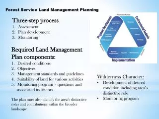
Forest Service Geospatial Services Geospatial services support the mission critical activities of the Forest Service—from day-to-day operations to research, long-term assessments, and planning.
Customers are found at all levels of the Forest Service - from District Offices at remote locations to Washington DC Headquarters.
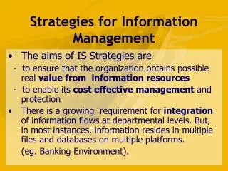
Information in the Organization Every action in an organization is supported by information Usually when we think of information we think of technology We must first think about our organizational behavior around information, and our requirements
Why Do We Have Information? • Why do we acquire, maintain and analyze information in an organization? To Support Decision Making… • Managing information for the most benefit to the organization requires GOVERNANCE
Governance Definition What is Information Governance? The set of rules, processes and people with which decisions about information are made in the organization
Information Governance Is a Set of Questions What decisions need to be made? How will they be made? Who should make those decisions? How will the results of the decisions be measured and monitored?
Good Governance Characteristics Comprehensive view of the whole organization Decisions are made by the right people at the right level of the organization (authority) Decisions are made by those with the needed perspective and expertise (knowledge)
Good Governance Characteristics (cont.) The decision making process is open and understood by those affected People understand how to influence decisions and their role in the process Provides the best use of resources at the time, in line with the goals of the organization There is accountability
The Enterprise Point of View Consider all lines of business, departments, and locations in which the organization operates Common strategy, goals and objectives Manage resources, people, information as assets
Enterprise Information Goals Efficient Standard Current Trusted Secure
Relationships This is a community effort to work toward the future of the geospatial program Implement the vision GMO cannot do this alone…. We need cooperation and active participation from all levels of the agency Grow and sustain relationships with the full Geospatial community & stakeholders
Training Increased emphasis on providing geospatial training to employees through webinars. The intent was to reach more students at less cost……….. Operation of the Geospatial Help Desk
U.S. Forest Service Practices These characteristics apply to all kinds of information, including geospatial The Forest service uses the “Enterprise Data Warehouse” (EDW) to realize these goals Single, secure, authoritative source accessible to the whole organization
Collection and Integration of Data from Numerous Data Sources Transactional System Transactional System A single analysis may require data from many sources. Transactional System Database File System Find the number of acres of weeds, by species, in a specific range allotment - and find a proposed treatment.
The Integration Process Bringing the data together, checking it, and standardizing the format to create a useful dataset is a complex and time-consuming process.
The Next Layer - Services Web Services Web Applications Business Intelligence (dashboards, analytics) ArcGIS ArcServer Other Geo Processing Internal and External Portals (Data.gov) EDW is the Engine
Factors Shaping What We Do, How We Do It, and Why • Resources • Expanding customer base • More diverse • More sophisticated • Higher expectations • Increasing emphasis on enterprise solutions • Serving customers (individuals, units, staffs) while redeeming leadership/stewardship responsibilities • Persistence of silos, stovepipes, and autonomous behaviors • Collaboration • Within the GMO • Within the FS geospatial community • External (FEMA, NASA, US Geological Survey…)
Factors Shaping What We Do, How We Do It, and Why • Emphasis on process discipline and accountability • Development and management of investment portfolios • Use of Project Management principles • Legacy programs • Priority initiatives • Technology—dynamic; increasingly interoperable, pervasive, and powerful • Architectures and standards • Contracted resources & Contract (acquisition) support
Information Governance Conclusions • The reason we have information is to make decisions • To get the most from our information we must have good information governance • Information Governance decisions answer a specific set of questions • These decisions have common factors that allow us to group them into logical sets • Scope • Time Frame • Decision Type • Decision Maker
Benefits Of Good Information Governance • Clear Process • Decisions and rationale are understood • People know their roles • People know how to influence the process • Best use of resources • There is Accountability
Program Coordination Our Goal… • … to better coordinate geospatial activities on an intra-agency and interagency basis…