Download

1 / 42
420 likes | 565 Vues
PISCO fish sampling training program:. 1. Introductions - Individuals, affiliations - Programs: PISCO, CRANE, MBNMS, TNC 2. The PISCO annual survey - purpose / questions - design 3. Fish data collection - counting (estimating density and size) - recording

E N D
PISCO fish sampling training program: • 1.Introductions • - Individuals, affiliations • - Programs: PISCO, CRANE, MBNMS, TNC • 2.The PISCO annual survey • - purpose / questions • - design • 3.Fish data collection • - counting (estimating density and size) • - recording • - sizing • Safety considerations • Fish identifications • Schedule
Introductions -- Participants Teaching Staff Mark Carr Randolph Skrovan Paul Tompkins Amanda Jensen Dave Benet Terry Efird Dave Rivera
Partnership for Interdisciplinary Studies of Coastal Oceans Consortium of 4 research universities: • Oregon State University • UC Santa Cruz • Stanford – Hopkins Marine Station • UC Santa Barbara Funded by: David and Lucile Packard Foundation, Department of Interior, State of California Gordan and Betty Moore Foundation
Objectives of PISCO To initiate and maintain: • A long-term, large scale-ecological study of • patterns and processes • An unprecedented interdisciplinary effort to study coastal reef ecosystems (e.g., ecologists, physical oceanographers, • physiologists, geneticists) • Communication between scientists, managers, policy-makers, and user groups • A novel interdisciplinary training program
Annual Kelp Forest Surveys Purposes (questions) 1. To describe large-scale, long-term patterns of annual and spatial variability of populations, community structure, kelp forest ecosystems; 2. To identify the potential role of variation in: - habitat features (e.g., substrate type, relief) - species interactions - oceanographic conditions (e.g., exposure, El Nino) - human activities (fishing, runoff) in explaining observed spatial and temporal patterns 3. Motivate process-oriented studies
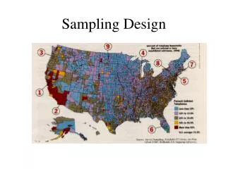
Annual Survey Design When July-October (early=invertebrate and algae; mid-season: benthic and midwater fish; later=canopy fish) Where • Different oceanographic regimes • North and south of Monterey Bay • Carmel Bay • Big Sur coast - Cayucos • Above, below, and at Pt Conception break • Channel Islands • 2. Marine reserves and “paired” comparison sites • Hopkins MLR • Pt Lobos • Big Creek • Channel Islands Marine Reserves
California Current California Pacific Ocean California Counter Current
UCSC Subtidal Monitoring Sites by Year Sampling Began 1999 2000 2001 2002 2003
5 m 10 m 5 m 15 m 12 m 20 m 20 m Approach: Within-site Sampling Design Coastline Fish transect distribution Algae / invertebrate transect distribution
Annual Surveys - Overall Sampling Design 1999 …… 200n Time Site 1 2 3 25 …… 1 2 Area Zone (5, 10, 15, 20m) S MS MD D Transects 3 -- 30x4x2m mid & btm -- 30x2x2m :
Annual Surveys What 1. All identifiable non-cryptic fishes- e.g., rockfishes, surfperches, greenlings 2. Estimate sizes- total length to nearest centimeter 3. Three levels in water column (where canopy present)- bottom- midwater- surface canopy (conducted later in year)
Fish Surveys Phase 1 – mid-water, bottom Diver 2 – runs tape - counts midwater fish - stays just ahead of bottom diver Diver 1 - lays tape - counts bottom fish
Fish Surveys Phase 2 – canopy Diver 2 - Lays tape - Count canopy fish Diver 1 - Estimates canopy Entire transect duration: <20min
Survey Methods and Counting Rules 1. Transect location: depth and distance from shore supercedes outer edge of forest 2. Drop to bottom (together) at pre-determined depth 3. Identify start and direction 4. Secure transect tape to kelp plant or rock 5. Midwater diver begins, stays ahead, and maintains visual contact with btm diver (constrained by depth) 6. Only count ahead, never look back to count behind you 7. Maintain reasonable speed (can bias counts)
Survey Methods and Counting Rules 7. Sequential windows of 2-3 m (use habitat markers) 8. First: count large mobile exposed fishes -- SNAPSHOT 9. Second: search and count unexposed fishes 10. Repeat next window 11. End of transect: - “pop” and rewind transect tape - regroup - random number of kicks to start of next transect 12. High relief -- contour rock and maintain depth 13. Sand -- if headed off reef > 4 m, redirect transect
3m Moving Windows
Moving Windows Look ahead, but not too far ahead
Moving In Bounds Use landmarks to help divide the transect
Stop, Scan, Search Mobile, shoaling species
Stop, Scan, Search Sedentary, solitary, cryptic species
Stop, Scan, Search Structure your counts, develop routine
When do I write all this stuff down? 1.After scan at beginning of bound, record mobile exposed species 2.At end of bound, record unexposed species 3.When you have more than 3 tallies to remember 4.Whenever you need to Golden rule: Never lower your slate!
(3, 8 Number 14 Size (cm) 8, 4)
Data Recording Protocols Data should be placed on data sheets in the following manner: Size of fish should be in centimeters on left side of box not set off by any other marks (parentheses, dashes, quotes, etc.) If a size is by itself within a box anywhere other than on the left hand side of the box, it should be circled for clarity. Number of fish counted should be placed to the right of the size of the fish inside parentheses with numbers separated by commas as follows: 12 (9, 15, 1)
The number 11 will now be denoted with a capital E for any size or frequency. E (9, 15, E) Any two vertical lines that could otherwise be interpreted as the number 11, will be interpreted as hatch marks indicating a quantity of 2 or a size of 2. Size Ranges will be acceptable when the diver feels that he/she is unable to reasonably estimate the actual size of each individual fish (i.e. schools of blues, aggregations of YOY’s). Ranges should be kept within a 5 cm bin (for example 25-30 or 30-35), but if possible, smaller bins should be made.
When denoting Male vs. Female Fish (Kelp Greenling and Sheephead), make symbols clear (♀ and ♂). It is acceptable to use (F and M) for the same purpose, but symbols are preferred. All Black-eyed Gobies should be larger than 8 cm to be recorded on data sheet. All small, cryptic sculpins will NOT be recorded except for juvenile Cabezon Olive and Yellowtail Rockfish are to be grouped in an OYT category. Fish that are unknownshould be classified to the best specific possibilities (such as Jack Smelt and Top Smelt, or White Perch or Silver Perch), or into the nearest taxonomic grouping possible (i.e. cottidae). If neither the specific possibilities, nor a family or genus can be discerned, fish should be recorded as “unknown” with a description for immediate topside investigation. No unknown beyond the above parameters shall be left as such without PI approval.
Sampling methods: Fish divers must use flashlightsAT ALL TIMES to look in cracks, holes, and to help in the identification of YOY’s. Data Sheetsmust be checked by the individual diver AND by one person in charge of collecting data sheets for the day. All information must be filled out including (transect, depth, temperature, surge, etc.)
UPCOAST/DOWNCOAST: A division of the site into two areas, referred to as sides, depending on their relative position along the coast (e.g., Hopkins is downcoast of MacAbee). Zone (5, 10, 15, 20): A division of the side into 4 categories representing onshore (5m)-offshore (20m) stratification or targeted bottom depths (m) for transects. Level (B M): Letter code for the position of the transect in the water column (Bottom or Midwater) Transect (1, 2, 3): A number representing one of the three transects sampled within the same zone. With the heading and zone, this describes the location of each transect relative to all others. Depth: Average actual depth of the transect estimated by the diver. Visibility: The diver estimation of horizontal visibility on each transect. Measured by reeling in the tape and noting the distance at which the end of the tape can first be seen.
Surge: Diver estimation of magnitude of horizontal displacement on each transect, recorded at depth (L)ight - no significant surge (M)oderate - noticeable lateral movement, diver must compensate. (H)igh - significant surge, diver moved out of transect bounds when not holding on Heading: Compass direction of transect along isobath Temp: The temperature on each transect measured by the divers computers. YOY on drift kelp: when YOY rockfish are observed over drift kelp, they are denoted with a circled “D”.
Sizing Fish Underwater 1. Total length 2. Aids to sizing fish 3. Factors that contribute to over- or under-estimation
Total length Target accuracy ± 10% 1. Total length
2. Aids to sizing fish 1.Slate marks 2.Transect tape marks 3.Hand measurements (measure your hand) 4.Bracketing (with habitat features) 5.Comparative approach (with habitat features) 6.Recalibration during dive (check yourself)
3. Factors that contribute to under and overestimation of size Overestimation Underestimation 1.Low light 2.Dull body color 3.Poor visibility 4. Objects in foreground 5.Deep-bodied fish 1.Bright light 2.Bright body color 3.Good visibility 4.Objects in background 5.Elongate fish
Safety Considerations • Dive profiles- approved by DSO- well within no-decompression limits- maximum depth 20m- 3-5 min safety stops mandatory on dives below 10m • Air consumption- safety over data collection (300 – 500 psi minimum) • Buddy system- members of a dive team are always in visual contact • Sea conditions- diving will only be conducted in good conditions • Live boating- fish teams are not usually live-boated
Dive Safety Brief 1.Dive log - sign out and in 2.Dive procedures - ascent rate 10m/min - deep-shallow - maintain dive team 3.Communications: pay phone (lab), cell phone & VHF Ch 16 (Paragon) 4. First Aid & Oxygen - Shore and Paragon 5.Evacuation plan: Lighthouse - left on Forest - Highway 68 - few miles on Pacific Grove, CHOMP
Evaluation 1.Ongoing 2.Some self-evaluation required 3.End of day - submit data sheets 4. Species ID quizzes 5.Feedback