Download
1 / 97
970 likes | 1.14k Vues
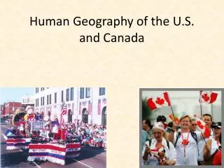
The U.S. and Canada. Toronto, Ontario. Montreal: Confluence of the St. Lawrence/Ottawa Rivers. Ottawa: Canada’s Federal Capital located on the Ottawa River. Canadian Parliament (Legislature). Washington, D.C. The U.S. Federal Capital. The Senate and the House. Chicago, Illinois.

E N D
Ottawa: Canada’s Federal Capitallocated on the Ottawa River.
Washington, D.C.The U.S. Federal Capital.The Senate and the House
St. Louis Gateway ArchAt the confluence of the Mississippiand Missouri rivers.
French Quarter in New Orleans, La. Bourbon St.
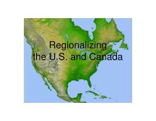
Chapter 5 Physical Geography of The United States & Canada
Rocky Mountains • The other major mountain range in the U.S. & Canada. It extends 3,000 miles from Alaska to New Mexico.
Appalachian Mountains • One of the major mountain ranges in North America. Extends 1,600 miles from Newfoundland, Canada to Alabama
Canadian Shield • Covers 2 million miles in Canada around Hudson Bay
Fall Line • The place where the higher land of the Piedmont drops to the Lower Atlantic Coastal Plain *****(Richmond, VA) is on the Fall Line
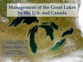
The Great Lakes • Lake Huron, Ontario, Michigan, Erie and Superior. • Found in the northern part of the U.S. and the southern part of Canada
Continental Divide • The line of the highest points in the Rocky Mountains. Marks the difference between rivers that flow east and those that flow west.
Mackenzie River • Canada’s longest river. Flows across the Northwest Territories.
Great Plains • A treeless region in the central portion of the United States
Permafrost • Permanently frozen ground
Everglades • A huge swampland in Florida, that covers 4,000 square miles.
Nomads • People who move from place to place.
Beringia • A land bridge that once connected Siberia and Alaska.
St. Lawrence Seaway • North America’s most important deep water shipping route.
Locks • Sections of waterways with closed gates where water levels are raised and lowered.
New England • A northern subregion of the United States (includes Maine, Vermont, New Hampshire, Massachusetts, Rhode Island, Connecticut)
Midwest (America’s Heartland) • The 12 states in the North-Central United States.
South • The subregion that covers ¼ of the land area of the United States and contains more than 1/3 of it’s population