Download
1 / 15
150 likes | 279 Vues
RECOGNIZING CLOUD FORMATIONS. IDT 7062 By Renee Payne. Tutorial Navigation. The Home button will returns you to the Title page. The Forward arrow button takes your to the Next page. The Back arrow button takes your to the Next page .

E N D
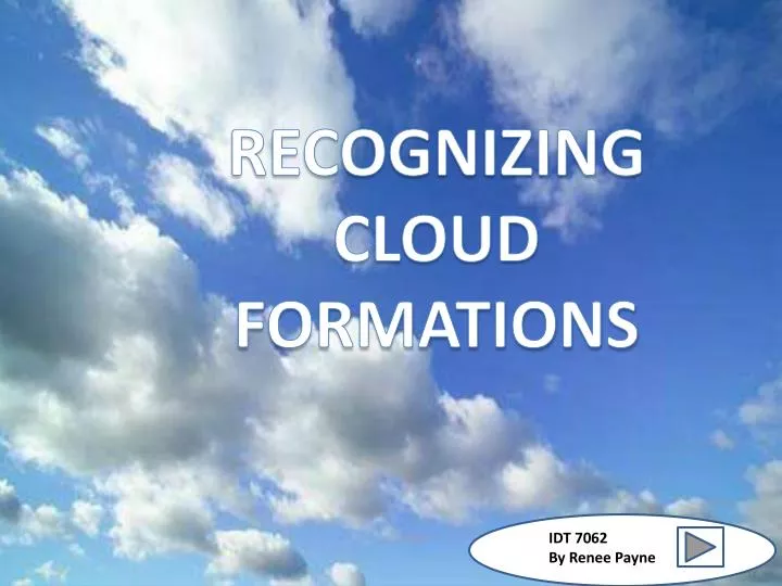
RECOGNIZING CLOUDFORMATIONS IDT 7062 By Renee Payne
Tutorial Navigation The Home button will returns you to the Title page. The Forward arrow button takes your to the Next page. The Back arrow button takes your to the Next page.
CLOUD GAZING?? We do it all the time. We all seem to find a fascination with what we find in the daylight skies. The soft white fluffy clouds across a perfectly blue sky is priceless to a weather watcherand cloud gazer. In this tutorial you will be able to recognize cloud formations anywhere. You will learn what a cloud is and the names of some cloud formations. After this tutorial will be able to familiarize yourself with the material and terms that describe clouds. You will be able to deduce what type of cloud is in the sky to determine or predict the weather.
Overview Clouds tell us so many things about the atmosphere as well as the weather. The inside of a cloud consists of tiny particles of dust and sometimes ice. These particles within the cloud cause clouds to exhibit various formations, thus pre-determining weather conditions . Clouds have important effects on the earth's temperature; they can trap heat in the atmosphere or they can block out the sun's rays. There are several types of clouds and they are based on types that depend on a differentiation of factors. Those factors are size,color, elevation and composition. The names of cloud’s have Latin connotations, and each name falls into four basic cloud categories. Cloud formations and movements can signal weather patterns an predict and forecast the weather. Did you know that the elements that make up a cloud are ice, droplets of water and air? There are four types of cloud groups and they are Cirrus, Stratus, cumulus, and Altos. The variations of these four groups are called Cirrocumulus, Cirrostratus, Altocumulus, Altostratus, Stratocumulus, Cumulonimbus.
Cirrus Clouds Cirrus clouds are considered to be wispy clouds. They are found above 20,000 feet. These long, wispy clouds are made entirely of ice crystals. Species of cirrus clouds include the hair-like cirrus fibrates;. The cirrus uncinus, clouds that look like a comma or a hook because of wind shear; cirrus spissatus, clouds thick enough to hide the sun; cirrus castellanus, which displays elements like the turrets on a castle; and cirrus floccus, a cloud with little tuft associated with virga, precipitation that dissipates before it can reach the ground.
Cirrocumulus Cirrocumulus clouds belong to the High Cloud group (5000-13000m). They are small rounded puffs that usually appear in long rows. Cirrocumulus are usually white, but sometimes appear gray. Cirrocumulus clouds are the same size or smaller than the width of your littlest finger when you hold up your hand at arm's length. If these clouds cover a lot of the sky, it is called a “Mackerel sky" because the sky looks like the scales of a fish. Cirrocumulus are usually seen in the winter time and indicate fair, but cold weather.
Cirrostratus Cirrostratus clouds belong to the High Cloud (5000-13000m) group. They are sheet like thin clouds that usually cover the entire sky. The sun or moon can shine through cirrostratus clouds . Sometimes, the sun or moon will appear to have a halo around it when in the presence of cirrostratus. The ice crystals from the cloud refracts the light from the sun or moon, creating a halo. This halo is the width of your hand when you hold it out at arm's length. Cirrostratus clouds usually come 12-24 hours before a rain or snow storm. This is especially true if Middle group clouds are associated with it.
Stratus Clouds Stratus clouds are dark and gray in appearance and produce rain or snow. gray clouds that hang below 6,500 feet and may accompany precipitation. Stratus clouds have a resemblance to fog and can cover the entire sky. A type of stratus cloud is the nimbostratus. This cloud indicates a wet weather front.
Stratocumulus Clouds Stratocumulus clouds also lie low but display the puffiness of cumulus clouds. Stratocumulus species are stratiformis, lenticularis and castellanus. Nimbostratus clouds are thick, ominous, dark clouds that produce rain or snow. Only light precipitation, generally in the form of drizzle, occurs with stratocumulus clouds. To distinguish between a stratocumulus and an altocumulus cloud, point your hand toward the cloud. If the cloud is about the size of your fist, then it is stratocumulus. Low Clouds The low cloud group consists of Stratus, Stratocumulus, and Nimbostratus clouds. Low clouds consist of water droplets. The base of a low cloud is from the ground surface to 2000m.
Altos Clouds Alto clouds are middle-level altitude clouds that can range anywhere from 6,500 to 20,000 feet up in the sky. One type of alto cloud is the altocumulus. If you spot one of these clouds it would appear to be spotted on a warm and humid summer morning,. These clouds typically tend to presage late afternoon thunderstorms..
Altocumulus Clouds Altocumulus clouds are white or gray in color and composed of water droplets. These clouds can appear in the shape of puffy masses, flattened layers or parallel bands or waves across the sky. Altocumulus clouds are part of the Middle Cloud group (2000-7000m up). They are grayish-white with one part of the cloud darker than the other. Altocumulus clouds usually form in groups and are about 1 km thick. If you see altocumulus clouds on a warm humid morning, then expect thunderstorms by late afternoon.
Altostratus Clouds An altostratus cloud usually covers the whole sky and has a gray or blue-gray appearance. The sun or moon may shine through an altostratus cloud, but will appear watery or fuzzy. The altostratus. Altostratus clouds are gray or blue-gray in color and tend to appear ahead of rainy weather. Altostratus cloud usually forms ahead of storms with continuous rain or snow. Occasionally, rain will fall from an altostratus cloud. If the rain hits the ground, then the cloud becomes classified as a nimbostratus cloud.
Cumulus Clouds Cumulus clouds appear as "heaps" of detached, puffy white clouds in the sky. These clouds can develop vertically and form domes or mountains of clouds. The tops of the clouds have rounded towers and the bottoms of the clouds are flat and can hover 330 feet above the ground.
Cumulonimbus Cumulonimbus clouds belong to the Clouds with Vertical Growth group. They are generally known as thunderstorm clouds. A cumulonimbus cloud can grow up to 10km high. At this height, high winds will flatten the top of the cloud out into an anvil-like shape. Cumulonimbus clouds are associated with heavy rain, snow, hail, lightning, and tornadoes. A type of cumulus cloud is the cumulonimbus. Cumulonimbus clouds can reach high altitudes of over 39,000 feet and indicate very stormy weather. These clouds can produce threatening storms of lightning, thunder or tornadoes.
References • http://img.ehowcdn.com/article-new/ehow/images/a04/fm/k0/clouds-800x800.jpg • http://thumbs.dreamstime.com/thumb160_47/11424672419G4E2Z.jpg • http://www.ehow.com/info_8376825_description-different-types-clouds.html#ixzz2Z5lYGvf5 • http://www.ehow.com/info_8191780_9-different-types-clouds.html#ixzz2Z5kZWBug • http://www.ehow.com/info_8376825_description-different-types-clouds.html#ixzz2Z5mPXnWJ • http://img.ehowcdn.com/article-new/ehow/images/a08/7f/tk/kind-weather-do-stratocumulus-clouds-800x800.jpg • http://i.ehow.com/images/a06/kk/bg/three-different-types-clouds-3.1-800x800.jpg • http://i.ehow.com/images/a06/kk/bg/three-different-types-clouds-4.1-800x800.jpg • http://www.ehow.com/info_8191780_9-different-types-clouds.html#ixzz2Z5vbXWP2 • http://www.ehow.com/info_8376825_description-different-types-clouds.html#ixzz2Z5mA8isG • http://cloudappreciationsociety.org/wp-content/uploads/2008/11/20081111194253_halo%20cloud.jpg • http://cloudappreciationsociety.org/wp-content/uploads/2008/11/20081111194253_halo%20cloud.jpg • http://cloudappreciationsociety.org/wp-content/uploads/2007/10/20071011190216_nuvole%20133s.jpg • http://www.windows2universe.org/earth/Atmosphere/images/cumulonimbus3_small.jpg • http://www.windows2universe.org/earth/Atmosphere/front.html