Download
1 / 3
50 likes | 228 Vues
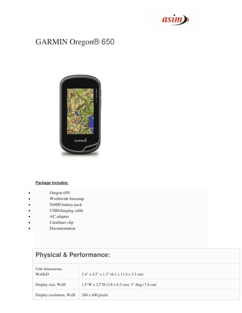
With high-sensitivity GPS and GLONASS satellite tracking, worldwide basemap with shaded relief and customizable buttons for 1-touch image capture and waypoint marking, Garmin Oregon 650 opens a new world of GPS mapping and positioning.<br>For More Information visit : http://www.asimcommunication.com/garmin-oregon-650/

E N D
GARMIN Oregon® 650 Package Includes: • • • • • • • Oregon 650 Worldwide basemap NiMH battery pack USB/charging cable AC adapter Carabiner clip Documentation Physical & Performance: Unit dimensions, WxHxD 2.4" x 4.5" x 1.3" (6.1 x 11.4 x 3.3 cm) Display size, WxH 1.5"W x 2.5"H (3.8 x 6.3 cm); 3" diag (7.6 cm) Display resolution, WxH 240 x 400 pixels
Display type transflective color TFT touchscreen Weight 7.4 oz (209.8 g) with batteries rechargeable NiMH pack (included) or 2 AA batteries (not included); NiMH or Lithium recommended Battery Battery life 16 hours Waterproof Yes (IPX7) Floats No High-sensitivity receiver Yes Interface high-speed USB and NMEA 0183 compatible Maps & Memory: Basemap Yes Preloaded maps no Ability to add maps Yes Built-in memory 3.5 GB Accepts data cards microSD™ card (not included) Waypoints/favorites/locations 4000 Routes 200 Track log 10,000 points, 200 saved tracks Features & Benefits: Automatic routing (turn by turn routing on roads) Yes (with optional mapping for detailed roads) Electronic compass Yes (tilt-compensated 3-axis) Touchscreen Yes Barometric altimeter Yes Camera yes (8 megapixel with autofocus; digital zoom) Geocaching-friendly Yes (Paperless) Custom maps compatible Yes Photo navigation (navigate to geotagged photos) Yes Hunt/fish calendar Yes Sun and moon information Yes
Tide tables productTemplate.tab.specs.picklist.yes_with_optional_bluechart Area calculation Yes Custom POIs (ability to add additional points of interest) Yes Unit-to-unit transfer (shares data wirelessly with similar units) Yes (plus images and custom maps) Picture viewer Yes Garmin Connect™ (online community where you analyze, categorize and share data) Yes Address: 306, Agarwal Arcade, Plot No. 6, Sector 12, Aashirwad Chowk, Dwarka, New Delhi-110075 Ph:011-28034223/24