Download
1 / 50
520 likes | 713 Vues
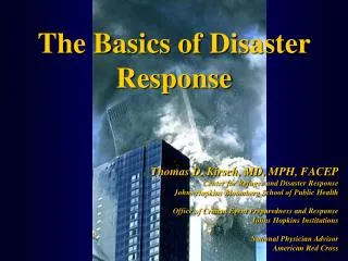
Hurricane Preparedness & Response Office of Homeland Security & Emergency Preparedness City of New Orleans, Louisiana. NOHSEP: An Overview. Office of Homeland Security & Emergency Preparedness Umbrella public safety agency in CNO/Orleans Parish

E N D
Hurricane Preparedness & Response Office of Homeland Security & Emergency PreparednessCity of New Orleans, Louisiana
NOHSEP: An Overview • Office of Homeland Security & Emergency Preparedness • Umbrella public safety agency in CNO/Orleans Parish • Municipal EMA responsible for the protection of life and property
2014 Season: An Overview • June 1 – November 30 • Peak for Gulf region is August/September • NHC and institutional researchers have predicted a less active season with below average numbers of named and major storms • Still, history shows us that these predictions do not always hold true…
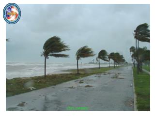
Be Prepared! • Make a disaster/contingency plan for yourself your family and your business should a tropical storm threaten our area • If you must evacuate, where? • Stay informed • Build a disaster kit • If a mandatory evacuation is called, act early!
Key Steps To Preparedness Assess risks to your critical operational functions. Back-up your data & ensure remote access. Advise your supply chain of actions taken. Activate crisis communication plan & Test It. Re-supply emergency kits. Establish contact with your insurance provider. Consider the need for alternate locations. Ensure Employees are Personally Prepared. **Note – Steps above do not constitute a complete plan.A full Disaster Recovery Business/Continuity Strategyis required for maximum resilience.
Preparing Your Supply Chain Supply Chain: the external vendors and suppliers you rely on todeliver your everyday services and products to members/customers. • Talk to your key vendors and suppliers about their recovery plans. • Ask yourself has it been tested? • Develop relationships with alternate vendors. • Eliminate single points of failure. • Educate your clients about the importance of preparedness. • Insure what can’t be protected. • Ensure your crisis scenario doesn’t have supply chain holes • Keep partners just as informed as your employees during recovery
Activating Your Crisis Communications Plan • Develop a process to make sure all stakeholders (internal and external) are aware of decisions and expectations. • Ensure redundancies independent of cell or terrestrial networks as much as possible • Ensure Phone List is UP-TO-DATE (with alternate phone #’s) • Utilize multiple cellphone network carriers if possible • Establish phone tree • Password protected web page (centralized emergency status) • Social Media strategy & usage • E-mail alert (have primary & secondary email addresses) • Call-in recording system • Text/Data Alert system – Ensure everyone familiar with system • Manage customer and key vendor communications. • Prepare a media communications plan. • Test the plan regularly and in the days prior to a “notice event”
Reviewing Your Insurance Coverage • Business Interruption/Resumption Insurance – Coverage to help in rebuilding your company in the event of a business interruption • Added/Extra Expense Insurance – Insurance to cover unexpected added costs in the event of an interruption or unexpected event. • Make certain you are insured for all potential risks. • Know the different types of coverage and limits. • Consider business interruption insurance and added expense insurance. • Keep photos of your building, equipment lists and policy information stored in a safe and secure offsite location. • Maintain an up-to-date Asset management program. • MOST losses following hurricanes are due to flooding.Most general policies do not cover flooding. Ensure you fully understand your coverage and any exposure to risk. • Don’t Wait until the Storm is Imminent. Do this Today.
Re-Supply Emergency Kits • Recovery plan • Important records • Insurance policies • Fixed asset inventory • Contracts • Operating system install disks • Licensing keys/Passwords • Letterhead • Office Supplies • Cash • Flashlight • Battery powered radio • Batteries • Food & Water for those working the recovery
Preparing Employees • Do they have a plan? • Evacuation/Shelter plan • Critical Document Storage • Emergency Alert System • Emergency/Go Kit • How can your organization help? • Workshops • Checklists • Emergency Kits • Family InvolvementDays
Disaster Supply Kit • Water • At least one gallon, preferably three, per person per day for drinking, sanitation and hygiene purposes • Food • Non-perishable, easy-to-store foods • Basic utensils including manual can opener
Your Disaster Plan • Your personal disaster plan should have the following components: • Evacuation plan • Communication plan • Friends and family • Co-workers and employer • Pet plan • Re-entry plan
Your Plan: Evacuating • Where will you go? • Friends, family, hotel/motel • Shelters (leave this as a last option) • How will you get there? • Plan your route and have an alternate • Remember, contra-flow is activated during evacuation! • Do you have reliable transportation? • Who will go with you? • Will you be able to achieve this logistically – fuel, food, etc.?
Preparing Financially • Protect your property • Conduct a household inventory • Buy Insurance • Keep cash with you (ATMs and credit cards may not always work in the aftermath of a storm)
Introduction of the 5-day Graphical Tropical Weather Outlook
“Cone of Uncertainty”Gets Smaller Every Year Current Cone 2003 Cone
Local NWS Offices TC Impact Graphics TC Coastal Flooding Impact Graphic • Storm surge impacts segmented into impact levels depending on amount of inundation • Gives a much richer, detailed view of impacts versus text products • Coastal flooding impacts defined locally and available on website next to coastal flooding potential impact graphic • http://weather.gov/tcig Hurricane Isaac – 4AM Tue Aug 28, 2012
Local NWS Offices TC Impact Graphics Wind Impact Graphic example from Hurricane Isaac These impact graphics are created by coastal offices only and will NOT accurately indicate threat beyond coastal office forecast areas
Major Update of SLOSH Basin 1) Levee Updates 2) Resolution Improvement 3) Most complex and highest resolution basin in the country 4) Large and slow moving storms now included (with 2mph motion MEOW available because of Isaac) 5) Coming May 2014
Probability Storm Surge (p-surge) • Storm surge probabilities based on NHC official advisory • Available roughly 48 hours prior to arrival of TS winds • Accounts for meteorological uncertainty in: • Track • Size • Forward speed • Intensity • Uncertainties based on historical errors • Version 2.0 (2014) also accounts for the tide and is above ground level
June 1, 2014 – November 30, 2014 • In New Orleans, we deal with 2 scenarios: • Category 2 or lower • Category 3 or higher • This serves as a benchmark trigger point from which many decisions are made • Category 3 or higher likely calls for mandatory City evacuation • Category 2 or lower likely calls for Sheltering in Place • But, there might be a situation with a strong Category 2 storm that would initiate the City evacuation process • All evacuations are ultimately the decision of the Mayor
HURRICANE ISSAC • Shift by Louisiana from activating plans based solely on the Safir-Simpson scale: • e.g., Contraflow for only Cat 3 or above • “All-Hazards” approach based upon forecasting by National Weather Service • Forecast modeling • Track guidance • Intensity guidance • Rainfall forecast • Marine forecast • Storm surge estimates • Wind estimates
HURRICANE ISSAC • Slow-moving Cat 1 • Tuesday, August 28: 30 WSW of Venice, NW @ 13 MPH • Wednesday, August 29: Landfall @ Lower Terrebonne/Lafourche, NW @ 6 MPH • Thursday, August 30: Downgraded to a Tropical Storm • Remained Tropical Storm into Southern Arkansas • Remained Remnant Low into Illinois and Indiana • Rainfall and storm surge posed significant risks for citizens in Louisiana and Mississippi • Tangipahoa River • Pearl River
Plans: Category 1-2 (Optional Evacuation) • People can choose to evacuate even without us advising to do so • Those remaining should be self-sustaining for at least 72hrs • Citizens should always prepare for loss of power and/or water for extended periods • We advise them to have: • Medicines, non-perishable foods, and water as well as alternate ways to keep them cold and/or heat them • One gallon of water per person per day • Flashlights, battery operated radios (and batteries), manual can opener, first aid kits with hand sanitizer, pet food, etc. (ready.nola.gov) • Citizens should “batten down the hatches” and secure any items in your yard or on the porch that could be impacted by high winds • Public safety agencies will shelter in place • Emergency response possibly delayed if wind speed is excessive
Plans: Category 3+(Mandatory Evacuation) • CAEP: Evacuspots will serve as collection points. One bag per person/have personal records such as birth certificate, insurance, homeowners, etc/medicines/plan to bring some cash just in case. 25k-30k persons in conjunction with DHH and DCFS to partner shelters. Will bring them back in re-entry phase. • Self-evac (Leave EARLY – PRIOR to contraflow): • Gas up tank/have family plan to ensure everyone knows what to do/know multiple routes to pre-determined evac point (having multiple locations is also advised should situation force you elsewhere)/know contraflow/bring food & water/personal records/medicines/cash in case ATMs are not online • Don’t forget the pets! • Those who choose NOT to leave: • Assume all risk for you and your family • Must understand there will be a time at which you will be on your own – self-supporting – without assistance. • 1st responders will NOT be able to service your call for help until it is safe for them to go out as well. Will be at pre-assigned hardened locations. • Curfew will also be in effect and if found away from your property, you will be subject to arrest – period.
2014 New Orleans City Assisted Evacuation Timeline Launch CAE; Dispatch buses and security First Responders to Task Force ALRs Begin MSY runs for Visitors & Tourists State buses with last evacuees leave city TSA/USDOT lean forward with packages RTA begins pickups at 17 locations TS Winds Reach Coastal LA RTA ends pickups at 17 locations Regional Information fusion CTR activated EXECUTE CAEP PHASE DOWN CAEP 6 24 36 30 12 50 48 40 84 60 58 54 0 72 Make Ready NOPD, LSP, LANG, OPSO lean forward w/ security/staging areas established MSY Shuts Down State Phase 3: Evacuation of areas north/east of the Mississippi River and south of Interstate 12; State implements Contraflow; Mayor orders Mandatory Evacuation State Phase 1: Evacuation of areas outside of any levee protection system RTA, MSY, NOMCVB, SPCA, and others activating hurricane plans ~12 hrs prior to hurricane landfall State Phase 2: Evacuation of areas north of Intracoastal Canal & south/west of Interstate 10 and Mississippi River State/Feds lean forward with Evacuation buses Note: This is only to be used as a guideline. It is thought to be a reasonable timeline; however, there may be more or less time available depending on the circumstances of the actual event.
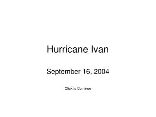
SITUATION • 2 million people at risk in Southeast Louisiana • 1.2 million in New Orleans Metro area alone • Very limited number of evacuation routes from population sources • More vulnerable areas need to evacuate first • Hurricane Ivan evacuation in 2004 proved that evacuations need to be managed: • “Gentlemen start your engines!” is not a viable solution
PHASED EVACUATION(hours prior to onset of Tropical Storm Winds) • PHASE I - (50 hours) Area south of Intracoastal Waterway, outside of levee protection system, vulnerable to Cat 1 or 2, no route restrictions
PHASED EVACUATION(hours prior to onset of Tropical Storm Winds) • PHASE II - (40 hours) Area south of the Mississippi River, levee protected, vulnerable to Cat 2 or higher, suggested routes but no restrictions
KEY CONTRAFLOW POINTS • Congestion during an evacuation is inevitable • Contraflow does not solve congestion, but makes better use of existing infrastructure • The public needs to be educated and informed on plans and given realistic expectations • The H-30 mark initiates Phase III where Contraflow can be implemented
How do we get the message out? • NOHSEP utilizes several methods, or platforms, to disseminate critical information during emergencies: • NOLA Ready Emergency Alert System (EAS) • NOLA Ready Website • NOLA Ready Materials • NOLA Ready Social Media (Facebook and Twitter) • Press Conferences/Outreach Events
NOLA Ready Social Media • It has become increasingly apparent that social media is now an official source of information • Not only for messages going out, but messages coming in • CEOC now processes social media inputs as official intelligence • During tropical weather: flooding, trees down, traffic lights out, etc. • Threats
The Value of Community Partnerships • A significant portion of our public relations is targeted towards vulnerable populations • We utilize community partnerships with faith-based, non-profit and similar organizations to reach the maximum number of citizens • Religious organizations • Non-profits such as ARC • Homeless service providers • Hotel security group • Council members
311 & NOLA Ready • Know anyone that might need assistance? • Neighbor, friend at church, elderly friend of a grandparent or parent, etc • Register for the CAE via 311 or ready.nola.gov • 311 will help find the closest Pick-up Point to your address • Medical needs/transportation needs will be addressed as part of this process – Special Needs Registry managed by the Health Department • Prepare NOW (update profiles year-round) • Sign-up for NOLA Ready to receive emergency alerts via text and/or email • Effectively manage your account online. 20 different alert categories by location, type and other useful groups including reverse 911 • Don’t forget to check your text plan with your provider
After the Storm • Pay attention to local authorities • If mandatory evacuation was called, an “all-clear” will be announced once it is safe to enter the city • Apply for tiered re-entry placards if you must come back before the general population (critical businesses etc.) • Reentry.nola.gov • Always carry ID once you’re back in town • Bring food and water back with you because local stores may not be up and running yet • Do a full check of your home and property for damage and other hazards
Re-Entry (only during mandatory evac) • Phased • Businesses be sure to register for placards early • Based on safety and services needed to reconstitute • Curfew • In place for everyone that is in City post-storm • General guidance • If found anywhere other than placard-based business, subject to arrest – period.
Re-Entry (Only for Mandatory Evacuation) • Phased • Businesses be sure to register for placards early- before a storm is in the Gulf • Based on safety and services needed to reconstitute • Over 5,000 placards or renewal stickers issued this year to businesses (hospitals, banks, critical services) • Curfew will be in place for everyone that is in City post-storm • If found anywhere other than placard-based business, subject to arrest – period.
Louisiana Business EOC • The Louisiana Business Emergency Operations Center (LA BEOC) enhances participation by businesses and non-profit organizations in disaster management efforts through the development and deployment of public-private partnerships for the benefit of the State of Louisiana. • The LA BEOC is a joint partnership between: • Louisiana Economic Development (LED) • Governor's Office of Homeland Security and Emergency Preparedness (GOHSEP) • National Incident Management Systems & Advanced Technologies (NIMSAT) Institute at the University of Louisiana at Lafayette • Stephenson Disaster Management Institute (SDMI) at Louisiana State University • More Information and Registration is at www.labeoc.org
Stay Informed! • Visit http://www.nola.ready.gov • Register for NOLA Ready EAS • Request outreach events • Request preparedness literature • Facebook: http://www.facebook.com/nohsep • Twitter: @nolaready • State: http://www.getagameplan.org/
Be Prepared! • Smartphone Apps • Red Cross(Hurricane, First Aid, Tornado), The Weather Channel, WWL Radio, Alert FM, National Weather Service, WDSU Hurricane Central, US Army Survival Manual, Boy Scout Handbook, Bible • Business Preparedness • www.readyrating.org • www.labeoc.org • www.ready.gov/business • www.disastersafety.org
Eric Pickering kepickering@nola.gov 504-658-8700 (office) New Orleans Office of Homeland Security & Emergency Preparedness 1300 Perdido Street, Suite 9W03New Orleans, LA 70112 ready.nola.gov @nolaready facebook.com/nohsep