Download
1 / 26
260 likes | 261 Vues
Beyond Spectral and Spatial data: Exploring other domains of information: 4. GEOG3010 Remote Sensing and Image Processing Lewis RSU. Domains of Information. spectral angular multi-temporal distance-resolved spatial. Distance-resolved.

E N D
Beyond Spectral and Spatial data:Exploring other domains of information: 4 GEOG3010 Remote Sensing and Image Processing Lewis RSU
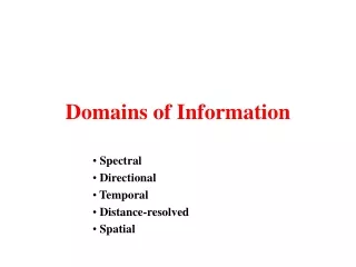
Domains of Information • spectral • angular • multi-temporal • distance-resolved • spatial
Distance-resolved • Can determine distance from satellites: • based on time-delay of signal
Distance-resolved • Can determine distance from satellites: • based on time-delay of signal
Distance-resolved • eg GPS
Distance-resolved • EO example: • radar interferometry
¾ way through half cycle 1 cycle (5.6 cm for C band) Distance-resolved • EO example: • radar interferometry: • assume know satellite position (¾+1)x180 = 315 degrees ¾ way through 270 degrees 2 x d1 = (N1+¾)x5.6 (360 degrees, 2 radians)
Distance-resolved • EO example: • radar interferometry: 2 x (d2 - d1) = (N2- N1) x 5.6 + (¾-0) x 5.6 0 way through 2 x d2 = (N2) x 5.6
Distance-resolved • EO example: • position 1: • 2 x (d2 - d1) = (N2- N1) x 5.6 + (¾-0) x 5.6 • position 2: • point on ground next to current point will have different phase change • if its within the same cycle (height change less than 5.6cm) • can tell relative height change between these points • very precise (mm)
Shuttle Radar Topography Mission 11 Feb 2000 (Endeavour) - 11 days 30m DEM of +/- 60 degrees latitude
Distance-resolved Measure small change - subsidence
Distance-resolved Measure small change - earthquake
Distance-resolved RADAR RAdio Detection And Ranging LIDAR LIght Detection And Ranging
Distance-resolved LIDAR • Send laser pulse from sensor • measure round trip time • = 2x distance • use NIR mostly • atmospheric effects minimised
Distance-resolved LIDAR • Examples - EA • fly aiborne LIDAR regularly for high resolution DEM • use first/last return • ground height / tree height
Distance-resolved LIDAR • Examples - VCL • Vegetation Canopy LIDAR • NASA mission to fly ???? • waveform LIDAR
Distance-resolved VCL • waveform LIDAR
Distance-resolved • waveform LIDAR
LIDAR • ‘Simple’ form of measurement • easy to use (? Simply) • doesn’t work (well) on high slopes • requires highly-sensitive instrumentation • potentials for new forms of information • waveform LIDAR
Interferometry • Used for number of years • operational (SRTM) • different ‘scales’ for different SAR frequencies • doesn’t work well (for height) if change between images • wind in forests • doesn’t work on high slopes