Download

1 / 18

E N D
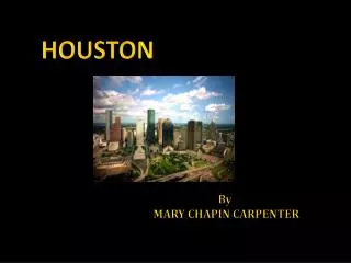
Houston, Texas is the largest city in the state of Texas and fourth largest in the nation. The city was founded in 1836 and has grown steadily since that time. The city currently has a population of 2.14 million within its city limits and nearly four million in the metropolitan area. The city itself has grown , now encompassing 579 square miles with a population density of 3,371.1 people per square mile. The median household income is $36,616. Since its inception the city has had a very close relationship with the system of bayous that drain rainwater. In the coming years the city of Houston’s inhabitants will have to make very important decisions about how the city will respond to its water. HoustonOverview
HoustonDrainage • The main route of water from the city is from the bayous, to channels, and then out to the Gulf of Mexico • Upon its founding the city was placed on a grid aligned with the existing bayous and not the points of the compass. • First experienced major flooding in 1843 • Houston ship channel built by the Corps of Engineers, brought a great deal of shipping to the Houston. • The largest bayou in the city is the Brays Bayou, encompassing 128 sq. miles • Nearly 700,000 people live in this area
HoustonImportant Landmarks • These areas contain some of the most important areas of the city: • Texas Medical Center • Houston Zoo • Houston Baptist University • Rice University • Major development around the Loop 610 and U.S. 59 Interchange
HoustonDrainage Current drainage schemes address problems as they arise. The current policies do very little to address the long term problems, the typical process is dealing with problems after they have boiled over. • Bayous exist as an alternative to ground absorption • Development of land creates more impervious surfaces that funnel rainfall to collection points more quickly than is natural. • This leads to flooding when water collects at a relief point and builds up, eventually flooding the surrounding areas. • Short, intense periods of rain are more likely to cause flooding because they are more likely to overwhelm the carrying capacity of an area.
HoustonWater • Drainage issues were merged into one organization to deal with drainage issues as a whole for the good of all areas of the city. • 1937- Harris County Flood Control District was established. • Bayous concrete lined based on the belief that this will control flooding. • 1973- Restrictions put in place to restrict development of the flood plain • 1980- “no downstream impact policy” all upstream development must return water to the system at the same rate that it did before development. This led to an increase of large holding areas for excess water. • The current plans for the system will require miles of additional drainage canals and nearly a billion dollars of investment to shore up the system.
HoustonQuestions • How population density and development relate when placed over drainage areas • How does this look in section? • Analyze in section the height and density of the built environment (are most areas roads, high rises, single family housing?) • Are there any specific groupings of development or pop. density around major water drainage? • Should we focus on the edges of development around major water drainage or the larger areas in the collection areas
HoustonWater • Active…. Can architecture act as a funnel to aid draining directly around these major drainage areas? Is the current built environment laid out in such a way that this can be accomplished reasonably? • Passive…. Should architecture focus on density and landscaping to aid percolation?
HoustonBibliography • Information: • Census Bureau Quick facts: http://quickfacts.census.gov/qfd/states/48/4835000.htm • http://www.buffalobayou.org/history.htmll • http://fas2.rice.edu/documents/Flood_History_Final.pdf • Maps: • http://www.cohcdp.swmp.org/Website/ProView/viewer.htm • http://www.gims.houstontx.gov/viewer1.htm • http://www.ersys.com/usa/48/4835000/density.htm • Images: • Google images: • http://www.ask.com/pictures?qsrc=167&o=10584&l=dis&q=houston • http://www.ask.com/pictures?l=dis&o=10584&q=houston%20drainage&qsrc=168