Download
1 / 19
210 likes | 378 Vues
INTERNATIONAL SYMPOSIUM ON BIOMASS ASSESSMENT METHODS 15 April 2010, DG RESEARCH – Brussels, Belgium. BIORAISE: A GIS tool for biomass resources assessment in Southern Europe. Luis Saúl Esteban Pascual CEDER-CIEMAT SPAIN luis.esteban@ciemat.es. WHAT IS BIORAISE?.

E N D
INTERNATIONAL SYMPOSIUM ON BIOMASS ASSESSMENT METHODS 15 April 2010, DG RESEARCH – Brussels, Belgium • BIORAISE: A GIS tool for biomass resources assessment in Southern Europe Luis Saúl Esteban Pascual CEDER-CIEMAT SPAIN luis.esteban@ciemat.es
WHAT IS BIORAISE? • BIORAISE is a web tool with GIS functionalities developed to answer the following questions: • How much biomass can be raised around a point? • What are the collection costs of such biomass? • What are the transport costs to a central point? • BIORAISE was launched in October 2009
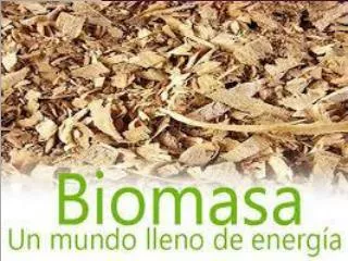
ORIGIN AND EXTENT The assessment methodology of BIORAISE was developed for the UE FP6 project CHRISGAS” (www.chrisgas.com). In the current version, the subject resources of BIORAISE are the residual agricultural and forestry biomass covering five EU countries (continental area): Spain, Portugal, France, Italy and Greece.
GIS • GENERAL METHODOLOGY Basic data bases: Corine Land Cover (georeferenced) Eurostat: crop statistics (NUT 2) Potential resourcesrestrictionsavailable resources Spain and Southern EU (Ciemat) Central and Northern EU (Växjö University) Logistics: Definition of Harvesting methods Transport methods Specific data bases: National forests maps and surveys National statistics Biomass yields Other coverages: Administrative boundaries, road networks, terrain models, soil erosion, organic carbon, etc Biomass costs at plant door Mapping biomass resources. Availability Costs (collection, transport)
RESTRICTIONS IN FORESTRY Slope from the World SRTM90 digital elevation data: a World digital elevation model of 90 m pixel (CGIAR-CSI, 2005) Erosion risk from the PSERA Map ( Pan-European Soil Erosion Risk Assessment (Kirkby et al, 2004) Organic carbon content in soils from The Map of Organic Carbon in topsoils in Europe (Jones et al, 2004)
Corine LandCover • Coverage and database integration
Corine LandCover Crops-forest (Nut2) • Coverage and database integration
Corine LandCover Crops-forest (Nut2) NEIGHBOURHOOD ANALYSIS • Coverage and database integration
HARVESTING AND TRANSPORT COSTS • Three Categories considered: • Herbaceous crop residues • Woody crop residues • Forestry residues
http://www.ceder.es http://bioraise.ciemat.es/
GENERAL NUMBERS IN 12 COUNTRIES POTENTIAL RESOURCES: 365Million odt/yr, 265 Million o.d. t/yr agricultural field residues 99 Million odt/yr forest residues AVAILABLE RESOURCES(after the application of restrictions): 205 Million odt/yr 156 Million odt/yr agricultural 49 Million odt/yr Forest COUNTRIES WITH HIGHEST AVAILABILITY: France: 58 Million odt/yr, Germany: 47 Million odt/yr
GENERAL NUMBERS IN 12 COUNTRIES Estimate of Forest and Agricultural Residues in Northern, Central and Southern Europe (Modt/yr)
What should be the potential biofuel production if available resources were used? 12 countries: 205 Modt/yr 66 Mt DME (3,1 biomass dry matter= 1 kg DME) 45 Mt diesel equivalent to 45 Mtoe (0,68 kg DME = 1 kg diesel) 17% of the final energy consumption in transport sector in 12 analysed countries (265 Mtoe in 2007 in 12 countries; 70% of EU27) (377 Mtoe in EU27)
IMPROVEMENTS FOR THE NEXT VERSION UPDATING The land use map, forest data, agricultural productions etc NEW FUNCTIONS Data extraction by NUT NEW BIOMASS RESOURCES Energy crops Shrubs Agro-industial production points