Download
1 / 40
400 likes | 556 Vues
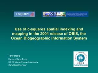
Metadata concepts, issues and experiences – lessons from 8 years of metadata management at CMR - for CSE Metadata Workshop, Canberra, May 2005. Tony Rees Divisional Data Centre CSIRO Marine Research, Australia (Tony.Rees@csiro.au). Overview. Some definitions / concepts

E N D
Metadata concepts, issues and experiences – lessons from 8 years of metadata management at CMR - for CSE Metadata Workshop, Canberra, May 2005 Tony Rees Divisional Data Centre CSIRO Marine Research, Australia (Tony.Rees@csiro.au)
Overview • Some definitions / concepts • Who are the clients for metadata? (what is our target audience) • How do people find metadata? (discovery / search mechanisms) • The national metadata infrastructure context (ASDD etc.) • Search methods – free text vs. structured searches, and the CMR (MarLIN) approach • What metadata to collect? • Space and time “footprints” in metadata records (storage and search implications) • How do we populate the system... • Selected implementation aspects (when actually building a system).
Metadata is … • Structured, summary information regarding a dataset or similar resource • Conforms to some standard – e.g. ANZLIC (for our region), ISO 19115, can have agency-specific extensions • Provides both descriptions of resources (cataloguing / documentation function) and potentially, previews of / access point to the data • Definition of “Dataset” – in the eye of the beholder – a logical set of data sharing common attributes e.g. data type, collection method, survey / expt ... – size of data “chunks” (granularity of the metadata) determined by agency practices and preferences • Probably good to distinguish dataset-level metadata from item level descriptions (keep in separate, tailored systems).
Some example metadata systems … • GCMD (NASA)
Some example metadata systems (cont’d)… • NERC Metadata Gateway (UK)
Some example metadata systems (cont’d) … • Australian Spatial Data Directory (another gateway)
Some example metadata systems (cont’d) … • MarLIN (CMR metadata system)
What are we trying to do here? • Describe our data holdings – to the inside and outside world • Bring together relevant dataset documentation (or pointers to it) in a single, www-accessible location • Provide a good (i.e.: tailored) set of search tools which suit our data holdings and “target” users • Facilitate access to our data – on a self serve basis (where possible) ** • Connect our entered information to the wider world for “discovery” purposes, e.g. to metadata gateways and internet search engines • Re-use metadata as a “building block” in broader Divisional systems (capture once, use many times) ** (** = value adding)
Who are the clients for our metadata? (hopefully not...)
Who are the clients for our metadata? (hopefully yes...)
Who are the clients for our metadata? • CSIRO researchers and their internal / external collaborators (e.g. for data discovery) • Divisional management • External parties – schools, public, scientific community, policy makers, consultants • Ourselves– if an extensive data custodian (use for internal cataloguing / data access purposes) • Recipients of CSIRO data – can supply metadata along with data products (also, may be a project deliverable) • Future users (v. important) – “corporate memory”
How do people find metadata? • Agency-level systems (own access points) • Metadata gateways – e.g. ASDD (Australian Spatial Data Directory) for Australia, NERC metadata gateway for UK • Future one-CSIRO system (??) • Internet search engines e.g. Google (if mechanism for crawling is enabled) • Standalone metadata files (e.g. supplied with data). NB: all have their place, e.g. agency-level systems may support richer or better targeted search facilities than those available via gateways.
Australian Spatial Data Directory – national cross-agency metadata gateway ASDD future agency system CMR DEH BoM GA etc. EDD MarLIN GA data BoM data DEH data CMR data etc. National Metadata Infrastructure metadata systems describe / point to ... • search via ASDD – search across multiple agencies, basic functionality • search via MarLIN – search only CMR holdings, but extra functionality (also view “CMR internal” records not visible to external users)
Limitations of text-based searching... • Basically a “hit and miss” method – no “browse” capability, or method to broaden / focus the search • Relies on searcher and metadata creator using same words for same concepts (does not happen in practice, with free text entry across multiple systems) • ... e.g. “whales” vs. “cetaceans” vs. “marine mammals” vs. species scientific names (multiple wordings covering potentially the same concept) • Also, converse applies – one word, multiple uses, e.g. shark (fish), shark cat (type of boat), Shark Bay (place)... • Variant spellings also a problem (e.g. sea lion vs. sea-lion vs. sealion; fishery vs. fisheries; organization vs. organisation; Mt. vs. Mount... • Typographical errors may render document invisible to a free text search (can be at either end, e.g. searcher or stored data).
cf – Advantages of picklists (“controlled vocabularies”)... • Steers users to use “one concept, one descriptor” approach; no spelling variants / errors • Can organise thematically / hierarchically, i.e. “shark” under zoology, “Shark Bay” under localities... (less confusion); also can have explicit relationships (broader / narrower, related categories, etc.) • Supports structured information retrieval and browsing • Good prompt for terms that the searcher (or content creator) may not otherwise think to enter • Amenable to global updates (hold list item ID’s in the record, actual values in a look-up table, change in one place only) • Can be access point to more extensive stored additional information (e.g. via project, voyage, organisation, publication ID) – content creator picks a value from the list, system automatically adds the rest Main difficulties: getting agreement on list content; anticipating all user needs; loss of flexibility / fine detail of expression (i.e., still a need for free text as optional supplement). Also, list maintenance is an overhead.
e.g. MarLIN approach... (example: search by taxonomic group)
(etc.) NB: (1) this method (in principle) maximises both “recall” (getting records that you do want) and “precision” (not getting records that you don’t want) (2) fewer “0 records returned” messages (user cannot search on terms not actually used)
What metadata to collect? – 1 • Core ANZLIC fields – title, abstract, space and time ranges, data quality, data contact point, ANZLIC search words... (c. 40 fields)
What metadata to collect? – 2 • Other fields of value to the agency – e.g... • project codes + associated info. • more specialised keywords or search terms • controlled defined regions list • links - data documentation, graphics links, data access • stored data volume, stored data location • references, contributors, acknowledgements (e.g. funding) ... • Some of the above correspond to elements in the ISO standard (c. 400 fields), some will be new • Tension between simple metadata set (few elements, but easy to collect) and more extensive dataset information (more effort to collect, but increased future value and / or structured search options).
CMR Metadata search page (portion) ... in order to be useful for structured searches, relevant information must be captured at metadata entry time, in a consistent way (e.g. via picklists and supporting tables).
Also need to consider space, time “footprints”, i.e. how to support these at search time Example for a CMR dataset (“Lira” catch dataset from 1973):
Dataset time range (as start, end dates) Search time range (as start, end dates) overlap = “hit” overlap = “hit” Dataset bounding box (as start, end lat & lon) Search bounding box (as start, end lat & lon) Storage of relevant Temporal and Spatial search info: (default) Machine-readable temporal search: • Tend to not worry about temporal patchiness (maybe just add text comment in “completeness” field) Machine-readable spatial search: • Spatial patchiness (or irregular polygon shapes) can be a more serious problem – CMR solution on next slide
Spatial footprints – improved method CMR has implemented a grid squares-based system for improved spatial “footprint” representation and querying (without requirement for a full GIS back end): Dataset spatial extent – stored as list of squares intersected Search by grid square (or set of squares) in list = “hit” not in list = “miss” • We use 0.5° x 0.5° squares – same resolution as 1:100 000 mapsheet series (approx. 50 x 50 km) • Global “c-squares” notation covers marine as well as land areas.
Related functionality on Museum Victoria “Bioinformatics” site(search interface shown): • Searcher can use this approach to define a non-rectangular region of interest (green highlighted cells) (NB, this uses a different [non global] notation for the cells, however the basic principle is the same)
Result for the relevant “Lira” CMR metadata record... • Red squares (as square IDs) are what is actually stored, can then be superimposed on any user-selected base map for display purposes • Now will not get “false positives” – e.g. from searching at Alice Springs
Remainder is “standard” metadata (ANZLIC + CMR extensions), e.g... (etc.)
How do we populate the system (get people to describe their data)? • Non-trivial problem • Education – value of metadata, responsibility of data custodians to describe their data in designated system/s • Prescriptive approach – build into project planning, sign-off, APA’s • Facilitation – dedicated personnel assist scientists, knock on doors • Making records on researchers’ behalf – resource intensive, also not ideal since person making the metadata does not have the best understanding of the data • Incrementally – e.g. as data is migrated into corporate systems, require the metadata to go with it (robust linkage) – NB, will probably always be “data islands” that this approach misses.
How far have we got...? • Currently there are some 2,100 records in the MarLIN system (etc.)
How far have we got...? – cont’d • 90-95% of “Data Centre” holdings described – after 8 yr process! (<1000 records, mostly ships’ data, by voyage and data type) • a few “data islands” have made concerted attempts to describe their data (e.g. 10-20+ records each) • some major data acquisition exercises have generated 50-100+ records, mostly for third party data (generally not visible on extranet) – e.g. where metadata is a specified project deliverable along with the data (good!) • remainder is pretty patchy (maybe 10% compliance) – hope to kickstart with project-based “skeleton records”, also more rigid directives / follow up from Divisional management.
What information model to use? Ideal world (probably unattainable): Library pubs. list Projects database Metadata system Persons database Item-level catalogues Ancillary information Stored data ... all information would be entered / maintained in one place only; updates would propagate automatically through the system; all resources would be electronic and seamlessly accessible
Best we can do for now... plus some other tables (not shown) for voyages, organisations, keywords... MarLIN “projects” table MarLIN “references” table? (or text descriptions) Metadata system – main “datasets” table MarLIN “persons” table MarLIN “doc” links (URLs) in table (also text descriptions) MarLIN “data” links (URLs) in table (also text descriptions) MarLIN “doc” + “graphic” links (URLs) in table (also text descriptions) Item-level catalogues Stored data Ancillary information digital + non-digital digital + non-digital digital + non-digital
Functionality / Processes to be supported (... list probably incomplete!) • User interfaces – create, edit, search metadata records • Administrator functions – user identities and privileges, “super-user”-level record modification, deletion, list maintenance • Moderator function – approve / edit content to be published • Security / authentication – who can access “internal” records (e.g. by specified IP domains or other mechanism) • Access logging – including what search terms used, how many “hits”, etc. (plus applications to review user log and access stats) • Application maintenance, tech. support, user training • Automated connections to remote systems, plus on-demand import / export features (e.g. via XML) • Ongoing development / modification to functionality or database structure – process, resources...
Metadata integration / remote calls (examples) • Project work space (HTML page)
Metadata integration / remote calls (examples) • Custom MarLIN search via web call (from different database)
Metadata integration / remote calls (examples) • Re-use of MarLIN supporting tables content (in other contexts)
Concluding remarks • Simple in theory, not so simple in practice, to design and implement a good system (especially in a research, rather than basic “products set” environment) – no “off the shelf” solution (or even key components) available • Designing a system gives the opportunity to incorporate new / improved concepts (scope for innovation, design challenges) • Should be benefits in sharing code, approaches, experiences across Divisions or other groups • Populating the system is as important as building it! • Connection to external gateways is not too hard, once system plus some publishable content exists • CMR is a lonely trailblazer within CSIRO .. still considered an example of “best practice” (a bit of a worry, seeing how far we still have to go)...
Thanks! • To visit MarLIN: go to www.marine.csiro.au >> Data Centre (www.marine.csiro.au/datacentre/) >> MarLIN (www.marine.csiro.au/marlin/) • MarLIN “Edit” interface – currently requires access privileges to visit (will look at online in tomorrow’s session).