Download
1 / 17
170 likes | 514 Vues
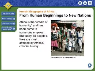
Geography, GIS and all that…. Dr Nigel Trodd GIS & Earth observation by remote sensing Coventry University. Overview. What is GIS? Geography & GIS / GIS & Geography what impact, if any, has GIS had? Who, if anyone, has benefited?. What is GIS?. What is Geography ?

E N D
Geography, GIS and all that… Dr Nigel Trodd GIS & Earth observation by remote sensing Coventry University
Overview What is GIS? Geography & GIS / GIS & Geography what impact, if any, has GIS had? Who, if anyone, has benefited?
What is GIS? • What is Geography? • What is Geographical Information? • “`Geographic information' is information which can be related to specific locations on the Earth. It covers an enormous range, including the distribution of natural resources, descriptions of infrastructure, patterns of land use and the health, wealth, employment, housing and voting habits of people. ... • Much human activity depends on the effective handling of such information - its collection, processing, storage and retrieval - but it is the ability Geographical Information Systems to integrate these functions and to deal with the locational character of geographic information that makes them such potential powerful tools'' (Chorley Report 1987: p.1).
What is GIS? Well designed GIS have the capability of providing: • quick and easy access to large volumes of data; • the ability to select detail by area or theme, to link or merge one data set with another, to analyze spatial characteristics of data.
What is GIS? • Geographical Information Systems ? • Geographical Information Science ? • Geographical Information Services ? …does it matter?
Geography and GIS • Market size • Worldwide: • > 280 brands, • > 370 products (GIS World 1993) • Europe: Euro 1.6 billion • GB: OS data add £100 million in value to GB PLC (OXERA 1996) • >140,000 organisations use GIS
Geography and GIS • Physical Geography: 6.4 M • Human Geography: 7.6 M • Geographical information systems: 8.5 M Web presence Geography: 22.7 M GIS: 16.5 M
Impact of GIS on Geography • "GIS has, of course, has a profound impact on geography as an academic discipline; one might say that it has encouraged the modernization of geography and the development of a coherent set of geographical techniques for the analysis and visualization of spatially-distributed phenomena" (Newby 1993). Newby, H., 1993. Geographical Information Systems: an ESRC perspective. In Mather, P. (ed.), Geographical Information Handling -Research and Applications, Chichester: John Wiley and Sons, 17-18.
Impact of GIS on Geography GIS are ``... as significant to spatial analysis as the inventions of the microscope and telescope were to science, the computer to economics, and the printing press to information dissemination. It is the biggest step forward in the handling of geographic information since the invention of the map'‘ (HMSO 1987: p.8).
Impact of GIS on Geography+ • "Its major effect has been to modernize UK geography in particular and the social sciences in general" (Newby 1993). • "GIS has made a tremendous impact in many fields of application, because it allows the manipulation and analysis of individual `layers' of spatial data, and it provides the tools for analyzing and modelling the inter-relationships between layers" (Bonham-Carter 1994).
Impact of GIS on Geography • "It is perhaps fair to say that we have to this point spent a large amount of time `reinventing the wheel', that is, getting methods that are already operational running in a GIS environment" (Rogerson & Fotheringham 1994). • "The notion of GIS as a science is unacceptable to those who maintain that GIS is, in and of itself, an intellectually sterile, theory- neutral, but powerful tool; or who feel strongly that Geography itself should be the science behind GIS" (Kennedy 1994, reported in Wright et al. 1994).
Has GIS benefited Geography? • "GIS should be seen as a tool that can assist in the development of geographic theory through facilitating empirical research" (Rogerson & Fotheringham 1994). Rogerson, P., & Fotheringham, S., 1994. GIS and spatial analysis: Introduction and overview. In Fotheringham, S., & Rogerson, P., (eds.), Spatial Analysis and GIS, London: Taylor and Francis, 281p.
Has Geography benefited GIS? BUT • Geographers tend to be poorly equipped with the necessary quantitative, analytical and information technology skills. "There is a view, held by perhaps a minority, which considers that GIS must be forcibly removed from the geographical community in order that it might develop more vigorously and be used more widely in the social, economic and environmental sciences" (Mather 1993). BUT • Computer scientists, with a few exceptions, have been slow to participate and rare to lead…
Is Geography good for GIS? • "Unfortunately, in disciplines like GIS, academic programmes cannot hope to compete with the significant development teams of highly qualified staff and the sophisticated development tools that even medium-sized companies have” (Jackson 1993).
Will GIS benefit you? • Encourages applied use of Information Technology • Emphasis on teaching people to think analytically • Opportunities: • Exposure to GIS an an information technology and its role in society • Use of GIS as an instructional tool to support existing learning and research objectives • GIS as a major focus of study or an integral part of an analysis-oriented project.
Bibliography Goodchild MF (1992) Geographical Information Science, IJGIS, 6, 31-45. Goodchild MF (1995) GIS and Geographic Research. In Pickles J (ed.) Ground Truth. The social implications of GIS. New York: Guilford. Heywood I (1997) Chorley - 10 years on. London: AGI. HMSO (1987) Handling Geographic Information: Report of the Committee of Enquiry chaired by Lord Chorley, London: HMSO. Longley PA et al. (eds.) (1999) Geographical information systems: principles, techniques, management and applications. New York: John Wiley. Mather P (ed.) (1993) Geographical Information Handling -Research and Applications, Chichester: John Wiley and Sons. Rhind D (1993) Maps, information & Geography: a new relationship, Geography, 78, 150-159. Taylor PJ & Johnson RJ (1995) GIS and Geography. In Pickles J (ed.) Ground Truth. The social implications of GIS. New York: Guilford. Wright D, Goodchild M & Proctor JD (1997) Demystifying the persistent ambiguity of GIS as “tool” versus “science”, AAAG, 87, 346-362. (http://dusk.geo.orst.edu/annals.html)