Download
1 / 26
260 likes | 403 Vues
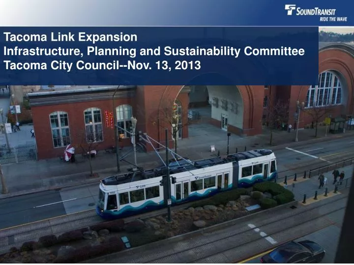
Tacoma Link Expansion Infrastructure, Planning and Sustainability Committee Tacoma City Council--Nov. 13, 2013. Timeline. May, 2013: ST Board selected E1 Corridor serving Stadium and MLK districts

E N D
Tacoma Link Expansion Infrastructure, Planning and Sustainability CommitteeTacoma City Council--Nov. 13, 2013
Timeline • May, 2013: ST Board selected E1 Corridor serving Stadium and MLK districts • ST and City staff worked together to identify specific route alignments, and conduct preliminary evaluation of alignments • Current: Public review of alignments and preliminary evaluation • Upcoming: ST Board, with City Council input, will determine which potential alignments should be advanced for more detailed evaluation through the environmental process 2
Project Goals • Improve mobility and transportation access for Tacoma • Increase transit ridership • Serve underserved neighborhoods • Spur economic development • Environmentally sensitive, sustainable project • Be competitive for federal funding 3
Expansion Design Standards • Expansion will be to Tacoma Link vehicle standards • Central Link light rail (from Seattle and the Airport) will require a transfer to go downtown/Stadium/Hilltop 4
Transfer Alignments • 30% Reduction in ridership • Passengers perceive penalty due to inconvenience • Adds 5 to 10 minutes to travel time • Conclusion: Transfer Alignments do not meet purpose and need of project 6
Evaluation Criteria For each route considered, we asked these questions. Would this route: 7
Community & Environmental Impacts-Differentiating Criteria Impact categories: • Property acquisitions, potential displacements • Parks and community facilities • Parking • Transportation • Utilities • Construction • Consistency with land use plans • Natural resources • Historic resources • Visual • Environmental justice • Noise Receptors 8
Community Facilities • Broadway Design option A2a and St. Helens A3 and A3a impact Theater Square and may interrupt community events, i.e., Broadway Farmer’s Market • All other alignments would have no direct impacts 9
Transportation – Bicycle Operations Reviewed designated bicycle facilities in Mobility Master Plan: Segment A: • Potential conflicts along Broadway, St. Helens between 7th and 9th and N 1st between Stadium and Tacoma Ave. Segment B: • Potential conflict along J street (B2 MLK/J Couplet) 11
Utilities • A1 Stadium Way fewer utility conflicts than other alignments due to recent reconstruction • All other alignments have potential impacts to sewer, storm drain, telecommunications, water, and electrical utilities 12
Construction • A2 Broadway would involve construction of a retaining wall and potential impacts to streets and streetscape • A2a Broadway Design Option and A3 St. Helens options would involve construction of a retaining wall, a reconstructed plaza, and potential impacts to the streets and streetscape • A3 St. Helens would also involve widening of the street between 7th St and 9th St • Stadium, Broadway, and a portion of St. Helens have recent street improvements. 13
Markets and Major Destinations Served • Transit market is considered 5 minute walk distance from potential station locations • Actual station locations to be determined in next phase • Potential station locations shown where grades 2% or less 14
Economic Development Potential Transit-Oriented Development “Transit oriented development (TOD) generally refers to higher-density development, with pedestrian priority, located within easy walking distance of a major public transit station or stop(s)” (Transit Cooperative Research Program) “Typically, a TOD project has the following characteristics: planning boundaries within a quarter- to a half-mile radius of a transit facility (a comfortable walking distance)” (Puget Sound Regional Council) 19
Economic Development Potential Methodology: Identified potentially redevelopableparcels within the walk distances (“underutilized” parcels--ratio of current building value to land value less than 150%) • Acres • Percentage of parcels 20
Cost • Work with the City and the community to identify a project that is the right fit for Tacoma. • ST’s cost estimates during the Alternatives Analysis (AA) phase were high-level estimates based on generalized unit costs from other projects • AA cost estimates were used to compare corridors • Currently, developing cost estimates based on 5% engineering and specific street alignments. However, no survey or field work has been performed yet. 22
Cost estimates for three of the alignments & Cost Savings Options • The project is at 5% engineering and the cost estimates will continue to be refined. • Depending on the alignment, the budget and revenue assumptions may need to be revisited. B2 Couplet adds $5M All above are rounded to nearest $5 million. YOE$ assuming midpoint of construction in year 2019. All design options impact ridership, 20 minute headways have the most impact on ridership. Single Track would reduce the planned 10-minute headways to 12-15 minutes. 24
Involving the Community Sound Transit is looking to involve the community through: • Neighborhood council and business district briefings • Stakeholder Roundtable discussions • Online survey • Website • Mailings, print and online ads • Community Open House Jan. 9, 4-7 p.m. at Stadium High School, Auxiliary Gym 25