Download
1 / 42
430 likes | 680 Vues
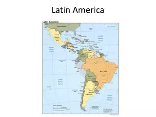
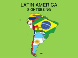
Latin America. Mexico Belize Guatemala El Salvador Honduras Nicaragua Costa Rica Panama Colombia Venezuela Guyana Suriname Ecuador Peru St. Kitts and Nevis St. Lucia St. Vincent and the Grenadines. Bolivia Brazil Paraguay Argentina Chile Uruguay Cuba Haiti

E N D
Mexico Belize Guatemala El Salvador Honduras Nicaragua Costa Rica Panama Colombia Venezuela Guyana Suriname Ecuador Peru St. Kitts and Nevis St. Lucia St. Vincent and the Grenadines Bolivia Brazil Paraguay Argentina Chile Uruguay Cuba Haiti Dominican Republic Jamaica Antigua and Barbuda Bahamas Barbados Dominica Grenada Trinidad and Tobago Countries of Latin America
UNDERGROUND RIVER SYSTEMS - CENTRAL AMERICA MAYAN UNDERWORLD
LLANO Cerrado PAMPAS
Geographic Characteristics • Tierra del Fuego – southern most point of Latin America • 7,000 miles long • Thousands of rivers • Galapagos Islands (part of Ecuador) Machu Picchu – Ancient Incan civilization in Peru.
Highlands • Andes Mountains – mountain range that runs through the western part of North, Central and South America. • The Andes are the: 2nd highest mountain range in the world. • The Andes extend approximately 5,000 miles in length. • Guiana Highlands – located in NE South America (mostly in Venezuela) • Brazilian Highlands – located along east coast of Brazil
Sierra Madres Sierra Madre Oriental Sierra Madre Occidental Sierra Madre Del Sur
Andes Mountains INCAS TERRACE FARMING
Pico da Neblina – highest peak in Brazil, standing at 9,882 feet. Brazilian Highlands
Plains Regions • Llanos– Grassy, treeless areas used for livestock and farming which is located in : Colombia and Venezuela • Cerrado– Plains that are great for farming located in the interior of the continent. Mainly found in Brazil. It is very undeveloped. • Pampas – Areas of grassland and rich soil found in: Argentina and Uruguay. LLANO Cerrado PAMPAS The gaucho culture originated here.
Rivers • Orinoco River – Flows about 1,500 miles, mainly through Venezuela in the north of South America. Drains the interior lands making homelands for the few Native American peoples remaining. • Amazon River – Flows about 4,000 miles west to east, emptying into the Atlantic Ocean. It is fed by over 1,000 tributaries, and has the largest discharge rate in the world • Paraná River – Flows about 3,000 miles south and west through Paraguay and Argentina, then turns eastward.
Orinoco River 1,500 miles Amazon River 4,000 miles ParanaRiver3,000 miles
Islands of Latin America • Greater Antilles – larger islands of the Caribbean. Cuba, Jamaica, Hispaniola (Haiti & Dominican Republic), and Puerto Rico • Lesser Antilles – smaller islands in the region located southeast of Puerto Rico • Bahamas – hundreds of islands off the southern tip of Florida and north of Cuba • All of the islands listed above are known collectively as the West Indies • Discovered by Christopher Columbus in the 1490’s
Bahamas Greater Antilles + Lesser Antilles
Natural Resources • Gold, silver, iron, copper, bauxite, tin, lead, nickel are all abundant in Latin America. • South America is among the world’s leaders in the mining of raw materials. • Oil, coal, natural gas, uranium and hydroelectric power are all plentiful in Latin America as well. • Venezuela and Mexico have major oil reserves. • Brazil is rich in hydroelectric power due to the number of rivers and waterfalls. • Trinidad has vast reserves of natural gas
Climate and Vegetation Varied climate with numerous climate regions: • Tropical Wet – Rain forests are dense forests made up of different species of trees. They form their own ecosystem. The largest forest is the Amazon rain forest. Rain forests can contain more than 2,500 varieties of trees…including the Brazil Nut Tree…which grows up to 150 feet high. • Tropical Wet and Dry – Primarily in South America…support savannas. Found in Brazil, Colombia and Argentina (Grasslands / Plains) • Semiarid– Generally dry, with a little rain. Found in Mexico, Brazil, Uruguay and Argentina • Desert– Northern Mexico and the coasts of Peru. • Atacama Desert – northern Chile • Patagonia – southern Argentina Brazil Nut Tree
Rainforests • More than half of the rainforest is located in Brazil • At the end of the : 20th century - (1900s) Nearly 50 million acres of rain forest worldwide was destroyed.
Climate Zones • Mid-Latitude Climate Zones • Humid Subtropical - rainy winters and hot, humid summers. Paraguay, Uruguay, southern Brazil, southern Bolivia and northern Argentina. Varied vegetation. • Mediterranean – hot, dry summers and cool, moist winters. Part of Chile along the west coast. Mainly chaparral vegetation. • Marine West Coast – cool, rainy winters, and mild, rainy summers. Southern Chile and Argentina have this climate. Forest vegetation.
Human-Environment Interaction • Slash-and-Burn – Technique of clearing fields for use by cutting down trees, and burning the land for use as farming or livestock. • Terraced Farming – Ancient technique of growing crops on hillsides or mountain slopes.
Urbanization People are steadily moving towards the cities to improve their lives. • Push factors – poor medical care, poor education, low-paying jobs, ownership of land by a few rich people • Pull factors – higher-paying jobs, better schools, better medical care • Several cities in South America rank among the world’s largest in population, and they are rapidly growing. • (2) Mexico City – 18,131,000 • (4) São Paulo - 17,711,000 • (10) Buenos Aires – 12,431,000 • (19) Rio de Janeiro – 10,556,000 • (26) Lima – 7,443,000 • (30) Bogotá - 6,834,000 • (42) Santiago – 5,261,000
Rio de Janeiro Major problems arise in these Latin American cities such as: Mexico City • High levels of air pollution • Shortage of drinkable water • Poor infrastructure
Tourism • Millions of people each year visit Latin American resorts. • Luxurious cruise ships anchor in the Caribbean. • Resorts offer many activities for locals to have job opportunities. • Gaps in rich tourists and local poor • Countries incur debt by building resorts/airports/harbors