Download

1 / 43
430 likes | 563 Vues
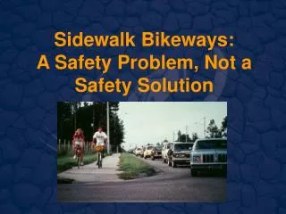
Urban bikeways. The bicyclist. Advanced or experienced riders Basic adult riders Children and inexperienced riders. Advanced or experienced riders

E N D
The bicyclist • Advanced or experienced riders • Basic adult riders • Children and inexperienced riders Advanced or experienced riders that use a bicycle in the same way they would a motor vehicle. These riders prefer the street, using the most direct route available. They prefer and need ample shoulder room on the existing street system, choosing the road rather than a separated path.
Basic adult riders may also use their bicycles for transportation purposes, but would rather avoid more heavily traveled or higher speed roads unless there is a designated (striped) bicycle lane. Basic riders will utilize shared-use paths and on-street routes through residential neighborhoods. Children and inexperienced riders typically do not travel as fast or as far, but do benefit from direct access between schools, convenience stores, parks, and their homes. Children will usually ride on neighborhoods streets that connect to separate, shareduse paths. Crossing busy streets is not encouraged unless accompanied by a parent.
Bicycle facilities • Shared roadway (no bikeway designation) • Signed shared roadway. • On-street, signed bicycle lanes • Separated, multiuse paths.
Shared roadway (no bikeway designation) Bicyclists will use these types of streets if there is enough room—usually about 14 ft. (4.27 m) wide paved travel ways in each direction—if there is a relatively low volume of traffic, or if there is no other choice. These routes generally are not signed for bicycle use as a way to discourage a non-experienced rider from using them until they gain enough experience to feel confident about handling unexpected conditions.
Signed shared roadway. This type is a signed route with the sign indicating that the road is generally suitable for advanced and basic adult riders.
On-street, signed bicycle lanes. This type of facility allocates a dedicated portion of the road surface for bicycle use by striping and signing an approximately 5-ft. (1.5 m) path between the curb and vehicular travel lane in both directions
Separated, multiuse paths. This type of facility is a dedicated hard and graded surface used by all forms of nonmotorized travel. In some cases separate travel lanes are dedicated for a pedestrian to use to minimize conflicts. The minimum width for a Multiuse Pathway as recommended by the 1999 AASHTO Guide is 10 ft. (3.05 m)
IMPROVING BICYCLING CONDITONS IN URBAN AREAS • Provision of safe and convenient bicycle travel in an urban area usually requires the construction of bicycle facilities. • Most of the time, this means trying to “retrofit” a bicycle facility into the existing transportation system. • Facilities typically include bicycle lanes, completely separated multiuse paths, or bicycle/pedestrian bridges to overcome major urban barriers such as rivers and streams, railroads, or major arterials. • This is often a time-consuming process that requires implementation through a capital improvement program or securing outside funding
Opportunities for new facilities Opportunities for creating bicycle facilities in urban areas are plentiful, if there is demonstrated community support for capturing them. Opportunities for urban bicycle facilities include: • Abandoned rail right-of-ways or the lands adjoining them. • Underutilized industrial areas. • Urban waterfront, riverfront, and stream corridors. • Urban arterials undergoing expansion or reconstruction. • Low-volume residential streets and minor collectors. • Utility corridors.
Bicycle improvements for urban streets Most bicycle riders use city streets on at least a portion of their trip. According to the Federal Highway Administration, a typical bicycle ride is less than two miles in length. At a minimum, bicycle riders need to access neighborhood streets to get to a dedicated bikeway facility. The following summarizes some of the basic principles for integrating bicycle use into the everyday traffic mix in an urban environment. Fix or replace dangerous drain grates. Improve railroad crossingsa Pay attention to the roadway edge Widen curb lanes Keep the street clean. Install bike sensitive traffic signals Consider traffic calming measures
Bicycle improvements for urban streets Fix or replace dangerous drain grates. • Parallel-bar drainage grates that may trap a bicycle wheel are obviously dangerous to the bicyclist. • At a minimum, existing drainage grates can be retrofitted by turning the bars or welding flat steel bars across the grate so they are perpendicular to the flow of travel across the grate. • Even this technique however, may jar the bicyclist. • A better solution is to use a curbface inlet or a “Vane Grate.” The vane-grate has openings that are small enough to prevent a bicycle tire from entering, but large enough to prevent debris from collecting on its surface. • Standard details should be permanently changed so that all grates installed that are safe or “bicycle friendly”.
Bicycle improvements for urban streets Pay attention to the roadway edge • Narrow bicycle tires can also get caught on a pavement edge that is higher than the gutter pan, or on pavement patches that form ridges on the surface. • This is an especially problematic during utility work. • Specifications for utility work should require a smooth match with the existing surface and a guarantee period should the patch fail.
Bicycle improvements for urban streets Keep the street clean. • Street sweeping is another simple technique that removes debris that collects at the side of the road. • This is particularly important in flood-prone areas where overburden builds up in the area where bicyclists typically ride.
Bicycle improvements for urban streets Improve railroad crossings • Tracks that cross the street at an angle of less than 45 degrees can catch a bicycle tire in the same manner as a drainage grate. • Two options for solving this problem include using a smooth rubberized crossing surface or, if there is enough room, curving the path so that it comes across the tracks at a right angle.
Bicycle improvements for urban streets Widen curb lanes • Providing additional space on standard streets sometimes is all that is needed to make it easier for cars and bicycles to share the travel surface. On four-lane arterial roads with existing 12-ft. • (3.66 m) travel lanes, the inside lane can be narrowed to 11-ft. (3.35 m) and the outside curb lane widened to 13-ft. (3.96 m). • The Maryland DOT found this to be effective in a 1985 study. • On two-lane roads, increasing the lane width to a minimum of 14 ft. (4.27 m) provides enough space (exclusive of the gutter pan). • Montgomery County, Maryland has adopted this standard County-wide.
Bicycle improvements for urban streets Install bike sensitive traffic signals • Bicycles often have problems triggering the sensors designed for vehicles to trip a signal. • This can be very frustrating for a cyclist, who then proceeds to ignore the signals. • This problem can be solved by using bicycle friendly detector loops, such as the “CalTrans Type D diagonal quadropole loop detector” or by marking the location in the bicycle lane where a bicyclist is most likely able to trigger the signal.
Bicycle improvements for urban streets Consider traffic calming measures • Improved bicycle safety can also be achieved by reducing vehicular travel speeds. • Care must be taken to make sure that pavement narrowing, lateral shifts, modern roundabouts and other types of traffic calming measures are bicycle friendly.
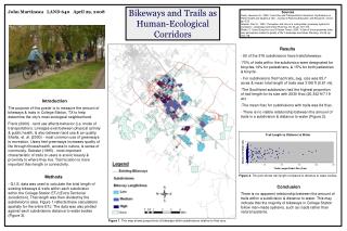
NEW BICYCLE FACILITIES IN URBAN AREAS • Creating new facilities in urban areas is primarily accomplished by “retrofitting” existing linear features such as an abandoned rail corridor or urban stream corridors to accommodate bicycles (and often other types of users). • Most of the decisions about bicycle routing are addressed at a community- wide scale. • Most state Department’s of Transportation have a statewide bicycle plan that defines priorities for major bicycle facilities. • Metropolitan Planning Organizations (MPOs) are responsible for coordinating the budgets for transportation improvements. • Many county and city governments also have bicycle facility plans that are part of the community’s comprehensive plans. • In order to get funding for a new bicycle facility, it must be included in at least the local comprehensive plan and the transportation improvement program. • Some communities fund new projects through capital improvement projects at a local level. • Demonstrating how a proposed facility fits in with an overall bicycle and pedestrian path network is a crucial part of gaining priority status for future funding and implementation.
Process Taking a look at the “big picture” is an important first step in creating bicycle facilities in urban areas. Some important questions to raise at the start of any bicycle planning exercise include: • Who are the persons that have an interest in the bikeway: the various types of users, neighbors, regulating agencies; major institutions and employers along the route; and other key stakeholders? • What are the existing conditions found along the proposed route and are there any “red flags” that might either prohibit construction or significantly raise the cost? • Are there any major capital improvement projects or large-scale development or expansion projects in the corridor? • Are there any significant environmental or cultural resources along the corridor? • Are there any nearby community facilities that would benefit from improved bicycle and pedestrian access?
Involving the persons with a keen interest in the bikeway is a critical first step in project planning. • It is often useful to create a Project Advisory Group that includes representatives from each of the adjoining neighborhoods, agencies, institutions, user groups, and other key stakeholders. • This approach will ensure that each of the groups with an interest in the project will be involved in the design process from the beginning rather than waiting until the “public meeting” to have an opportunity to provide input. • The Advisory Group should walk the proposed route early in the process to identify important issues and other stakeholder groups. • In any bikeway planning project, it is important to clearly delineate the decision-making process.
The following ten steps describe one possible approach that can lead to a successful agreement about the location of a multi-use pathway in an urban area: • Step 1: Organize the project and form an advisory group • Step 2: Identify “design user” • Step 3: Identify and review existing and available data/identify “red flags” • Step 4: Meet with community groups, user groups and neighbors • Step 5: Assess the types of regulatory issues that will need to be addressed and avoid locations where regulations may be burdensome to project implementation • Step 6: Assess the proposed alignment alternatives • Step 7: Evaluate and select a preferred alignment • Step 8: Develop the preferred alignment with options for design treatment • Step 9: Public meetings and presentations • Step 10: Prepare the final facility plan with implementation and phasing plan The project advisory group should assist with the decision-making at each of the steps described above so that any potential problems and pitfalls have been ironed out well before the public meeting.
Existing conditions A summary map showing the existing conditions helps to explain the rationale for making location and design decisions and to facilitate the sharing of information with community groups, officials and all decision-makers. The following elements are helpful: • Existing topography and planimetric features. • Existing vegetation (trees, shrubs, woodland, natural features). • Hydrology (wetland, floodplain, drainage features). • Soil conditions that affect trail development. • Existing paved surfaces and structures (roads, sidewalks, curb cuts, bridges, culverts, tunnels, • Utility Easements (streetlights, water, sewer, storm drains, manholes gas, telephones, electric and traffic control devices).
Existing conditions • Location of active rail lines and safety zones associated with them. • Existing pedestrian circulation and access,including flow restrictions and safety problem areas. • Existing and potential adjacent land uses and planned projects . • Historic sites (listed and eligible properties). • Existing connecting trails and public lands. • High-use destinations for bicyclists (e.g. schools, parks, other recreational venues). • Documentation of accident locations, especially involving bicyclists and vehicles (as indication of danger points).
Alignment alternatives and design options • A first level of screening is often used to avoid potential constraints to trail development. For example, a slope that is too steep to accommodate a bike path should be avoided (5% or greater requires ramps under the Americans with Disabilities Act). • Alignment alternatives are then developed to avoid the constraints. • Design options should also be developed to incorporate decisions about trail width, trail surface, and the intended design user. In heavy use areas, trail widths should be widened to accommodate the anticipated volume of users. Changes to the trail surface can also be used to accommodate a wider variety of users. • Skateboarders, roller bladers, and other small wheel users prefer asphalt to concrete. Joggers prefer softer surfaces such as crushed stone.
Overcoming obstacles At the planning stage, it is important to determine whether or not a particular constraint or obstacle can be overcome and at what cost. In urban areas obstacles may include: Major urban street intersections with no space for pedestrian and bicycle users. • Rail lines • Stream crossings • Narrow bridges with little or no room for bicycles • Lack of available right-of-way
Design exceptions. To overcome obstacles, it may be necessary to seek an exception to published design guidelines, and to sign the route to warn trail users of upcoming areas of concern that could not be avoided. For example, where a separated path must cross a driveway, it is important to place a sign that clearly indicates who has the right of way. Asking bicyclists to dismount may seem like an unreasonable request, but it makes it clear that if cyclists in both directions must cross a driveway, then the automobile should be given right-of-way. If automobiles are asked to give up the right-of-way, bicyclist should be warned of upcoming vehicular crossings.
Bridges • Bicycle bridges are often needed to overcome major barriers. A bicycle bridge must be wide enough to accommodate a bicyclist plus a clear zone on either side of the path. 14 ft. (4.27 m) is a reasonable bicycle bridge width. • Clearance requirements for bridges often create additional design difficulties. This often necessitates the construction of custom made bridges. Bridges over railroads must meet minimum clearances by the rail owner. This can often by met by creating a subtle arch to the bridge. Less costly bridges can be manufactured off-site and assembled on-site. This is often appropriate for smaller bridges. Simple wooden structures can be constructed to cross smaller streams and creeks. • In the United States, ramps approaching the bridge must meet Americans with Disabilities Act (ADA) requirements. The maximum slope for an approaching pathway is 5%. Where slopes greater than 5% are required, then a ramp must be constructed. The maximum slope of the ramp is 1 ft. (.31 m) rise for every 12 ft. (3.66 m) horizontal distance. Level landings are required for every 32 ft. (9.75 m) in ramp length.
Signals Crossing major urban arterials can often be accomplished through the use of bicycle friendly traffic signals. Having a dedicated phase for bicycle and pedestrian use is the safest option. The dedicated phase must have enough time to cross the street, and be frequent enough to discourage jaywalking. In some cases, providing a dedicated pedestrian/bicycle phase is not possible without causing dangerous vehicular backups. In this case, it is possible to signal an intersection so that pedestrians and bicyclists can move with the direction of travel “Yield to pedestrian” signs are needed for turning traffic, as are warning signs for bicyclists.
Warning signs Where uncertain conditions cannot be avoided, warning signs need to be placed to give trail users a chance to slow down or in some cases dismount. The Manual of Uniform Control Devices has a complete chapter on bicycle signs (FHA 2000). It is important to utilize MUTCD signs so that trail users will learn to use the signs from one location to another. In some cases, special signs will be needed to alert motor vehicles to unusual and/or unexpected conditions.
Community linkages Linking trails to community facilities is another important principle in urban bicycle path design. Bicycle paths are more likely to be utilized if they link homes with often visited locations such as parks, schools, and neighborhoods.