Download
1 / 13
661 likes | 1.99k Vues
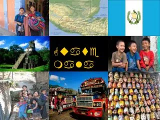
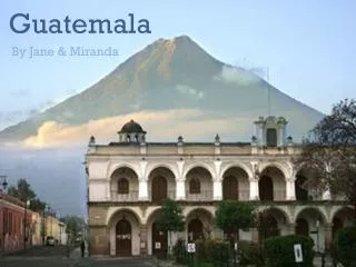
Guatemala. By: Chloe Grace Tritschler 7 th Period. Map of Guatemala. Country: Guatemala Capital: Guatemala City Major Languages : Spanish(60%), Amerindian languages(40%) Continent: North America. Introduction. Physical Map of Guatemala.

E N D
Guatemala By: Chloe Grace Tritschler 7th Period Map of Guatemala
Country: Guatemala • Capital: Guatemala City • Major Languages: Spanish(60%), Amerindian languages(40%) • Continent: North America Introduction Physical Map of Guatemala
Guatemala’s first settlers appeared in 12,000 BC. These were known as the Mayans. This group ruled for about 2000 years. • It was a Spanish colony for 300 after it was conquered by Pedro de Alvarado. At this time the Mayan civilization was over. • It eventually gained its independence from Spain on September 15, 1821. • It had a dictator in 1898 named Manuel Estrada Cabrera. He lasted until 1920. He was overthrown • Guatemala had a guerrilla war that lasted 36 years. • A peace treaty was signed in 1996 ending the war. History Tikal, Guatemala
Major Landforms: Guatemala has many landforms including Lago de Atitlan, Monterrico, and VolcanPacaya. Lago de Atitlan is a lake that has cystal clear water and Mayan remains. • Major Landmarks: Tikal is one of the most recognized places on Earth. It’s an ancient Mayan city used for sacrificial rituals. • Major Bodies of Water: Monterrico is one body of water. It has black sand and a little volcanic activity. • Major Citites: Guatemala City, Huehuetenago, and Santa Cruz del Quiche are some of the major cities. Monterrico Guatemala City Geography
Guatemala has a constitutional demographic republic. • Their clothing consists of loose shirts with either loose pants or a blowy skirt. They also wear dresses. Men usually wear a loose shirt with loose pants. The patterns are bright and geometric. • Guatemala doesn’t have many holidays, but they have Easter, Christmas, and New Year’s Day. They have their own Independence Day which falls on September 15. • Guatemalans eat Mexican inspired foods such as guacamole, rice, and refried beans. But they do have an original dish called Maangchi Kim. It includes chicken with an original sauce, rice, refried beans, and an assortment of vegetables. Culture Maangchi Kim
A cross in Guatemala. • Guatemalan music includes influences from the Mayans and Mexicans. They use many different musical instruments including the guitar, bongos, maracas, and the national musical instrument being the marimba. It is a lot like a xylophone. • In Guatemala, most people are Roman Catholic with that being 50%-60% of the population. Next is Protestant with 40%, and indigenous Mayan faith being last with 1%. Culture Marimba
Natural Resources: Some natural resources include petroleum, nickel, rare woods, fish, and hydropower. • Manufacturing Areas: Guatemala City is usually considered the manufacturing capital, as well as the real capital. • Land Use: The northern part of Guatemala, near the border of Mexico is usually where most farming takes place. • Major Occupations: Most Guatemalans are in services. It’s the most reliable occupation. This is at 48%. Then agriculture with 38% and industry with 14% • Currency: The currency of Guatemala is the Guatemalan Quetzal. Nickel Economy Guatemalan Quetzal
The climate of Guatemala is tropical. It gets cooler in the highlands, but for the lowlands, it usually stays hot and humid. • Average Yearly Rainfall: It ranges to 200 inches in the South and 70 inches in the North. • Average Yearly Temperature: The average temperature is 20 degrees Celsius. A tropical rainforest in Guatemala Climate
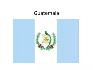
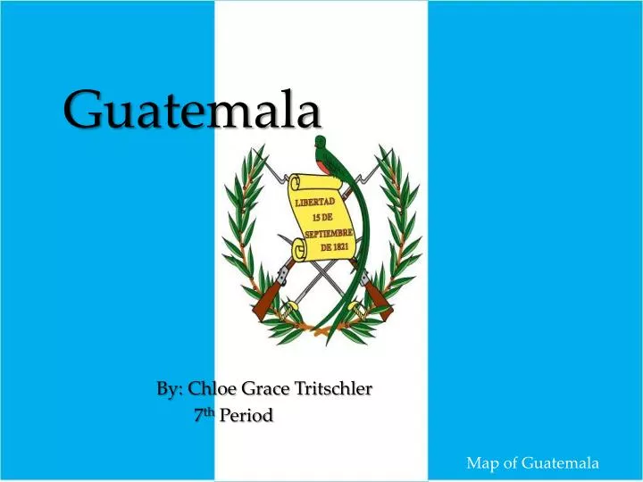
Population: 15.08 Million • History of Flag: The blue stripes represent the two oceans that surround Guatemala, the Atlantic Ocean and the Pacific Ocean. The white stripe down the middle represents purity. In the middle is the coat of arms. Guatemala used the Central America flag until Spain decided to put red and yellow into it. After that, Guatemala adapted their own flag. • Travel Tips: Bring snacks instead of paying for them there so you have enough money for sight seeing. Also, take the chicken buses. They’re just public transportation units that are cheap and useful. Chicken Bus Interesting Facts
Modes of Transportation: Chicken buses, cars, bikes, and walking are some modes of transportation. • Strange Laws: One law is only women are allowed to ride on the back of motorcycles because they are less likely to shoot you. • Native Animals: The Howler Monkey is a native animal in Guatemala. Interesting Facts Howler Monkey
Guatemala is a very unique country that has much to offer. With the Mayan ruins, to it’s native Spanish roots, Guatemala always has much to offer. It may not be the best running country in the world, but it’s always trying to improve. Conclusion Guatemala City
Which ancient civilization started here? • What is the main religion of Guatemala? • What is the capital of Guatemala? • When was Guatemala founded? Questions
"Guatemala." Central Intelligence Agency. Central Intelligence Agency, n.d. Web. 16 Mar. 2014. • "Geography." Infoplease. Infoplease, n.d. Web. 17 Mar. 2014. • "History of Guatemala." Princeton University. N.p., n.d. Web. 18 Mar. 2014. • "10 Top Tourist Attractions in Guatemala." Touropia. N.p., n.d. Web. 18 Mar. 2014. Bibliography