Download
1 / 26
260 likes | 411 Vues
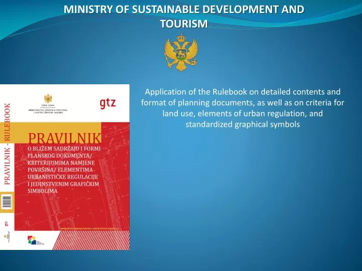
MINISTRY OF SUSTAINABLE DEVELOPMENT AND TOURISM. Application of the Rulebook on detailed contents and format of planning documents, as well as on criteria for land use, elements of urban regulation, and standardized graphical symbols. RULEBOOK

E N D
MINISTRY OF SUSTAINABLE DEVELOPMENT AND TOURISM Application of the Rulebook on detailed contents and format of planning documents, as well as on criteria for land use, elements of urban regulation, and standardized graphical symbols
RULEBOOK on detailedcontents and format of planning documents, as well as on criteria for land use, elements f urban regulation and standardized graphical symbols • Contents: • Basic provisions • Detailed contents of planning documents • Planning document format • Land use categories • Criteria for land use allocation • Urban units for planning • Elements of urban regulation • Spatial indicators • Other contents of planning document • Graphical symbols for land use categories • Final provisions
RULEBOOK 2.Detailed content of planning document • textual part • graphical part • annexes: analytical-documentary basis, general documentation • Textual part: • introduction • analytical part • general and specific objectives • planning solution • guidelines for a planning document implementation
RULEBOOK 2. detailed content of planning document • Depending on the type of a planning document, any graphical part shall comprise: • official topographic map, ie topographic and cadastral plan or any other updated and authenticated survey layers showing boundaries of the plan • excerpt from any planning document of a higher rank • excerpt from valid planning documents intended for the area concerned and the surrounding area • engineering-geological and seismic properties of the terrain • condition of physical structures and the land use, with the presentation of those buildings constructed contrary to the law and plan • administrative classification and classification into planning units • plan of land use and facilities for public services • plan of measures, requirements and regimes intended for the protection of environment, nature and cultural heritage • status and plan of green and open spaces (landscape) • status and plan of road infrastructure • status and plan of hydro-technical infrastructure • status and plan of electric power systems • status and plan of telecommunication infrastructure • status and plan of thermal-technical infrastructure system • allotment, leveling and grading plan • plan with implementation guidelines (staged impl., forms of alterations and further elaboration) • Graphical part of a planning document should also contain two synthesis maps: • status of organization, development and use of planning area (with determinants of spatial planning, ie constants in the space and restriction on the construction) and • plan of organization, development and use of planning area.
RULEBOOK 2. detailed content of planning document Analytical and documentation base: An analytical and documentation basis shall be an addendum to a plan, such basis comprising expert and other documents based on which the plan has been developed or which have been developed with reference to such plan, but have not been included in the plan composition in their original form. An analytical and documentation basis shall comprise the requirements, guidelines and suggestions necessary for the development of a planning document of authorities, business companies, institutions and other legal entities that are responsible for: economic and demographic development projections, water management, electric power industry management, transportation, telecommunication, broadcasting, health system management, national defense, culture, housing and communal activities, geodesy, geology, geophysics, seismology and hydrometeorology related activities, statistics, agriculture, forestry, tourism, nature protection, cultural and natural heritage, environmental protection, and alike. An analytical and documentation basis shall comprise a listing and appropriate excerpts on the facts and situation or issues relevant for the elaboration of the plan (information, reports, communications, analyses, studies, expertises, reviews, solutions and recommendations upon a tender, expert opinions, programs, plans, projects, cartographic publications, excerpts from records, minutes, articles form print media, excerpts from text books and other scientific and professional publications, film, video and audio clips, and alike).
RULEBOOK 2. detailed content of planning document • General documentation: • a decision to draft the planning documents with terms of reference, stating the number of the Official Gazette of Montenegro in which it was published • an approval with the official seal of the competent authority, ie. of the body in charge of preliminary activities • a license held by a business company or a foreign person to develop planning documentation, as well as a license held by the planner in charge and registration numbers of pertinent licenses held by respective planners • guidelines, requirements and documentation of competent authorities and institutions, gathered during a plan development • requirements for providing opinions and opinions provided from competent institutions and public authorities on a pre-draft planning document • statement by the body responsible for preliminary activities on the conformity of planning documents with the Law • a decision to approve a draft plan and to refer it to public discussion, including also the schedule of such public discussion • a short version of a planning document, for the purpose of public discussion • a report on public discussion, ie. on a repeated public discussion • an expert evaluation of comments received in a public discussion, with the opinion of a plan contractor to each comment to a draft plan, ie. To a repeated draft plan • a report on the strategic environmental assessment (if an obligation to develop it has been prescribed) of a planning document, for which the approval has been given by the authority of state administration competent for environmental issues or the competent local government authority • an approval by the state administration authority responsible for the planning activities for a draft planning document • a decision to adopt a planning document with the contents prescribed by the law, stating the number of OGM in which it was published • data of a public tender procedure for planning and architectural conceptual design development
RULEBOOK 3. Format of planning document • digital format of a planning document • for presentation and filing purposes, analogue format should also be made • Each cartographic representation or graphical addendum of a planning document shall contain in particular the following: • the Client’s name and logo • the title of such planning document • the indication of such planning document’s drafting stage (draft, proposal, plan) • the designation and scale of a map, and its sequence number • the year and month in which such plan was drawn up • the name , logo and seal of such plan contractor, ie. business company or foreign person • the name/s of any responsible planner or planners • the standard initials of cardinal points and wind rose • captions consisting of the applied symbols, colors and hatchings, in accordance with the present Rulebook. • The title page of a planning document should include in particular the following: • the Client’s name and logo • The title and time horizon of such planning document • The indication of such planning document drafting stage (pre-draft, draft, repeated draft, working version of proposal, proposal , plan) • the name and logo of the business company or foreign person that is such plan contractor • A plan contractor is obliged to prepare the short versions of the textual part and graphical representations drawn to adequate scales, for the purposes of public discussion
RULEBOOK 4. land use categories • General land use categories: • settlement areas • agricultural areas • forest areas • water areas • other natural areas • areas of technical infrastructure • special-purpose areas and areas subjected to special-use regimes • General land use categories • 1:100 000, 1:50 000, 1:25 000, 1:10 000 • Detailed land use categories • 1:5 000, 1:2500, 1:1 000, 1:500
RULEBOOK 4. Land use categories • Detailed land use categories: • Residential areas • Areas for central activities • Areas for tourism • Areas for education and social protection • Areas for health protection • Areas for culture • Areas for sport and recreation • Areas for industry and production • Areas for multiple purposes • Areas for landscape development-areas of urban greenery • Areas for agriculture • Forest areas • Sea areas • Water areas on land • Other natural areas • Areas of road infrastructure • Areas of other and utility infrastructure and facilities • Areas for waste treatment, recovery and disposal • Cemeteries • Religious buildings • Reserve areas • Mineral deposits and excavation areas • Areas of importance to national defense
RULEBOOK 4. Land use categories • Residential areas: • Residential areas shall be those areas governed under a planning as intended mainly for permanent and temporary habitation. • A planning document may provide for single-family or several-family habitations that, as a rule, may not be planned to be in the same block. • Residential areas may be of different gross population densities: • low density ranging from 60 - 120 inhabitants/ha • medium density ranging from 120 - 250 inhabitants/ha • high density ranging from 250 - 500 inhabitants/ha • very high density ranging from 500 – 1000 inhabitants/ha
RULEBOOK 4. land use categories • Areas for tourism: • Areas for tourism shall be those areas that are intended by planning document primarily for tourism development. • The areas referred to in para.1 above may be planned for the following buidling complexes and buildings: • For accommodation of tourists: • - hotels (T1) • - tourism settlements (T2), • - motels, organized and temporary campsites, mountaineering huts and hunting huts, youth hostels, resorts (T3) • For providing food and drink services • For nautical tourism ports: marinas, moorings, anchorages (N) • Exceptionally, the following may be planned for the areas for tourism: • - Buildings and facilities of business, commercial and service activities, sports and recreation • Infrastructure facilities and networks • Parking lots and garages for staff and users and visitors vehicles • - Stations for supplying motor vehicles with fuel (petrol stations), provided they have been released special requirements in line with the law • The areas referred to un para.1 above may not be planned for buildings of temporary and permanent habitation (apartments, tourist accommodation and alike)
RULEBOOK 5. criteria for land use allocation • SETTLEMENT area use: • Settlement area as governed under a planning document shall encompass both construction land and non-construction land not intended for construction (vacant). • Construction land – any land allocated under a planning document to accommodate the construction of buildings: • built-up and developed construction land • open and undeveloped construction land
RULEBOOK 5. criteria for land use allocation • SETTLEMENT area use: • Criteria for allocating settlement area use: • -previously examine any possibility of construction (reserve areas) on the existing construction land, while particularly any possibility of construction on the incompletely developed part of such land and in relation to the capacities of the existing infrastructure • -adjust building density and population density according to the type of settlement • -design the construction land in line with geomorphologic and hydrological parameters as a settlement unit detached form any other such unit • An advantage should be given to the development of: • -degraded spaces (former industrial and military areas, abandoned quarries and alike) • -state-owned built-up areas • -areas with utility infrastructure developed and roads constructed • -already commenced developments and localities within settlements or immediately beside settlements • Construction land shall be planned in such a manner that: • it can be expanded by 20% of its already existing size at maximum if the ratio of its built-up and open spaces is 80 : 20 • it can be expanded by 10% of its already existing size at maximum if the ratio of its built-up and open spaces is 60 : 40 • it cannot be expanded if the ratio of its built-up and open spaces is 50 : 50 • if its built-up space is smaller than the open one, it must be reduced to the balanced ratio thereof. • These rules shall not be applicable to rural areas where, for the purpose of the recovery and stimulation of development, the construction land may be expanded up to 50% of its existing space.
RULEBOOK 5. criteria for land use allocation • Separate construction area: • Separate construction land, which is defined under a planning document, shall comprise built-up and/or open spaces outside the areas of such existing settlements. • Separate construction land area may be intended under a planning document to accommodate a bigger number of spatial units of a uniform urban concept, so as to make each unit: • to be of up to 15 ha; • to be provided with a corresponding number of parking places and access to public roads. • Mutual association of separate construction lands should be restricted by a planning document, ie. They should not be planned to be on the areas that are highly valuable forests and agricultural land of quality, or in rural settlements, environmental units or on landscapes of special importance. • Planning document may allocate new separate construction lands for tourism purposes outside a settlement only if they, as planned under the applicable plans, have 80% or more of their space already built-up.
RULEBOOK 5. criteria for land use allocation TOURISM areas: Share of accommodation units in hotels (T1)must be 70% in the central hotel building at minimum, and 30% in villas and hotel annexes at maximum. Aggregate areas of the space allocated for the central hotel buildings shall be 70% at minimum, whereas aggregate area of the space planned for hotel annexes or villas shall be 30% at maximum. Share of accommodation units in tourism settlements(T2)must be 30% in the central buildings at minimum, whereas 70% in villas and hotel annexes at maximum. Aggregate area of the space allocated for the central hotel buildings shall be 50%at minimum, whereas aggregate area of the space planned for hotel annexes or villas shall be 50% at maximum. Hotel areas (T1) may not be converted into a tourism settlement purposes(T2), whereas tourism settlements(T2) may be converted into hotels(T1).
RULEBOOK 6. Urban units for planning and elements of regulation • urban lot • block • zone • Elements of urban regulation, which are determined in line with features of urban lot, shall be: • Shape and minimum size of urban lot • Purpose of urban lot • Boundary line • Building line • Vertical size • Requirements for designing and construction of buildings • Requirements for energy efficiency of buildings • Requirements for connection to utility infrastructure and road network • Beside mandatory elements of urban regulation referred to above, the following may also be determined: • - Maximum allowed capacity of building (number of apartments or gross floor area) • - Auxiliary building: type, size and position on the lot • - Leveling points – mandatory zero level • - Public spaces • - Common green spaces • - Pedestrian paths and areas etc.
RULEBOOK 9. Transitional and final provisions Planning documents for which decisions to draft them had been made before the coming into force of this Rulebook , but for which proposals have not been approved yet, shall be developed in accordance with this Rulebook.
RULEBOOK Data model MonPlanGML project defines that data model for planning documents, which is a condition for the full definition of spatial data base and implementation of this Rulebook. MonPlanGML model is projected with a goal to create and present spatial data defined by the Rulebook in GML standard. GML (Geography Markup Language) represents a standard prescribed by OGC (Open Geospatial Consortium) with the aim to describe geographic data, based on XML sintax. GML enables exchange of data of different producers, even the possibility for different systems to function together, when data coding standard format has been defined. GTZ developed MonPlanGML data model, while the model analysis and comments on the model were prepared by WINDd.o.o.
NEXT ACTIVITIES • Technical corrections of the Rulebook in order to remove noted deficiencies: • Adding the missing symbols • Re-defining symbols that are identical or have the same title • Defining in more details signs that depend on plan scales and size of area represented by the sign • Harmonisation of MonPlanGML data model with the Rulebook and its adoption • Preparation of guidelines for the Rulebook application • Definining titles of layers and object classes and template development • Defining procedures for the control of planning documents
RULEBOOK Graphical symbols
RULEBOOK Graphical symbols
RULEBOOK Graphical symbols BORDERS 1. State border (land and territorial seas) Solid line 2.0mm uthickness, colour RGB 129,0,0 2. Municipal border Solid line 1.0mm uthickness, colour RGB 129,0,0 3. Cadastral municipalities border Solid line 0.8mm thickness, colour RGB 129,0,0 4. Town or settlement border Solid line 0.4mm thickness, colour RGB 129,0,0
RULEBOOK Graphical symbols PLAN BORDERS 1. SPMNE Filled rings 3mm diameter with 5mm gap (from ring centers), colour RGB 255,0,0 2. DSP Filled and blank rings intermittently 3mm diameter (from ring centers) with 5mm gap, colour RGB 255,0,0 3. SPSP Blank rings 3mm diameter with 5mm gap (from ring centers) colour RGB 255,63,0 jointed with filled line of the same colour 4. DSL Blank rings 2.4mm diameter with 3.75mm gap (from ring centers) colour RGB 255,63,0 jointed with filled line of the same colour.
RULEBOOK Graphical symbols 5. SUP Filled rings 2.4mm diameter with 3.75mm gap (from ring centers) color RGB 189,46,0 6. DUP Filled line with point-point-point segments; size of full color point 1.5mm; Distance between points 0.5mm (from point brims); distance between point-point-point segments 3.0mm (from outmost point brims); color RGB 189,0,0 7. LSL Filled line with point-point-point segments; size of full blank point 1.5mm; Distance between points 0.5mm (from point brims); distance between point-point-point segments 3.0mm (from outmost point brims); color RGB 189,0,0 8. UP Filled line with point-point-point segments; size of full blank point 1.0mm; Distance between points 0.5mm (from point brims); distance between point-point-point segments 3.0mm (from outmost point brims); color RGB 255,0,63
RULEBOOK Graphical symbols TRAFFIC INFRASTRUCTURE - ON GROUND 1. High way Two solid lines of 1.4mm thickness in RGB 255,0,0 , with 0.3mm blank in between 2. Speedway Two solid lines of 1.0mm thickness in RGB 255,0,0 I, with 0.2mm blank in between 3. Motorway Solid line of 1.5mm thickness in RGB 255,0,0 color 4. Regional traffic line Solid line of 1.3mm thickness in RGB 255,0,0 color 5. Local road Solid line of 0.9mm thickness in RGB 255,0,0 color
MINISTRY OF SUSTAINABLE DEVELOPMENT AND TOURISM Thank you for your attention!